![](/images/other/stat-length.png)
![Randonnée A pied Unknown - Via Mariae M12-13 - Photo](https://media.geolcdn.com/t/1900/400/ext.pjpeg?maxdim=2&url=https%3A%2F%2Fmedia.geolcdn.com%2Ff%2F79994a33-a251-4f9a-a3e8-374f7c7ab33b.jpeg)
Via Mariae M12-13
SityTrail - itinéraires balisés pédestres
Tous les sentiers balisés d’Europe PRO
![Longueur](/images/other/stat-length.png)
Longueur
10,1 km
![Altitude max](https://static1.geolcdn.com/siteimages/upload/files/1508320355ic_sort_altitude_max_24dp.png)
Altitude max
743 m
![Dénivelé positif](https://static1.geolcdn.com/siteimages/upload/files/1508320355ic_sort_den_pos_24dp.png)
Dénivelé positif
186 m
![Km-Effort](/images/other/stat-length.png)
Km-Effort
12,9 km
![Altitude min](https://static1.geolcdn.com/siteimages/upload/files/1508320355ic_sort_altitude_min_24dp.png)
Altitude min
566 m
![Dénivelé négatif](https://static1.geolcdn.com/siteimages/upload/files/1508320355ic_sort_den_neg_24dp.png)
Dénivelé négatif
276 m
![Boucle](https://static1.geolcdn.com/siteimages/upload/files/16400158638029165_repeat_loop_refresh_sync_direction_icon.png)
Boucle
Non
Balise
Date de création :
2022-02-21 10:43:17.273
Dernière modification :
2022-03-08 23:51:13.175
![A pied](https://static1.geolcdn.com/sitytour/trail-icons/100.png)
2h55
Difficulté : Facile
![Scannez ce code QR pour ouvrir la randonnée dans l'application SityTrail](https://capi.geolives.com/qq0zvz2zws4bq2lad0pu/sitytour/trails/3139437/qr.png?size=200)
Application GPS de randonnée GRATUITE
À propos
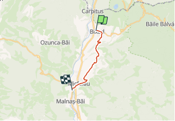
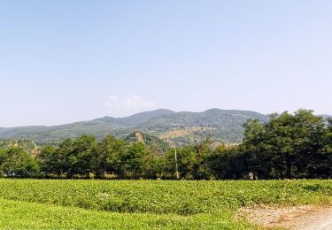
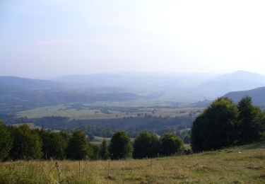
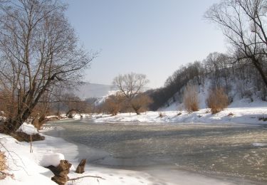
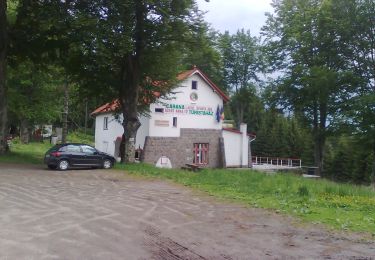
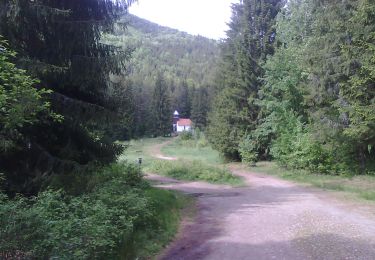
Randonnée A pied de 10,1 km à découvrir à Covasna. Cette randonnée est proposée par SityTrail - itinéraires balisés pédestres.
Description
z az út híd a nemzetek, a vallások, az emberek között. Összeköti a Nyugatot és a Keletet, így válik egy Középkelet-európai Népeket Összekötő Úttá.
Site web: http://www.mariaut.ro/
Localisation
Pays :
Roumanie
Région :
Covasna
Département/Province :
Unknown
Commune :
Unknown
Localité :
Unknown
Départ:(Dec)
Départ:(UTM)
411843 ; 5106031 (35T) N.
Commentaires
Randonnées à proximité
![Randonnée A pied - Bixad - Ozunca-Băi - Photo](https://media.geolcdn.com/t/375/260/ext.jpg?maxdim=2&url=https%3A%2F%2Fmedia.geolcdn.com%2Ff%2F79994a33-a251-4f9a-a3e8-374f7c7ab33b.jpeg)
![A pied A pied](https://static1.geolcdn.com/sitytour/trail-icons/100.png)
![Randonnée A pied - sat Tușnadu Nou - Tinovul Mohos - Cabana Lacul Sfânta Ana - Photo](https://media.geolcdn.com/t/375/260/ext.jpg?maxdim=2&url=https%3A%2F%2Fmedia.geolcdn.com%2Ff%2F9e519858-8185-493d-8b60-10e093ed3952.jpeg)
![A pied A pied](https://static1.geolcdn.com/sitytour/trail-icons/100.png)
sat Tușnadu Nou - Tinovul Mohos - Cabana Lacul Sfânta Ana
A pied
Facile
,
Harghita,
,
Roumanie
![](/images/other/stat-length.png)
10,1 km | 12 km-effort
2h 43min
![](https://static1.geolcdn.com/siteimages/upload/files/16400158638029165_repeat_loop_refresh_sync_direction_icon.png)
Non
![Randonnée A pied - Cabana Sf. Ana - Băile-Balvanyos - Photo](https://media.geolcdn.com/t/375/260/ext.jpg?maxdim=2&url=https%3A%2F%2Fmedia.geolcdn.com%2Ff%2Fc2775865-d2b3-4a59-9049-86680b2a0a13.jpeg)
![A pied A pied](https://static1.geolcdn.com/sitytour/trail-icons/100.png)
Cabana Sf. Ana - Băile-Balvanyos
A pied
Facile
,
Harghita,
,
Roumanie
![](/images/other/stat-length.png)
4,6 km | 6,7 km-effort
1h 31min
![](https://static1.geolcdn.com/siteimages/upload/files/16400158638029165_repeat_loop_refresh_sync_direction_icon.png)
Non
![Randonnée A pied - Bixad - Urmele Cetății Vápa - Ozunca-Băi - Photo](https://media.geolcdn.com/t/375/260/ext.jpg?maxdim=2&url=https%3A%2F%2Fmedia.geolcdn.com%2Ff%2Fbd1a2bb1-bc29-4f24-9c23-9e3147a3f30d.jpeg)
![A pied A pied](https://static1.geolcdn.com/sitytour/trail-icons/100.png)
Bixad - Urmele Cetății Vápa - Ozunca-Băi
A pied
Facile
,
Covasna,
,
Roumanie
![](/images/other/stat-length.png)
5,9 km | 7,8 km-effort
1h 46min
![](https://static1.geolcdn.com/siteimages/upload/files/16400158638029165_repeat_loop_refresh_sync_direction_icon.png)
Non
![Randonnée A pied - Stația CFR Bicsadu Oltului - sub Vf. Ciomatul Mare - Băile Tușnad - Photo](https://media.geolcdn.com/t/375/260/ext.jpg?maxdim=2&url=https%3A%2F%2Fmedia.geolcdn.com%2Ff%2F7c5558b8-de85-4782-b4c5-6a4aa3769236.jpeg)
![A pied A pied](https://static1.geolcdn.com/sitytour/trail-icons/100.png)
Stația CFR Bicsadu Oltului - sub Vf. Ciomatul Mare - Băile Tușnad
A pied
Facile
,
Covasna,
,
Roumanie
![](/images/other/stat-length.png)
6,6 km | 12 km-effort
2h 42min
![](https://static1.geolcdn.com/siteimages/upload/files/16400158638029165_repeat_loop_refresh_sync_direction_icon.png)
Non
![Randonnée A pied - RO-blue cross - Photo](https://media.geolcdn.com/t/375/260/ext.jpg?maxdim=2&url=https%3A%2F%2Fmedia.geolcdn.com%2Ff%2F77691171-2561-4c51-9235-7a01b2bb909d.jpeg)
![A pied A pied](https://static1.geolcdn.com/sitytour/trail-icons/100.png)
![Randonnée A pied - sat Carpituș - Lacul Sfânta Ana - Cabana Lacul Sfânta Ana - Photo](https://media.geolcdn.com/t/375/260/ext.jpg?maxdim=2&url=https%3A%2F%2Fmedia.geolcdn.com%2Ff%2Fb4edda9b-fe1d-4c23-b0f0-276a2390bae8.jpeg)
![A pied A pied](https://static1.geolcdn.com/sitytour/trail-icons/100.png)
sat Carpituș - Lacul Sfânta Ana - Cabana Lacul Sfânta Ana
A pied
Facile
,
Harghita,
,
Roumanie
![](/images/other/stat-length.png)
5 km | 8,4 km-effort
1h 55min
![](https://static1.geolcdn.com/siteimages/upload/files/16400158638029165_repeat_loop_refresh_sync_direction_icon.png)
Non
![Randonnée A pied - Stația CFR Malnaș Băi - vf. Burda - Photo](https://media.geolcdn.com/t/375/260/ext.jpg?maxdim=2&url=https%3A%2F%2Fstatic1.geolcdn.com%2Fsiteimages%2Fupload%2Ffiles%2F1545311037marcheuse_200dpi.jpg)
![A pied A pied](https://static1.geolcdn.com/sitytour/trail-icons/100.png)
Stația CFR Malnaș Băi - vf. Burda
A pied
Facile
,
Covasna,
,
Roumanie
![](/images/other/stat-length.png)
3,7 km | 5,1 km-effort
1h 8min
![](https://static1.geolcdn.com/siteimages/upload/files/16400158638029165_repeat_loop_refresh_sync_direction_icon.png)
Non