![](/images/other/stat-length.png)
![Randonnée A pied Szügy - Mária út M10/08 Szügy - Szécsény - Photo](https://media.geolcdn.com/t/1900/400/3189fc4e-79c2-4044-aeb6-9f4baeb79e09.jpeg&format=pjpeg&maxdim=2)
Mária út M10/08 Szügy - Szécsény
SityTrail - itinéraires balisés pédestres
Tous les sentiers balisés d’Europe GUIDE+
![Longueur](/images/other/stat-length.png)
Longueur
22 km
![Altitude max](https://static1.geolcdn.com/siteimages/upload/files/1508320355ic_sort_altitude_max_24dp.png)
Altitude max
263 m
![Dénivelé positif](https://static1.geolcdn.com/siteimages/upload/files/1508320355ic_sort_den_pos_24dp.png)
Dénivelé positif
413 m
![Km-Effort](/images/other/stat-length.png)
Km-Effort
28 km
![Altitude min](https://static1.geolcdn.com/siteimages/upload/files/1508320355ic_sort_altitude_min_24dp.png)
Altitude min
155 m
![Dénivelé négatif](https://static1.geolcdn.com/siteimages/upload/files/1508320355ic_sort_den_neg_24dp.png)
Dénivelé négatif
410 m
![Boucle](https://static1.geolcdn.com/siteimages/upload/files/16400158638029165_repeat_loop_refresh_sync_direction_icon.png)
Boucle
Non
Balise
Date de création :
2022-02-21 10:29:05.427
Dernière modification :
2022-03-08 20:28:27.236
![A pied](https://static1.geolcdn.com/sitytour/trail-icons/100.png)
6h18
Difficulté : Moyen
![Scannez ce code QR pour ouvrir la randonnée dans l'application SityTrail](https://capi.geolives.com/qq0zvz2zws4bq2lad0pu/sitytour/trails/3138560/qr.png?size=200)
Application GPS de randonnée GRATUITE
À propos
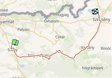
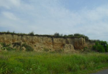
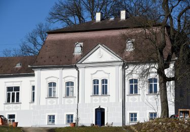
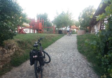
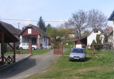
Randonnée A pied de 22 km à découvrir à Grande plaine et nord, Nógrád megye, Szügy. Cette randonnée est proposée par SityTrail - itinéraires balisés pédestres.
Description
Randonnée créée par MUTKE.
Symbole: purple m
Site web: http://mariaut.hu
Localisation
Pays :
Hongrie
Région :
Grande plaine et nord
Département/Province :
Nógrád megye
Commune :
Szügy
Localité :
Unknown
Départ:(Dec)
Départ:(UTM)
374834 ; 5321690 (34U) N.
Commentaires
Randonnées à proximité
![Randonnée A pied okres Veľký Krtíš - Náučný chodník Stromy čebovských lesov - Photo](https://media.geolcdn.com/t/375/260/1f6b80b0-532b-4d79-a576-b7d435ae4be1.jpeg&format=jpg&maxdim=2)
![A pied A pied](https://static1.geolcdn.com/sitytour/trail-icons/100.png)
Náučný chodník Stromy čebovských lesov
A pied
Facile
okres Veľký Krtíš,
Région de Banská Bystrica,
Inconnu,
Slovaquie
![](/images/other/stat-length.png)
4,1 km | 5,6 km-effort
1h 16min
![](https://static1.geolcdn.com/siteimages/upload/files/16400158638029165_repeat_loop_refresh_sync_direction_icon.png)
Non
![Randonnée A pied Felsőpetény - Reformáció Emlékút 1 (Egyházasdengeleg - Nógrád) - Photo](https://media.geolcdn.com/t/375/260/0e16c49f-e8e0-4be0-b672-8ec9e04143b0.jpeg&format=jpg&maxdim=2)
![A pied A pied](https://static1.geolcdn.com/sitytour/trail-icons/100.png)
Reformáció Emlékút 1 (Egyházasdengeleg - Nógrád)
A pied
Facile
Felsőpetény,
Grande plaine et nord,
Nógrád megye,
Hongrie
![](/images/other/stat-length.png)
11,4 km | 14,8 km-effort
3h 21min
![](https://static1.geolcdn.com/siteimages/upload/files/16400158638029165_repeat_loop_refresh_sync_direction_icon.png)
Non
![Randonnée A pied Hollókő - Hollókő - Vártúra Ösvény és Biológiai Tanösvény - Photo](https://media.geolcdn.com/t/375/260/f30cfa37-465b-46c5-ac3d-d1b9c15fd940.jpeg&format=jpg&maxdim=2)
![A pied A pied](https://static1.geolcdn.com/sitytour/trail-icons/100.png)
Hollókő - Vártúra Ösvény és Biológiai Tanösvény
A pied
Facile
Hollókő,
Grande plaine et nord,
Nógrád megye,
Hongrie
![](/images/other/stat-length.png)
3,7 km | 5,3 km-effort
1h 12min
![](https://static1.geolcdn.com/siteimages/upload/files/16400158638029165_repeat_loop_refresh_sync_direction_icon.png)
Oui
![Randonnée A pied Nagyoroszi - Mária út M10/07 Nagyoroszi-Szügy - Photo](https://media.geolcdn.com/t/375/260/dce31873-1731-4323-a0ca-b3d934cc6feb.jpeg&format=jpg&maxdim=2)
![A pied A pied](https://static1.geolcdn.com/sitytour/trail-icons/100.png)
Mária út M10/07 Nagyoroszi-Szügy
A pied
Moyen
Nagyoroszi,
Grande plaine et nord,
Nógrád megye,
Hongrie
![](/images/other/stat-length.png)
22 km | 25 km-effort
5h 46min
![](https://static1.geolcdn.com/siteimages/upload/files/16400158638029165_repeat_loop_refresh_sync_direction_icon.png)
Non
![Randonnée A pied Alsópetény - HU-S+ - Photo](https://media.geolcdn.com/t/375/260/6dbf6a40-acf9-42a3-ae46-1309dd9f309a.jpeg&format=jpg&maxdim=2)
![A pied A pied](https://static1.geolcdn.com/sitytour/trail-icons/100.png)
HU-S+
A pied
Facile
Alsópetény,
Grande plaine et nord,
Nógrád megye,
Hongrie
![](/images/other/stat-length.png)
6,6 km | 7,9 km-effort
1h 47min
![](https://static1.geolcdn.com/siteimages/upload/files/16400158638029165_repeat_loop_refresh_sync_direction_icon.png)
Non
![Randonnée A pied Terény - Z24 - Photo](https://media.geolcdn.com/t/375/260/dad9d464-c769-4862-b2c2-fe29302ab2f3.jpeg&format=jpg&maxdim=2)
![A pied A pied](https://static1.geolcdn.com/sitytour/trail-icons/100.png)
Z24
A pied
Facile
Terény,
Grande plaine et nord,
Nógrád megye,
Hongrie
![](/images/other/stat-length.png)
4,6 km | 5,8 km-effort
1h 19min
![](https://static1.geolcdn.com/siteimages/upload/files/16400158638029165_repeat_loop_refresh_sync_direction_icon.png)
Non
![Randonnée A pied Szanda - Z27 - Photo](https://media.geolcdn.com/t/375/260/43baaed1-338d-43d7-87c6-bf2106967d7c.jpeg&format=jpg&maxdim=2)
![A pied A pied](https://static1.geolcdn.com/sitytour/trail-icons/100.png)
Z27
A pied
Facile
Szanda,
Grande plaine et nord,
Nógrád megye,
Hongrie
![](/images/other/stat-length.png)
4,5 km | 6,1 km-effort
1h 23min
![](https://static1.geolcdn.com/siteimages/upload/files/16400158638029165_repeat_loop_refresh_sync_direction_icon.png)
Non
![Randonnée A pied Buják - Z18 - Photo](https://media.geolcdn.com/t/375/260/cadffcf6-fa13-4d0d-b4fd-399df7af60f3.jpeg&format=jpg&maxdim=2)
![A pied A pied](https://static1.geolcdn.com/sitytour/trail-icons/100.png)
Z18
A pied
Facile
Buják,
Grande plaine et nord,
Nógrád megye,
Hongrie
![](/images/other/stat-length.png)
8,4 km | 10,6 km-effort
2h 24min
![](https://static1.geolcdn.com/siteimages/upload/files/16400158638029165_repeat_loop_refresh_sync_direction_icon.png)
Non
![Randonnée A pied Bokor - Z19 - Photo](https://media.geolcdn.com/t/375/260/cadffcf6-fa13-4d0d-b4fd-399df7af60f3.jpeg&format=jpg&maxdim=2)
![A pied A pied](https://static1.geolcdn.com/sitytour/trail-icons/100.png)
Z19
A pied
Facile
Bokor,
Grande plaine et nord,
Nógrád megye,
Hongrie
![](/images/other/stat-length.png)
11,3 km | 14,4 km-effort
3h 16min
![](https://static1.geolcdn.com/siteimages/upload/files/16400158638029165_repeat_loop_refresh_sync_direction_icon.png)
Non