


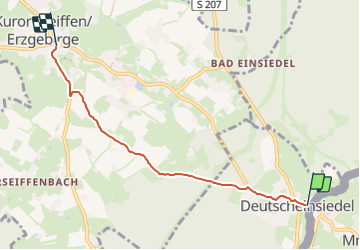

12 km | 17,1 km-effort


Tous les sentiers balisés d’Europe GUIDE+


Application GPS de randonnée GRATUITE
 SityTrail
IGN / Instituts géographiques
SityTrail World
Le monde est à vous
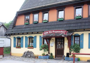
Randonnée A pied de 4,2 km à découvrir à Saxe, Erzgebirgskreis, Deutschneudorf. Cette randonnée est proposée par SityTrail - itinéraires balisés pédestres.
Symbole: grüner Strich, weißer Grund
A pied
![Randonnée A pied Litvínov - [Ž] 6949 Hamr - Nad hrází Mostecké přehrady - Photo](https://media.geolcdn.com/t/375/260/066fef76-c2e2-4e7c-95b7-4d56047c103c.jpeg&format=jpg&maxdim=2)
A pied
A pied
![Randonnée A pied Klíny - [Z] 3923 Litvínov (rozc.) - Klíny (bus) - Photo](https://media.geolcdn.com/t/375/260/0bbaa3e7-7dd7-499d-8741-8d3c1ed19925.jpeg&format=jpg&maxdim=2)
A pied

A pied
A pied
A pied
A pied

A pied