![](/images/other/stat-length.png)
![Randonnée A pied Preetz - Schusteracht - Photo](https://media.geolcdn.com/t/1900/400/ext.pjpeg?maxdim=2&url=https%3A%2F%2Fstatic1.geolcdn.com%2Fsiteimages%2Fupload%2Ffiles%2F1545311037marcheuse_200dpi.jpg)
Schusteracht
SityTrail - itinéraires balisés pédestres
Tous les sentiers balisés d’Europe GUIDE+
![Longueur](/images/other/stat-length.png)
Longueur
12,8 km
![Altitude max](https://static1.geolcdn.com/siteimages/upload/files/1508320355ic_sort_altitude_max_24dp.png)
Altitude max
52 m
![Dénivelé positif](https://static1.geolcdn.com/siteimages/upload/files/1508320355ic_sort_den_pos_24dp.png)
Dénivelé positif
111 m
![Km-Effort](/images/other/stat-length.png)
Km-Effort
14,3 km
![Altitude min](https://static1.geolcdn.com/siteimages/upload/files/1508320355ic_sort_altitude_min_24dp.png)
Altitude min
20 m
![Dénivelé négatif](https://static1.geolcdn.com/siteimages/upload/files/1508320355ic_sort_den_neg_24dp.png)
Dénivelé négatif
98 m
![Boucle](https://static1.geolcdn.com/siteimages/upload/files/16400158638029165_repeat_loop_refresh_sync_direction_icon.png)
Boucle
Non
Balise
Date de création :
2022-02-21 08:13:48.867
Dernière modification :
2022-02-21 08:13:48.867
![A pied](https://static1.geolcdn.com/sitytour/trail-icons/100.png)
3h14
Difficulté : Facile
![Scannez ce code QR pour ouvrir la randonnée dans l'application SityTrail](https://capi.geolives.com/qq0zvz2zws4bq2lad0pu/sitytour/trails/3136286/qr.png?size=200)
Application GPS de randonnée GRATUITE
À propos
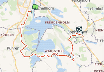
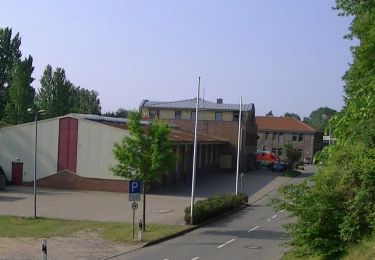
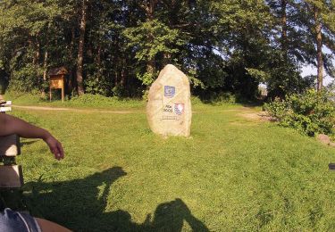
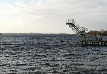
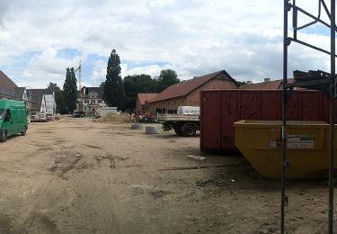
Randonnée A pied de 12,8 km à découvrir à Schleswig-Holstein, Plön, Preetz. Cette randonnée est proposée par SityTrail - itinéraires balisés pédestres.
Description
Randonnée créée par Schusteracht e.V..
Symbole: Wanderer über liegender Acht
Localisation
Pays :
Allemagne
Région :
Schleswig-Holstein
Département/Province :
Plön
Commune :
Preetz
Localité :
Unknown
Départ:(Dec)
Départ:(UTM)
583558 ; 6009098 (32U) N.
Commentaires
Randonnées à proximité
![Randonnée A pied Dersau - Rundweg Nehmtener Horn - Photo](https://media.geolcdn.com/t/375/260/e2a309ff-9e09-4cbe-904a-60c1d7eb8419.jpeg&format=jpg&maxdim=2)
![A pied A pied](https://static1.geolcdn.com/sitytour/trail-icons/100.png)
Rundweg Nehmtener Horn
A pied
Facile
Dersau,
Schleswig-Holstein,
Plön,
Allemagne
![](/images/other/stat-length.png)
15,4 km | 17,8 km-effort
4h 2min
![](https://static1.geolcdn.com/siteimages/upload/files/16400158638029165_repeat_loop_refresh_sync_direction_icon.png)
Oui
![Randonnée A pied Dersau - Rundweg Dersauer Uklei - Photo](https://media.geolcdn.com/t/375/260/e2a309ff-9e09-4cbe-904a-60c1d7eb8419.jpeg&format=jpg&maxdim=2)
![A pied A pied](https://static1.geolcdn.com/sitytour/trail-icons/100.png)
Rundweg Dersauer Uklei
A pied
Facile
Dersau,
Schleswig-Holstein,
Plön,
Allemagne
![](/images/other/stat-length.png)
4,7 km | 5,5 km-effort
1h 15min
![](https://static1.geolcdn.com/siteimages/upload/files/16400158638029165_repeat_loop_refresh_sync_direction_icon.png)
Oui
![Randonnée A pied Plön - Plöner Seen - Photo](https://media.geolcdn.com/t/375/260/5b089332-1f50-4093-a2f8-3b715c3d9800.jpeg&format=jpg&maxdim=2)
![A pied A pied](https://static1.geolcdn.com/sitytour/trail-icons/100.png)
Plöner Seen
A pied
Facile
Plön,
Schleswig-Holstein,
Plön,
Allemagne
![](/images/other/stat-length.png)
4,1 km | 5 km-effort
1h 8min
![](https://static1.geolcdn.com/siteimages/upload/files/16400158638029165_repeat_loop_refresh_sync_direction_icon.png)
Non
![Randonnée A pied Grevenkrug - Eidertal Wanderweg - Photo](https://media.geolcdn.com/t/375/260/e3a3f7c9-6324-4495-8e47-9ab10e2d7b72.jpeg&format=jpg&maxdim=2)
![A pied A pied](https://static1.geolcdn.com/sitytour/trail-icons/100.png)
Eidertal Wanderweg
A pied
Facile
Grevenkrug,
Schleswig-Holstein,
Rendsburg-Eckernförde,
Allemagne
![](/images/other/stat-length.png)
9,7 km | 10,9 km-effort
2h 29min
![](https://static1.geolcdn.com/siteimages/upload/files/16400158638029165_repeat_loop_refresh_sync_direction_icon.png)
Non
![Randonnée A pied Plön - Rundweg Prinzeninsel - Photo](https://media.geolcdn.com/t/375/260/979e4758-02fa-4b03-9b40-306a383bdaf3.jpeg&format=jpg&maxdim=2)
![A pied A pied](https://static1.geolcdn.com/sitytour/trail-icons/100.png)
Rundweg Prinzeninsel
A pied
Facile
Plön,
Schleswig-Holstein,
Plön,
Allemagne
![](/images/other/stat-length.png)
3,3 km | 3,7 km-effort
50min
![](https://static1.geolcdn.com/siteimages/upload/files/16400158638029165_repeat_loop_refresh_sync_direction_icon.png)
Oui
![Randonnée A pied Plön - Schöhsee-Rundweg - Photo](https://media.geolcdn.com/t/375/260/d27e6b66-5329-42cd-a7d6-de120f9b6aab.jpeg&format=jpg&maxdim=2)
![A pied A pied](https://static1.geolcdn.com/sitytour/trail-icons/100.png)
Schöhsee-Rundweg
A pied
Facile
Plön,
Schleswig-Holstein,
Plön,
Allemagne
![](/images/other/stat-length.png)
5,3 km | 6,2 km-effort
1h 24min
![](https://static1.geolcdn.com/siteimages/upload/files/16400158638029165_repeat_loop_refresh_sync_direction_icon.png)
Oui
![Randonnée A pied Malente - Dieksee-Rundweg - Photo](https://media.geolcdn.com/t/375/260/fb6de59d-ef71-4b03-a11f-4e04069e9518.jpeg&format=jpg&maxdim=2)
![A pied A pied](https://static1.geolcdn.com/sitytour/trail-icons/100.png)
Dieksee-Rundweg
A pied
Facile
Malente,
Schleswig-Holstein,
Ostholstein,
Allemagne
![](/images/other/stat-length.png)
11,3 km | 12,6 km-effort
2h 52min
![](https://static1.geolcdn.com/siteimages/upload/files/16400158638029165_repeat_loop_refresh_sync_direction_icon.png)
Oui
![Randonnée A pied Malente - Rundweg Holzbergturm - Photo](https://media.geolcdn.com/t/375/260/35722b8c-a4b5-4c49-80fc-7c5a0dba9601.jpeg&format=jpg&maxdim=2)
![A pied A pied](https://static1.geolcdn.com/sitytour/trail-icons/100.png)
Rundweg Holzbergturm
A pied
Facile
Malente,
Schleswig-Holstein,
Ostholstein,
Allemagne
![](/images/other/stat-length.png)
6,9 km | 8,3 km-effort
1h 53min
![](https://static1.geolcdn.com/siteimages/upload/files/16400158638029165_repeat_loop_refresh_sync_direction_icon.png)
Oui
![Randonnée A pied Malente - Kellersee Rundweg - Photo](https://media.geolcdn.com/t/375/260/af543d82-42bd-4b90-8f5f-19fcaafc6fdf.jpeg&format=jpg&maxdim=2)
![A pied A pied](https://static1.geolcdn.com/sitytour/trail-icons/100.png)
Kellersee Rundweg
A pied
Facile
Malente,
Schleswig-Holstein,
Ostholstein,
Allemagne
![](/images/other/stat-length.png)
14,8 km | 16,5 km-effort
3h 45min
![](https://static1.geolcdn.com/siteimages/upload/files/16400158638029165_repeat_loop_refresh_sync_direction_icon.png)
Oui