![](/images/other/stat-length.png)
entre Pont sur SEINE et MARNAY
jeannine grandjean
Utilisateur
![Longueur](/images/other/stat-length.png)
![Altitude max](https://static1.geolcdn.com/siteimages/upload/files/1508320355ic_sort_altitude_max_24dp.png)
![Dénivelé positif](https://static1.geolcdn.com/siteimages/upload/files/1508320355ic_sort_den_pos_24dp.png)
![Km-Effort](/images/other/stat-length.png)
![Altitude min](https://static1.geolcdn.com/siteimages/upload/files/1508320355ic_sort_altitude_min_24dp.png)
![Dénivelé négatif](https://static1.geolcdn.com/siteimages/upload/files/1508320355ic_sort_den_neg_24dp.png)
![Boucle](https://static1.geolcdn.com/siteimages/upload/files/16400158638029165_repeat_loop_refresh_sync_direction_icon.png)
![Marche](https://static1.geolcdn.com/sitytour/trail-icons/101.png)
2h43
Difficulté : Difficile
![Scannez ce code QR pour ouvrir la randonnée dans l'application SityTrail](https://capi.geolives.com/qq0zvz2zws4bq2lad0pu/sitytour/trails/3133781/qr.png?size=200)
Application GPS de randonnée GRATUITE
À propos
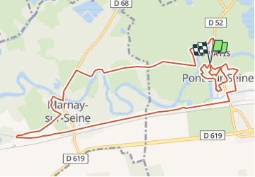
Randonnée Marche de 13,1 km à découvrir à Grand Est, Aube, Pont-sur-Seine. Cette randonnée est proposée par jeannine grandjean.
Description
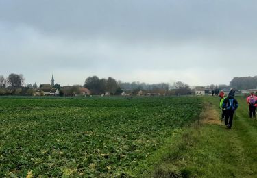
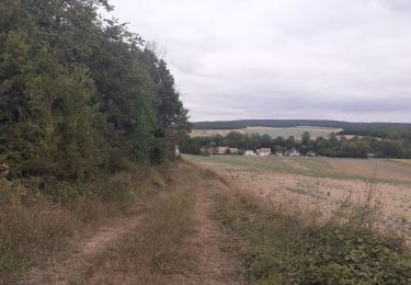
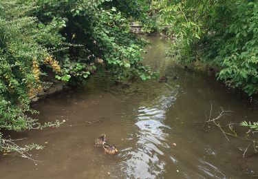
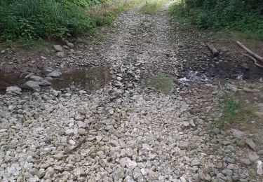
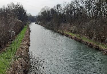
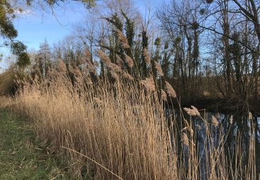
au départ du camping, flânerie dans Pont en suivant l'emplacement des anciens remparts puis les rives de la Seine. Rejoindre le camping, traverser la rivière et par le premier chemin à gauche, rejoindre Marnay à travers les chemins de pâturage. Traverser de nouveau la Seine pour gagner l'autre rive et descendre en contrebas de l'église pour longer quelque temps la rivière ; passer devant le Jardin Botanique, regagner Pont en longeant le canal de Bernières Conflans ; ne pas manquer le pont-levis, le lavoir, la Porte saint-Martin et l'église du même nom, avant de rejoindre le camping
Localisation
Commentaires
Randonnées à proximité
![Randonnée Marche Saint-Aubin - Saint Aubin et la vallée de l'Ardusson - Photo](https://media.geolcdn.com/t/375/260/f350ed10-944d-4a3f-a8a0-a8fbb2c48c0b.jpg&format=jpg&maxdim=2)
![Marche Marche](https://static1.geolcdn.com/sitytour/trail-icons/101.png)
Marche
![](/images/other/stat-length.png)
![](https://static1.geolcdn.com/siteimages/upload/files/16400158638029165_repeat_loop_refresh_sync_direction_icon.png)
![Randonnée Marche Saint-Aubin - St Aubin - Fontaine Mâcon - St Aubin - Photo](https://media.geolcdn.com/t/375/260/e257991e-7cb7-4143-9b1a-d9a805529f6d.jpg&format=jpg&maxdim=2)
![Marche Marche](https://static1.geolcdn.com/sitytour/trail-icons/101.png)
Marche
![](/images/other/stat-length.png)
![](https://static1.geolcdn.com/siteimages/upload/files/16400158638029165_repeat_loop_refresh_sync_direction_icon.png)
![Randonnée Marche Saint-Aubin - St Aubin - Fontaine Mâcon - Abbaye du Paraclet - St Aubin - Photo](https://media.geolcdn.com/t/375/260/91520258-9572-40f5-aac3-ae8eb59945ec.jpg&format=jpg&maxdim=2)
![Marche Marche](https://static1.geolcdn.com/sitytour/trail-icons/101.png)
Marche
![](/images/other/stat-length.png)
![](https://static1.geolcdn.com/siteimages/upload/files/16400158638029165_repeat_loop_refresh_sync_direction_icon.png)
![Randonnée V.T.C. Marnay-sur-Seine - Marnay bis - Photo](https://media.geolcdn.com/t/375/260/d3dd4a92-ca0b-442d-80fb-f340a7687fae.jpg&format=jpg&maxdim=2)
![V.T.C. V.T.C.](https://static1.geolcdn.com/sitytour/trail-icons/203.png)
![Randonnée Marche Crancey - Entre CRANCEY et PONT SUR SEINE - Photo](https://media.geolcdn.com/t/375/260/57d0ce4e-2aa7-4ecd-8bc9-3fd6665e20d8.jpg&format=jpg&maxdim=2)
![Marche Marche](https://static1.geolcdn.com/sitytour/trail-icons/101.png)
Marche
![](/images/other/stat-length.png)
![](https://static1.geolcdn.com/siteimages/upload/files/16400158638029165_repeat_loop_refresh_sync_direction_icon.png)
![Randonnée Marche Pont-sur-Seine - De Pont sur Seine à Marnay - Photo](https://media.geolcdn.com/t/375/260/381e93b8-caf4-43dd-ac99-d1509d92dd1f.jpg&format=jpg&maxdim=2)
![Marche Marche](https://static1.geolcdn.com/sitytour/trail-icons/101.png)
Marche
![](/images/other/stat-length.png)
![](https://static1.geolcdn.com/siteimages/upload/files/16400158638029165_repeat_loop_refresh_sync_direction_icon.png)
![Randonnée Marche Esclavolles-Lurey - Esclavolles Esclavolles via éoliennes et Potangis - Photo](https://media.geolcdn.com/t/375/260/ext.jpg?maxdim=2&url=https%3A%2F%2Fstatic1.geolcdn.com%2Fsiteimages%2Fupload%2Ffiles%2F1553511878bg_sport_marche.png)
![Marche Marche](https://static1.geolcdn.com/sitytour/trail-icons/101.png)
Marche
![](/images/other/stat-length.png)
![](https://static1.geolcdn.com/siteimages/upload/files/16400158638029165_repeat_loop_refresh_sync_direction_icon.png)
![Randonnée A pied Saint-Aubin - Saint-Aubin, Quincey - Photo](https://media.geolcdn.com/t/375/260/ext.jpg?maxdim=2&url=https%3A%2F%2Fstatic1.geolcdn.com%2Fsiteimages%2Fupload%2Ffiles%2F1545311037marcheuse_200dpi.jpg)
![A pied A pied](https://static1.geolcdn.com/sitytour/trail-icons/100.png)
A pied
![](/images/other/stat-length.png)
![](https://static1.geolcdn.com/siteimages/upload/files/16400158638029165_repeat_loop_refresh_sync_direction_icon.png)
![Randonnée A pied La Villeneuve-au-Châtelot - La Villeneuve au Châtelot, Courtavant - Photo](https://media.geolcdn.com/t/375/260/ext.jpg?maxdim=2&url=https%3A%2F%2Fstatic1.geolcdn.com%2Fsiteimages%2Fupload%2Ffiles%2F1545311037marcheuse_200dpi.jpg)
![A pied A pied](https://static1.geolcdn.com/sitytour/trail-icons/100.png)
A pied
![](/images/other/stat-length.png)
![](https://static1.geolcdn.com/siteimages/upload/files/16400158638029165_repeat_loop_refresh_sync_direction_icon.png)