![](/images/other/stat-length.png)
![Randonnée Marche Argelès-Gazost - G3 Argeles tour du lavedan - Photo](https://media.geolcdn.com/t/1900/400/ext.pjpeg?maxdim=2&url=https%3A%2F%2Fstatic1.geolcdn.com%2Fsiteimages%2Fupload%2Ffiles%2F1553511878bg_sport_marche.png)
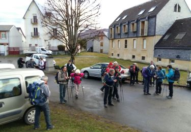
G3 Argeles tour du lavedan
LouisROGER
Utilisateur GUIDE
![Longueur](/images/other/stat-length.png)
Longueur
11,9 km
![Altitude max](https://static1.geolcdn.com/siteimages/upload/files/1508320355ic_sort_altitude_max_24dp.png)
Altitude max
943 m
![Dénivelé positif](https://static1.geolcdn.com/siteimages/upload/files/1508320355ic_sort_den_pos_24dp.png)
Dénivelé positif
536 m
![Km-Effort](/images/other/stat-length.png)
Km-Effort
19 km
![Altitude min](https://static1.geolcdn.com/siteimages/upload/files/1508320355ic_sort_altitude_min_24dp.png)
Altitude min
460 m
![Dénivelé négatif](https://static1.geolcdn.com/siteimages/upload/files/1508320355ic_sort_den_neg_24dp.png)
Dénivelé négatif
533 m
![Boucle](https://static1.geolcdn.com/siteimages/upload/files/16400158638029165_repeat_loop_refresh_sync_direction_icon.png)
Boucle
Oui
Date de création :
2022-02-18 08:33:25.989
Dernière modification :
2022-02-19 10:46:46.401
![Marche](https://static1.geolcdn.com/sitytour/trail-icons/101.png)
4h02
Difficulté : Difficile
![Scannez ce code QR pour ouvrir la randonnée dans l'application SityTrail](https://capi.geolives.com/qq0zvz2zws4bq2lad0pu/sitytour/trails/3133117/qr.png?size=200)
Application GPS de randonnée GRATUITE
À propos
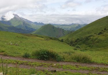
Randonnée Marche de 11,9 km à découvrir à Occitanie, Hautes-Pyrénées, Argelès-Gazost. Cette randonnée est proposée par LouisROGER.
Description
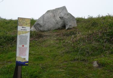
Montée progressive, un dernier coup de collier avant le pique nique avant le quartier des sources, descente rapide sur Arras en Lavedan en s'arrêtant pour les affichages du sentier pédagogique.
Arrêt à la librairie bistrot à Arras !!
Localisation
Pays :
France
Région :
Occitanie
Département/Province :
Hautes-Pyrénées
Commune :
Argelès-Gazost
Localité :
Unknown
Départ:(Dec)
Départ:(UTM)
736295 ; 4765662 (30T) N.
Commentaires
Randonnées à proximité
![Randonnée Marche Arcizans-Dessus - la fontaine de Nabias - Photo](https://media.geolcdn.com/t/375/260/7a92cfc2-a248-4e38-88ec-b8751d1d13fa.jpg&format=jpg&maxdim=2)
![Marche Marche](https://static1.geolcdn.com/sitytour/trail-icons/101.png)
la fontaine de Nabias
Marche
Très facile
(1)
Arcizans-Dessus,
Occitanie,
Hautes-Pyrénées,
France
![](/images/other/stat-length.png)
4,2 km | 6,8 km-effort
1h 40min
![](https://static1.geolcdn.com/siteimages/upload/files/16400158638029165_repeat_loop_refresh_sync_direction_icon.png)
Oui
![Randonnée Marche Argelès-Gazost - Le Mont de Gez en circuit - Argelès Gazost - Photo](https://media.geolcdn.com/t/375/260/ext.jpg?maxdim=2&url=https%3A%2F%2Fservices.sitytrail.com%2FGeolivesWS%2FDownloadMedia.ashx%3FTrailID%3D172309%26Media%3D13627_4.jpg)
![Marche Marche](https://static1.geolcdn.com/sitytour/trail-icons/101.png)
Le Mont de Gez en circuit - Argelès Gazost
Marche
Moyen
(1)
Argelès-Gazost,
Occitanie,
Hautes-Pyrénées,
France
![](/images/other/stat-length.png)
11,8 km | 20 km-effort
4h 30min
![](https://static1.geolcdn.com/siteimages/upload/files/16400158638029165_repeat_loop_refresh_sync_direction_icon.png)
Oui
![Randonnée Vélo électrique Argelès-Gazost - CABALIROS 30 JUIN 2023 - Photo](https://media.geolcdn.com/t/375/260/d00efa13-e401-495e-87f8-f59eb1442703.jpg&format=jpg&maxdim=2)
![Vélo électrique Vélo électrique](https://static1.geolcdn.com/sitytour/trail-icons/205.png)
CABALIROS 30 JUIN 2023
Vélo électrique
Moyen
Argelès-Gazost,
Occitanie,
Hautes-Pyrénées,
France
![](/images/other/stat-length.png)
39 km | 57 km-effort
4h 47min
![](https://static1.geolcdn.com/siteimages/upload/files/16400158638029165_repeat_loop_refresh_sync_direction_icon.png)
Oui
![Randonnée Marche Argelès-Gazost - ARGELES La boucle de l arrieulat - Photo](https://media.geolcdn.com/t/375/260/cee8eb17-b22b-4615-9318-bf7446bdbe22.jpg&format=jpg&maxdim=2)
![Marche Marche](https://static1.geolcdn.com/sitytour/trail-icons/101.png)
ARGELES La boucle de l arrieulat
Marche
Difficile
Argelès-Gazost,
Occitanie,
Hautes-Pyrénées,
France
![](/images/other/stat-length.png)
10,3 km | 14,6 km-effort
3h 4min
![](https://static1.geolcdn.com/siteimages/upload/files/16400158638029165_repeat_loop_refresh_sync_direction_icon.png)
Oui
![Randonnée Marche Adast - PIERREFITTE le lac des gaves - Photo](https://media.geolcdn.com/t/375/260/a0379007-9073-4faa-9884-292529d4cd9e.jpg&format=jpg&maxdim=2)
![Marche Marche](https://static1.geolcdn.com/sitytour/trail-icons/101.png)
PIERREFITTE le lac des gaves
Marche
Très facile
Adast,
Occitanie,
Hautes-Pyrénées,
France
![](/images/other/stat-length.png)
6,2 km | 6,7 km-effort
1h 51min
![](https://static1.geolcdn.com/siteimages/upload/files/16400158638029165_repeat_loop_refresh_sync_direction_icon.png)
Oui
![Randonnée Marche Argelès-Gazost - ARGELES Mont de Gez G3 fait - Photo](https://media.geolcdn.com/t/375/260/653c1198-5439-4c4b-acf2-a53537be36e4.jpg&format=jpg&maxdim=2)
![Marche Marche](https://static1.geolcdn.com/sitytour/trail-icons/101.png)
ARGELES Mont de Gez G3 fait
Marche
Moyen
Argelès-Gazost,
Occitanie,
Hautes-Pyrénées,
France
![](/images/other/stat-length.png)
10,2 km | 18,3 km-effort
5h 39min
![](https://static1.geolcdn.com/siteimages/upload/files/16400158638029165_repeat_loop_refresh_sync_direction_icon.png)
Oui
![Randonnée Marche Ouzous - Ouzous pibeste-fait - Photo](https://media.geolcdn.com/t/375/260/ext.jpg?maxdim=2&url=https%3A%2F%2Fstatic1.geolcdn.com%2Fsiteimages%2Fupload%2Ffiles%2F1553511878bg_sport_marche.png)
![Marche Marche](https://static1.geolcdn.com/sitytour/trail-icons/101.png)
Ouzous pibeste-fait
Marche
Moyen
(1)
Ouzous,
Occitanie,
Hautes-Pyrénées,
France
![](/images/other/stat-length.png)
11,3 km | 22 km-effort
4h 29min
![](https://static1.geolcdn.com/siteimages/upload/files/16400158638029165_repeat_loop_refresh_sync_direction_icon.png)
Oui
![Randonnée Marche Ouzous - Pic du Pibeste - Photo](https://media.geolcdn.com/t/375/260/ext.jpg?maxdim=2&url=https%3A%2F%2Fstatic1.geolcdn.com%2Fsiteimages%2Fupload%2Ffiles%2F1553511878bg_sport_marche.png)
![Marche Marche](https://static1.geolcdn.com/sitytour/trail-icons/101.png)
Pic du Pibeste
Marche
Moyen
(1)
Ouzous,
Occitanie,
Hautes-Pyrénées,
France
![](/images/other/stat-length.png)
13 km | 25 km-effort
6h 9min
![](https://static1.geolcdn.com/siteimages/upload/files/16400158638029165_repeat_loop_refresh_sync_direction_icon.png)
Oui
![Randonnée Marche Salles - Escala du Prat du Rey - Photo](https://media.geolcdn.com/t/375/260/ext.jpg?maxdim=2&url=https%3A%2F%2Fstatic1.geolcdn.com%2Fsiteimages%2Fupload%2Ffiles%2F1553511878bg_sport_marche.png)
![Marche Marche](https://static1.geolcdn.com/sitytour/trail-icons/101.png)
Escala du Prat du Rey
Marche
Moyen
(1)
Salles,
Occitanie,
Hautes-Pyrénées,
France
![](/images/other/stat-length.png)
11,3 km | 22 km-effort
4h 24min
![](https://static1.geolcdn.com/siteimages/upload/files/16400158638029165_repeat_loop_refresh_sync_direction_icon.png)
Oui