![](/images/other/stat-length.png)
![Randonnée A pied Gemeinde Baden - Helenental (Hotel Sacher) - Einöde - Photo](https://media.geolcdn.com/t/1900/400/96005e36-a092-4293-861d-5f48d029f4f4.jpeg&format=pjpeg&maxdim=2)
Helenental (Hotel Sacher) - Einöde
SityTrail - itinéraires balisés pédestres
Tous les sentiers balisés d’Europe GUIDE+
![Longueur](/images/other/stat-length.png)
![Altitude max](https://static1.geolcdn.com/siteimages/upload/files/1508320355ic_sort_altitude_max_24dp.png)
![Dénivelé positif](https://static1.geolcdn.com/siteimages/upload/files/1508320355ic_sort_den_pos_24dp.png)
![Km-Effort](/images/other/stat-length.png)
![Altitude min](https://static1.geolcdn.com/siteimages/upload/files/1508320355ic_sort_altitude_min_24dp.png)
![Dénivelé négatif](https://static1.geolcdn.com/siteimages/upload/files/1508320355ic_sort_den_neg_24dp.png)
![Boucle](https://static1.geolcdn.com/siteimages/upload/files/16400158638029165_repeat_loop_refresh_sync_direction_icon.png)
![A pied](https://static1.geolcdn.com/sitytour/trail-icons/100.png)
1h27
Difficulté : Facile
![Scannez ce code QR pour ouvrir la randonnée dans l'application SityTrail](https://capi.geolives.com/qq0zvz2zws4bq2lad0pu/sitytour/trails/3129683/qr.png?size=200)
Application GPS de randonnée GRATUITE
À propos
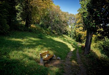
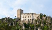
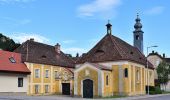
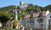
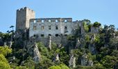
Randonnée A pied de 3,9 km à découvrir à Basse-Autriche, Bezirk Baden, Gemeinde Baden. Cette randonnée est proposée par SityTrail - itinéraires balisés pédestres.
Description
Der ÖTK gilt als Pionier des Fremdenverkehrs. Heute ist der ÖTK mit über 360 Kursen und geführten Touren in 50 Freizeitsportarten der größte Anbieter im Outdoor-Segment in Österreich.
Site web: https://oetk.at
Localisation
Commentaires
Randonnées à proximité
![Randonnée A pied Gemeinde Baden - Helenental - Purbachtal - Siegenfeld - Photo](https://media.geolcdn.com/t/375/260/5a614943-aefd-4044-ae93-346b84510ace.jpeg&format=jpg&maxdim=2)
![A pied A pied](https://static1.geolcdn.com/sitytour/trail-icons/100.png)
A pied
![](/images/other/stat-length.png)
![](https://static1.geolcdn.com/siteimages/upload/files/16400158638029165_repeat_loop_refresh_sync_direction_icon.png)
![Randonnée A pied Gemeinde Baden - Baden (Kurpark) - Siegenfeld - Photo](https://media.geolcdn.com/t/375/260/5a614943-aefd-4044-ae93-346b84510ace.jpeg&format=jpg&maxdim=2)
![A pied A pied](https://static1.geolcdn.com/sitytour/trail-icons/100.png)
A pied
![](/images/other/stat-length.png)
![](https://static1.geolcdn.com/siteimages/upload/files/16400158638029165_repeat_loop_refresh_sync_direction_icon.png)
![Randonnée A pied Gemeinde Sooß - Sooß - Hinterer Lindkogel - Photo](https://media.geolcdn.com/t/375/260/07679af8-2fd7-4614-800e-6519adbad7ed.jpeg&format=jpg&maxdim=2)
![A pied A pied](https://static1.geolcdn.com/sitytour/trail-icons/100.png)
A pied
![](/images/other/stat-length.png)
![](https://static1.geolcdn.com/siteimages/upload/files/16400158638029165_repeat_loop_refresh_sync_direction_icon.png)
![Randonnée A pied Gemeinde Alland - Augustinerhütte - Zobelhof - Photo](https://media.geolcdn.com/t/375/260/d4acc02f-48be-4d40-b654-ee5e1a7a248e.jpeg&format=jpg&maxdim=2)
![A pied A pied](https://static1.geolcdn.com/sitytour/trail-icons/100.png)
A pied
![](/images/other/stat-length.png)
![](https://static1.geolcdn.com/siteimages/upload/files/16400158638029165_repeat_loop_refresh_sync_direction_icon.png)
![Randonnée A pied Gemeinde Heiligenkreuz - Cholerakapelle - Kalkgraben - Photo](https://media.geolcdn.com/t/375/260/42925560-1c0c-4861-8850-2a2d95fa07c0.jpeg&format=jpg&maxdim=2)
![A pied A pied](https://static1.geolcdn.com/sitytour/trail-icons/100.png)
A pied
![](/images/other/stat-length.png)
![](https://static1.geolcdn.com/siteimages/upload/files/16400158638029165_repeat_loop_refresh_sync_direction_icon.png)
![Randonnée A pied Gemeinde Baden - Baden Kurpark - Gaaden - Photo](https://media.geolcdn.com/t/375/260/3873ba05-45c9-4033-8553-14176e92ff3b.jpeg&format=jpg&maxdim=2)
![A pied A pied](https://static1.geolcdn.com/sitytour/trail-icons/100.png)
A pied
![](/images/other/stat-length.png)
![](https://static1.geolcdn.com/siteimages/upload/files/16400158638029165_repeat_loop_refresh_sync_direction_icon.png)
![Randonnée A pied Gemeinde Bad Vöslau - Bad Vöslau - Vöslauer Kalkgraben - Photo](https://media.geolcdn.com/t/375/260/8fe19a0b-ce65-4dac-a7fe-c8251ec9ea11.jpeg&format=jpg&maxdim=2)
![A pied A pied](https://static1.geolcdn.com/sitytour/trail-icons/100.png)
A pied
![](/images/other/stat-length.png)
![](https://static1.geolcdn.com/siteimages/upload/files/16400158638029165_repeat_loop_refresh_sync_direction_icon.png)
![Randonnée A pied Gemeinde Baden - Beethoven Panoramaweg - Photo](https://media.geolcdn.com/t/375/260/d11d188e-e880-4a30-8e81-b48722b166a5.jpeg&format=jpg&maxdim=2)
![A pied A pied](https://static1.geolcdn.com/sitytour/trail-icons/100.png)
A pied
![](/images/other/stat-length.png)
![](https://static1.geolcdn.com/siteimages/upload/files/16400158638029165_repeat_loop_refresh_sync_direction_icon.png)
![Randonnée A pied Gemeinde Bad Vöslau - Beethoven Rundwanderweg - Photo](https://media.geolcdn.com/t/375/260/93a477f0-1654-4aa9-a0f9-f54798e8806b.jpeg&format=jpg&maxdim=2)
![A pied A pied](https://static1.geolcdn.com/sitytour/trail-icons/100.png)
A pied
![](/images/other/stat-length.png)
![](https://static1.geolcdn.com/siteimages/upload/files/16400158638029165_repeat_loop_refresh_sync_direction_icon.png)