![](/images/other/stat-length.png)
![Randonnée A pied Lasberg - Mühlenweg - Photo](https://media.geolcdn.com/t/1900/400/e818d116-b894-461c-8ced-d07ee935fca6.jpeg&format=pjpeg&maxdim=2)
Mühlenweg
SityTrail - itinéraires balisés pédestres
Tous les sentiers balisés d’Europe GUIDE+
![Longueur](/images/other/stat-length.png)
Longueur
8,1 km
![Altitude max](https://static1.geolcdn.com/siteimages/upload/files/1508320355ic_sort_altitude_max_24dp.png)
Altitude max
655 m
![Dénivelé positif](https://static1.geolcdn.com/siteimages/upload/files/1508320355ic_sort_den_pos_24dp.png)
Dénivelé positif
223 m
![Km-Effort](/images/other/stat-length.png)
Km-Effort
11 km
![Altitude min](https://static1.geolcdn.com/siteimages/upload/files/1508320355ic_sort_altitude_min_24dp.png)
Altitude min
513 m
![Dénivelé négatif](https://static1.geolcdn.com/siteimages/upload/files/1508320355ic_sort_den_neg_24dp.png)
Dénivelé négatif
223 m
![Boucle](https://static1.geolcdn.com/siteimages/upload/files/16400158638029165_repeat_loop_refresh_sync_direction_icon.png)
Boucle
Oui
Balise
Date de création :
2022-02-16 17:12:26.308
Dernière modification :
2022-03-03 17:40:00.42
![A pied](https://static1.geolcdn.com/sitytour/trail-icons/100.png)
2h30
Difficulté : Facile
![Scannez ce code QR pour ouvrir la randonnée dans l'application SityTrail](https://capi.geolives.com/qq0zvz2zws4bq2lad0pu/sitytour/trails/3129046/qr.png?size=200)
Application GPS de randonnée GRATUITE
À propos
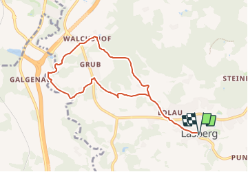
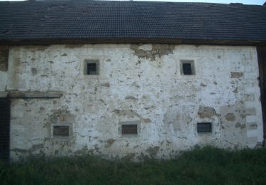
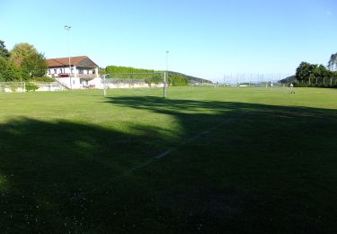
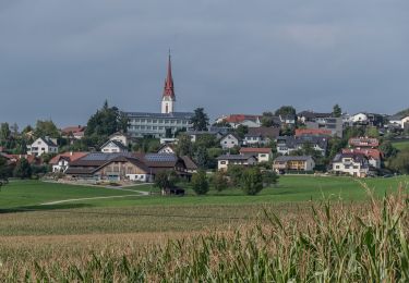
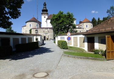
Randonnée A pied de 8,1 km à découvrir à Haute-Autriche, Bezirk Freistadt, Lasberg. Cette randonnée est proposée par SityTrail - itinéraires balisés pédestres.
Description
Randonnée créée par Lasberg Tourismus.
Symbole: weißer Text La6 auf rotem Grund
Localisation
Pays :
Autriche
Région :
Haute-Autriche
Département/Province :
Bezirk Freistadt
Commune :
Lasberg
Localité :
Unknown
Départ:(Dec)
Départ:(UTM)
466063 ; 5368771 (33U) N.
Commentaires
Randonnées à proximité
![Randonnée A pied Freistadt - Planetenwanderweg - Photo](https://media.geolcdn.com/t/375/260/6e085a65-c0c5-42fb-b94e-dc71481b28dd.jpeg&format=jpg&maxdim=2)
![A pied A pied](https://static1.geolcdn.com/sitytour/trail-icons/100.png)
Planetenwanderweg
A pied
Moyen
Freistadt,
Haute-Autriche,
Bezirk Freistadt,
Autriche
![](/images/other/stat-length.png)
15,4 km | 23 km-effort
5h 10min
![](https://static1.geolcdn.com/siteimages/upload/files/16400158638029165_repeat_loop_refresh_sync_direction_icon.png)
Non
![Randonnée A pied Freistadt - Mittelalterlicher Erlebnispfad - Photo](https://media.geolcdn.com/t/375/260/5679c0c0-a572-4b08-80c8-3d20cf7df9d8.jpeg&format=jpg&maxdim=2)
![A pied A pied](https://static1.geolcdn.com/sitytour/trail-icons/100.png)
Mittelalterlicher Erlebnispfad
A pied
Difficile
Freistadt,
Haute-Autriche,
Bezirk Freistadt,
Autriche
![](/images/other/stat-length.png)
26 km | 35 km-effort
7h 50min
![](https://static1.geolcdn.com/siteimages/upload/files/16400158638029165_repeat_loop_refresh_sync_direction_icon.png)
Oui
![Randonnée A pied Neumarkt im Mühlkreis - Kefermarkt-Rundweg - Photo](https://media.geolcdn.com/t/375/260/bea5ee9e-5fa4-4a81-a978-6d081e7ddbe4.jpeg&format=jpg&maxdim=2)
![A pied A pied](https://static1.geolcdn.com/sitytour/trail-icons/100.png)
Kefermarkt-Rundweg
A pied
Facile
Neumarkt im Mühlkreis,
Haute-Autriche,
Bezirk Freistadt,
Autriche
![](/images/other/stat-length.png)
6,7 km | 9,5 km-effort
2h 9min
![](https://static1.geolcdn.com/siteimages/upload/files/16400158638029165_repeat_loop_refresh_sync_direction_icon.png)
Non
![Randonnée A pied Neumarkt im Mühlkreis - Burgstall-Rundweg - Photo](https://media.geolcdn.com/t/375/260/7661415f-b1a1-4997-b3f4-700045b6b36f.jpeg&format=jpg&maxdim=2)
![A pied A pied](https://static1.geolcdn.com/sitytour/trail-icons/100.png)
Burgstall-Rundweg
A pied
Facile
Neumarkt im Mühlkreis,
Haute-Autriche,
Bezirk Freistadt,
Autriche
![](/images/other/stat-length.png)
6,3 km | 9,1 km-effort
2h 4min
![](https://static1.geolcdn.com/siteimages/upload/files/16400158638029165_repeat_loop_refresh_sync_direction_icon.png)
Oui
![Randonnée A pied Neumarkt im Mühlkreis - Kempfendorer Berg Rundwanderweg - Photo](https://media.geolcdn.com/t/375/260/0985909d-a2d4-474b-a240-b44f10724cbc.jpeg&format=jpg&maxdim=2)
![A pied A pied](https://static1.geolcdn.com/sitytour/trail-icons/100.png)
Kempfendorer Berg Rundwanderweg
A pied
Facile
Neumarkt im Mühlkreis,
Haute-Autriche,
Bezirk Freistadt,
Autriche
![](/images/other/stat-length.png)
9,4 km | 12,9 km-effort
2h 55min
![](https://static1.geolcdn.com/siteimages/upload/files/16400158638029165_repeat_loop_refresh_sync_direction_icon.png)
Oui
![Randonnée A pied Lasberg - Elzer-Weg - Photo](https://media.geolcdn.com/t/375/260/4109331c-b27b-485c-b5b7-0b35754deafc.jpeg&format=jpg&maxdim=2)
![A pied A pied](https://static1.geolcdn.com/sitytour/trail-icons/100.png)
Elzer-Weg
A pied
Facile
Lasberg,
Haute-Autriche,
Bezirk Freistadt,
Autriche
![](/images/other/stat-length.png)
3,6 km | 6,1 km-effort
1h 22min
![](https://static1.geolcdn.com/siteimages/upload/files/16400158638029165_repeat_loop_refresh_sync_direction_icon.png)
Non
![Randonnée A pied Kefermarkt - Buchbergweg - Photo](https://media.geolcdn.com/t/375/260/78387aa7-1c3a-469e-88f6-c21fd54182d9.jpeg&format=jpg&maxdim=2)
![A pied A pied](https://static1.geolcdn.com/sitytour/trail-icons/100.png)
Buchbergweg
A pied
Facile
Kefermarkt,
Haute-Autriche,
Bezirk Freistadt,
Autriche
![](/images/other/stat-length.png)
3,4 km | 6,1 km-effort
1h 23min
![](https://static1.geolcdn.com/siteimages/upload/files/16400158638029165_repeat_loop_refresh_sync_direction_icon.png)
Non
![Randonnée A pied Lasberg - Vier-Berge-Weg - Photo](https://media.geolcdn.com/t/375/260/92dcbc28-8e43-4a92-890f-a960fb42af3f.jpeg&format=jpg&maxdim=2)
![A pied A pied](https://static1.geolcdn.com/sitytour/trail-icons/100.png)
Vier-Berge-Weg
A pied
Difficile
Lasberg,
Haute-Autriche,
Bezirk Freistadt,
Autriche
![](/images/other/stat-length.png)
25 km | 38 km-effort
8h 32min
![](https://static1.geolcdn.com/siteimages/upload/files/16400158638029165_repeat_loop_refresh_sync_direction_icon.png)
Oui
![Randonnée A pied Sankt Oswald bei Freistadt - Sankt Oswalder Höhenweg - Photo](https://media.geolcdn.com/t/375/260/b687d49e-e8e4-4989-b2be-9d8fa580ee3a.jpeg&format=jpg&maxdim=2)
![A pied A pied](https://static1.geolcdn.com/sitytour/trail-icons/100.png)
Sankt Oswalder Höhenweg
A pied
Facile
Sankt Oswald bei Freistadt,
Haute-Autriche,
Bezirk Freistadt,
Autriche
![](/images/other/stat-length.png)
5,5 km | 8,5 km-effort
1h 55min
![](https://static1.geolcdn.com/siteimages/upload/files/16400158638029165_repeat_loop_refresh_sync_direction_icon.png)
Non