![](/images/other/stat-length.png)
![Randonnée A pied Niederneukirchen - Wanderweg 5 Kapellen und Wegkreuze - Photo](https://media.geolcdn.com/t/1900/400/b93fa360-269f-445e-8413-0e5f4f5c3754.jpeg&format=pjpeg&maxdim=2)
Wanderweg 5 Kapellen und Wegkreuze
SityTrail - itinéraires balisés pédestres
Tous les sentiers balisés d’Europe GUIDE+
![Longueur](/images/other/stat-length.png)
Longueur
6 km
![Altitude max](https://static1.geolcdn.com/siteimages/upload/files/1508320355ic_sort_altitude_max_24dp.png)
Altitude max
354 m
![Dénivelé positif](https://static1.geolcdn.com/siteimages/upload/files/1508320355ic_sort_den_pos_24dp.png)
Dénivelé positif
112 m
![Km-Effort](/images/other/stat-length.png)
Km-Effort
7,4 km
![Altitude min](https://static1.geolcdn.com/siteimages/upload/files/1508320355ic_sort_altitude_min_24dp.png)
Altitude min
299 m
![Dénivelé négatif](https://static1.geolcdn.com/siteimages/upload/files/1508320355ic_sort_den_neg_24dp.png)
Dénivelé négatif
76 m
![Boucle](https://static1.geolcdn.com/siteimages/upload/files/16400158638029165_repeat_loop_refresh_sync_direction_icon.png)
Boucle
Non
Balise
Date de création :
2022-02-16 17:05:32.49
Dernière modification :
2022-03-03 16:16:53.738
![A pied](https://static1.geolcdn.com/sitytour/trail-icons/100.png)
1h40
Difficulté : Facile
![Scannez ce code QR pour ouvrir la randonnée dans l'application SityTrail](https://capi.geolives.com/qq0zvz2zws4bq2lad0pu/sitytour/trails/3128766/qr.png?size=200)
Application GPS de randonnée GRATUITE
À propos
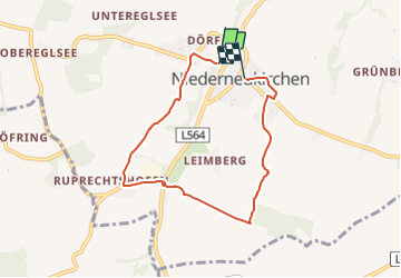
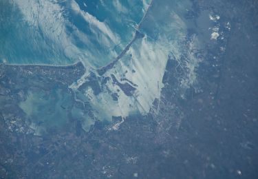
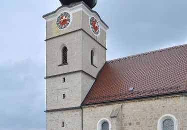
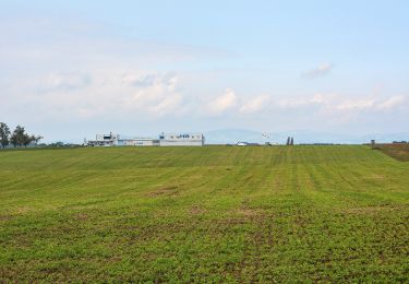
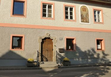
Randonnée A pied de 6 km à découvrir à Haute-Autriche, Bezirk Linz-Land, Niederneukirchen. Cette randonnée est proposée par SityTrail - itinéraires balisés pédestres.
Description
Randonnée créée par Gemeinde Niederneukirchen.
Symbole: Lila Kreis auf gelbem Grund und in schwarz die Ziffer 5
Localisation
Pays :
Autriche
Région :
Haute-Autriche
Département/Province :
Bezirk Linz-Land
Commune :
Niederneukirchen
Localité :
Unknown
Départ:(Dec)
Départ:(UTM)
450609 ; 5334484 (33U) N.
Commentaires
Randonnées à proximité
![Randonnée A pied Niederneukirchen - Wanderweg 4 Steggraben-Ruprechtshofen - Photo](https://media.geolcdn.com/t/375/260/718ae45c-070d-400e-99b5-7d59f21b383d.jpeg&format=jpg&maxdim=2)
![A pied A pied](https://static1.geolcdn.com/sitytour/trail-icons/100.png)
Wanderweg 4 Steggraben-Ruprechtshofen
A pied
Facile
Niederneukirchen,
Haute-Autriche,
Bezirk Linz-Land,
Autriche
![](/images/other/stat-length.png)
9,5 km | 11,7 km-effort
2h 39min
![](https://static1.geolcdn.com/siteimages/upload/files/16400158638029165_repeat_loop_refresh_sync_direction_icon.png)
Oui
![Randonnée A pied Hofkirchen im Traunkreis - Wanderweg Krottental - Photo](https://media.geolcdn.com/t/375/260/a4d92969-9284-418c-a99c-f13c6a9f1a6c.jpeg&format=jpg&maxdim=2)
![A pied A pied](https://static1.geolcdn.com/sitytour/trail-icons/100.png)
Wanderweg Krottental
A pied
Facile
Hofkirchen im Traunkreis,
Haute-Autriche,
Bezirk Linz-Land,
Autriche
![](/images/other/stat-length.png)
6,9 km | 8,1 km-effort
1h 50min
![](https://static1.geolcdn.com/siteimages/upload/files/16400158638029165_repeat_loop_refresh_sync_direction_icon.png)
Oui
![Randonnée A pied Hofkirchen im Traunkreis - Wanderweg Lanzenberg - Photo](https://media.geolcdn.com/t/375/260/fad5c2cb-e5de-41fe-8d11-38975e3cd9db.jpeg&format=jpg&maxdim=2)
![A pied A pied](https://static1.geolcdn.com/sitytour/trail-icons/100.png)
Wanderweg Lanzenberg
A pied
Facile
Hofkirchen im Traunkreis,
Haute-Autriche,
Bezirk Linz-Land,
Autriche
![](/images/other/stat-length.png)
5,5 km | 6,8 km-effort
1h 33min
![](https://static1.geolcdn.com/siteimages/upload/files/16400158638029165_repeat_loop_refresh_sync_direction_icon.png)
Oui
![Randonnée A pied Sankt Florian - Rundwanderweg Tillysburg - Photo](https://media.geolcdn.com/t/375/260/b8dcd07d-19c8-4c88-92b7-8c4009b2af96.jpeg&format=jpg&maxdim=2)
![A pied A pied](https://static1.geolcdn.com/sitytour/trail-icons/100.png)
Rundwanderweg Tillysburg
A pied
Facile
Sankt Florian,
Haute-Autriche,
Bezirk Linz-Land,
Autriche
![](/images/other/stat-length.png)
13,5 km | 16,9 km-effort
3h 50min
![](https://static1.geolcdn.com/siteimages/upload/files/16400158638029165_repeat_loop_refresh_sync_direction_icon.png)
Oui
![Randonnée A pied Niederneukirchen - Wanderweg 6 Rund um den Kirchturm - Photo](https://media.geolcdn.com/t/375/260/ce002758-d35a-4536-bf98-c3e96d4fe7a4.jpeg&format=jpg&maxdim=2)
![A pied A pied](https://static1.geolcdn.com/sitytour/trail-icons/100.png)
Wanderweg 6 Rund um den Kirchturm
A pied
Facile
Niederneukirchen,
Haute-Autriche,
Bezirk Linz-Land,
Autriche
![](/images/other/stat-length.png)
3,4 km | 4,3 km-effort
58min
![](https://static1.geolcdn.com/siteimages/upload/files/16400158638029165_repeat_loop_refresh_sync_direction_icon.png)
Non
![Randonnée A pied Niederneukirchen - Wanderweg 2 Kühholz - Photo](https://media.geolcdn.com/t/375/260/31bae9c3-2b36-49c8-b761-a30d25f285cd.jpeg&format=jpg&maxdim=2)
![A pied A pied](https://static1.geolcdn.com/sitytour/trail-icons/100.png)
Wanderweg 2 Kühholz
A pied
Facile
Niederneukirchen,
Haute-Autriche,
Bezirk Linz-Land,
Autriche
![](/images/other/stat-length.png)
5,5 km | 6,6 km-effort
1h 29min
![](https://static1.geolcdn.com/siteimages/upload/files/16400158638029165_repeat_loop_refresh_sync_direction_icon.png)
Oui
![Randonnée A pied Wolfern - Wanderweg Hagleiten - Photo](https://media.geolcdn.com/t/375/260/648b83e5-8153-4adf-9b37-2410fae9e744.jpeg&format=jpg&maxdim=2)
![A pied A pied](https://static1.geolcdn.com/sitytour/trail-icons/100.png)
Wanderweg Hagleiten
A pied
Facile
Wolfern,
Haute-Autriche,
Bezirk Steyr-Land,
Autriche
![](/images/other/stat-length.png)
10,8 km | 13,1 km-effort
2h 58min
![](https://static1.geolcdn.com/siteimages/upload/files/16400158638029165_repeat_loop_refresh_sync_direction_icon.png)
Oui