


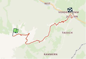

3,1 km | 4,9 km-effort

Tous les sentiers balisés d’Europe GUIDE+


Application GPS de randonnée GRATUITE
 SityTrail
IGN / Instituts géographiques
SityTrail World
Le monde est à vous
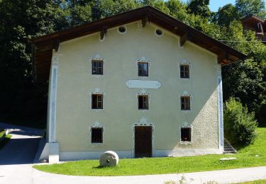
Randonnée A pied de 6,4 km à découvrir à Salzbourg, Bezirk Zell am See, Saalbach-Hinterglemm. Cette randonnée est proposée par SityTrail - itinéraires balisés pédestres.
Symbole: roter Grund weißer Strich


A pied
A pied
A pied
A pied
![Randonnée A pied Marktgemeinde Fieberbrunn - [12] Fieberbrunn Jägersteig - Photo](https://media.geolcdn.com/t/375/260/9edda448-f93a-4af8-b4d9-b9ec1461bad0.jpeg&format=jpg&maxdim=2)
A pied
![Randonnée A pied Marktgemeinde Fieberbrunn - [18] Fieberbrunn - Blumenweg - Photo](https://media.geolcdn.com/t/375/260/b0fb6c51-bb1d-48af-8466-686aec3e3c44.jpeg&format=jpg&maxdim=2)
A pied
![Randonnée A pied Marktgemeinde Fieberbrunn - [2] Fieberbrunner Höhenweg - Photo](https://media.geolcdn.com/t/375/260/e8040533-add9-44ec-957a-500c7078819f.jpeg&format=jpg&maxdim=2)
A pied
![Randonnée A pied Marktgemeinde Fieberbrunn - [1] Fieberbrunn - Wanderschuh - Photo](https://media.geolcdn.com/t/375/260/fd03419b-07ff-495d-9845-bd674901fd7c.jpeg&format=jpg&maxdim=2)
A pied
![Randonnée A pied Marktgemeinde Fieberbrunn - [3] Fieberbrunn - Karstein - Photo](https://media.geolcdn.com/t/375/260/3deaf227-084c-4bb2-b343-4239f2614f36.jpeg&format=jpg&maxdim=2)
A pied