![](/images/other/stat-length.png)
![Randonnée A pied Ilz - Ilzer Rosenapfelweg - Photo](https://media.geolcdn.com/t/1900/400/a181ac5c-e47b-4b59-955c-367c65f252ce.jpeg&format=pjpeg&maxdim=2)
Ilzer Rosenapfelweg
SityTrail - itinéraires balisés pédestres
Tous les sentiers balisés d’Europe GUIDE+
![Longueur](/images/other/stat-length.png)
Longueur
3,6 km
![Altitude max](https://static1.geolcdn.com/siteimages/upload/files/1508320355ic_sort_altitude_max_24dp.png)
Altitude max
396 m
![Dénivelé positif](https://static1.geolcdn.com/siteimages/upload/files/1508320355ic_sort_den_pos_24dp.png)
Dénivelé positif
11 m
![Km-Effort](/images/other/stat-length.png)
Km-Effort
4,1 km
![Altitude min](https://static1.geolcdn.com/siteimages/upload/files/1508320355ic_sort_altitude_min_24dp.png)
Altitude min
284 m
![Dénivelé négatif](https://static1.geolcdn.com/siteimages/upload/files/1508320355ic_sort_den_neg_24dp.png)
Dénivelé négatif
117 m
![Boucle](https://static1.geolcdn.com/siteimages/upload/files/16400158638029165_repeat_loop_refresh_sync_direction_icon.png)
Boucle
Non
Balise
Date de création :
2022-02-16 16:50:32.681
Dernière modification :
2022-03-03 12:57:28.677
![A pied](https://static1.geolcdn.com/sitytour/trail-icons/100.png)
55m
Difficulté : Facile
![Scannez ce code QR pour ouvrir la randonnée dans l'application SityTrail](https://capi.geolives.com/qq0zvz2zws4bq2lad0pu/sitytour/trails/3128070/qr.png?size=200)
Application GPS de randonnée GRATUITE
À propos
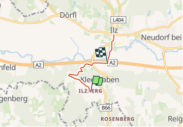
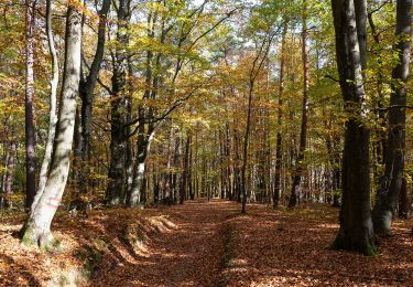
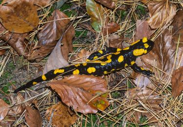
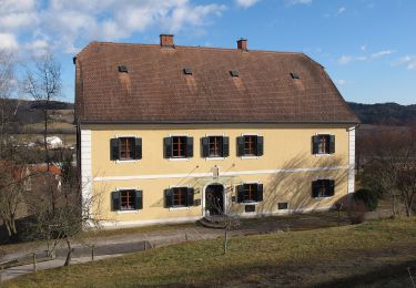
Randonnée A pied de 3,6 km à découvrir à Styrie, Bezirk Hartberg-Fürstenfeld, Ilz. Cette randonnée est proposée par SityTrail - itinéraires balisés pédestres.
Description
Randonnée créée par Vulkanland.
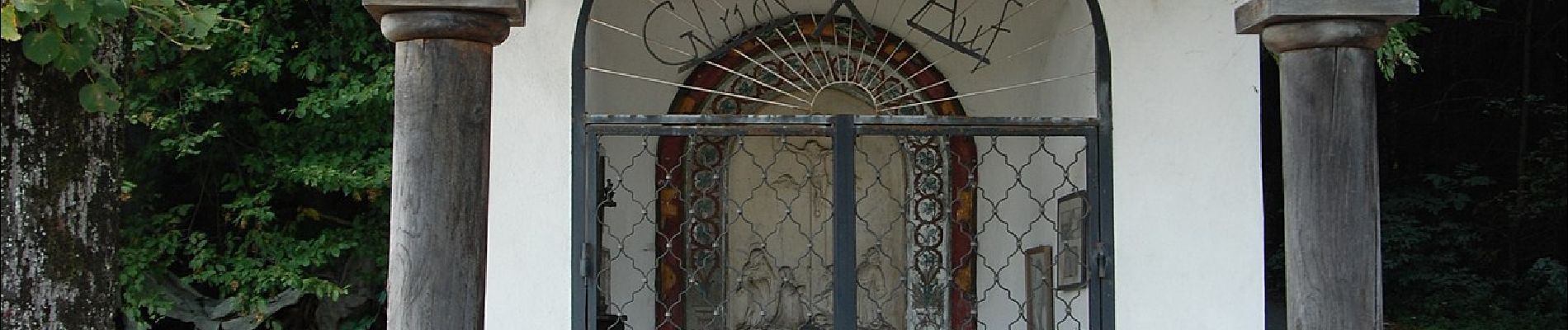
Symbole: Gelbe Tafel Vulkanland mit Aufschrift Ilzer Rosenapfelweg
Localisation
Pays :
Autriche
Région :
Styrie
Département/Province :
Bezirk Hartberg-Fürstenfeld
Commune :
Ilz
Localité :
Unknown
Départ:(Dec)
Départ:(UTM)
569685 ; 5213708 (33T) N.
Commentaires
Randonnées à proximité
![Randonnée A pied Bad Waltersdorf - S1 Berg- und Tal Rundwanderweg - Photo](https://media.geolcdn.com/t/375/260/44c06e8c-23ab-4301-b184-4ac3b204ecd2.jpeg&format=jpg&maxdim=2)
![A pied A pied](https://static1.geolcdn.com/sitytour/trail-icons/100.png)
S1 Berg- und Tal Rundwanderweg
A pied
Facile
Bad Waltersdorf,
Styrie,
Bezirk Hartberg-Fürstenfeld,
Autriche
![](/images/other/stat-length.png)
10 km | 12 km-effort
2h 43min
![](https://static1.geolcdn.com/siteimages/upload/files/16400158638029165_repeat_loop_refresh_sync_direction_icon.png)
Non
![Randonnée A pied Stubenberg - Klammrunde - Photo](https://media.geolcdn.com/t/375/260/da81cdef-c26a-4882-b4e5-36b56d66709a.jpeg&format=jpg&maxdim=2)
![A pied A pied](https://static1.geolcdn.com/sitytour/trail-icons/100.png)
Klammrunde
A pied
Facile
Stubenberg,
Styrie,
Bezirk Hartberg-Fürstenfeld,
Autriche
![](/images/other/stat-length.png)
4,2 km | 6,4 km-effort
1h 27min
![](https://static1.geolcdn.com/siteimages/upload/files/16400158638029165_repeat_loop_refresh_sync_direction_icon.png)
Oui
![Randonnée A pied Ludersdorf-Wilfersdorf - Wanderweg 15 - Photo](https://media.geolcdn.com/t/375/260/55fde9cb-2918-4c0a-855f-6f02a54bea2e.jpeg&format=jpg&maxdim=2)
![A pied A pied](https://static1.geolcdn.com/sitytour/trail-icons/100.png)
Wanderweg 15
A pied
Facile
Ludersdorf-Wilfersdorf,
Styrie,
Bezirk Weiz,
Autriche
![](/images/other/stat-length.png)
6,7 km | 9,5 km-effort
2h 9min
![](https://static1.geolcdn.com/siteimages/upload/files/16400158638029165_repeat_loop_refresh_sync_direction_icon.png)
Non
![Randonnée A pied Bad Loipersdorf - Lautenberg/Schaufelberg Runde (Weg 7) - Photo](https://media.geolcdn.com/t/375/260/0ef68ff7-d780-4303-9d12-c45fbc4d8f49.jpeg&format=jpg&maxdim=2)
![A pied A pied](https://static1.geolcdn.com/sitytour/trail-icons/100.png)
Lautenberg/Schaufelberg Runde (Weg 7)
A pied
Facile
Bad Loipersdorf,
Styrie,
Bezirk Hartberg-Fürstenfeld,
Autriche
![](/images/other/stat-length.png)
3,8 km | 5,2 km-effort
1h 11min
![](https://static1.geolcdn.com/siteimages/upload/files/16400158638029165_repeat_loop_refresh_sync_direction_icon.png)
Oui
![Randonnée A pied Bad Loipersdorf - Au & Uferweg, kurze Variante (Weg 8) - Photo](https://media.geolcdn.com/t/375/260/9d6ff6f2-489d-4087-935b-672a1098ffaf.jpeg&format=jpg&maxdim=2)
![A pied A pied](https://static1.geolcdn.com/sitytour/trail-icons/100.png)
Au & Uferweg, kurze Variante (Weg 8)
A pied
Facile
Bad Loipersdorf,
Styrie,
Bezirk Hartberg-Fürstenfeld,
Autriche
![](/images/other/stat-length.png)
7,7 km | 10,2 km-effort
2h 19min
![](https://static1.geolcdn.com/siteimages/upload/files/16400158638029165_repeat_loop_refresh_sync_direction_icon.png)
Oui
![Randonnée A pied Bad Loipersdorf - Für](https://media.geolcdn.com/t/375/260/b03ffa49-a331-44da-890d-7d84c3bb7a91.jpeg&format=jpg&maxdim=2)
![A pied A pied](https://static1.geolcdn.com/sitytour/trail-icons/100.png)
Für "Grenzgänger" (Weg 2)
A pied
Facile
Bad Loipersdorf,
Styrie,
Bezirk Hartberg-Fürstenfeld,
Autriche
![](/images/other/stat-length.png)
4,3 km | 6 km-effort
1h 21min
![](https://static1.geolcdn.com/siteimages/upload/files/16400158638029165_repeat_loop_refresh_sync_direction_icon.png)
Oui
![Randonnée A pied Bad Loipersdorf - Kleiner Höhenrundweg (Weg 5) - Photo](https://media.geolcdn.com/t/375/260/999e08bb-955b-4635-a0ba-e7dd5ecae701.jpeg&format=jpg&maxdim=2)
![A pied A pied](https://static1.geolcdn.com/sitytour/trail-icons/100.png)
Kleiner Höhenrundweg (Weg 5)
A pied
Facile
Bad Loipersdorf,
Styrie,
Bezirk Hartberg-Fürstenfeld,
Autriche
![](/images/other/stat-length.png)
6,6 km | 9,1 km-effort
2h 3min
![](https://static1.geolcdn.com/siteimages/upload/files/16400158638029165_repeat_loop_refresh_sync_direction_icon.png)
Oui
![Randonnée A pied St. Margarethen an der Raab - Wanderweg 5 - Photo](https://media.geolcdn.com/t/375/260/e9e441b2-dec2-4074-aea9-3ef1e3d6aed3.jpeg&format=jpg&maxdim=2)
![A pied A pied](https://static1.geolcdn.com/sitytour/trail-icons/100.png)
Wanderweg 5
A pied
Facile
St. Margarethen an der Raab,
Styrie,
Bezirk Weiz,
Autriche
![](/images/other/stat-length.png)
11 km | 14,8 km-effort
3h 21min
![](https://static1.geolcdn.com/siteimages/upload/files/16400158638029165_repeat_loop_refresh_sync_direction_icon.png)
Non
![Randonnée A pied Bad Waltersdorf - Herrschaftswaldweg (W7) - Photo](https://media.geolcdn.com/t/375/260/a53dbc2d-f6e3-46d6-a11b-08b69fe5948f.jpeg&format=jpg&maxdim=2)
![A pied A pied](https://static1.geolcdn.com/sitytour/trail-icons/100.png)
Herrschaftswaldweg (W7)
A pied
Facile
Bad Waltersdorf,
Styrie,
Bezirk Hartberg-Fürstenfeld,
Autriche
![](/images/other/stat-length.png)
8,9 km | 11,3 km-effort
2h 33min
![](https://static1.geolcdn.com/siteimages/upload/files/16400158638029165_repeat_loop_refresh_sync_direction_icon.png)
Non