![](/images/other/stat-length.png)
![Randonnée A pied Stadt Kufstein - Thierberg-Runde - Photo](https://media.geolcdn.com/t/1900/400/d9229499-fadb-4b2f-84bb-885bfff162c2.jpeg&format=pjpeg&maxdim=2)
Thierberg-Runde
SityTrail - itinéraires balisés pédestres
Tous les sentiers balisés d’Europe GUIDE+
![Longueur](/images/other/stat-length.png)
![Altitude max](https://static1.geolcdn.com/siteimages/upload/files/1508320355ic_sort_altitude_max_24dp.png)
![Dénivelé positif](https://static1.geolcdn.com/siteimages/upload/files/1508320355ic_sort_den_pos_24dp.png)
![Km-Effort](/images/other/stat-length.png)
![Altitude min](https://static1.geolcdn.com/siteimages/upload/files/1508320355ic_sort_altitude_min_24dp.png)
![Dénivelé négatif](https://static1.geolcdn.com/siteimages/upload/files/1508320355ic_sort_den_neg_24dp.png)
![Boucle](https://static1.geolcdn.com/siteimages/upload/files/16400158638029165_repeat_loop_refresh_sync_direction_icon.png)
![A pied](https://static1.geolcdn.com/sitytour/trail-icons/100.png)
2h08
Difficulté : Facile
![Scannez ce code QR pour ouvrir la randonnée dans l'application SityTrail](https://capi.geolives.com/qq0zvz2zws4bq2lad0pu/sitytour/trails/3127885/qr.png?size=200)
Application GPS de randonnée GRATUITE
À propos
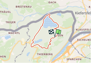
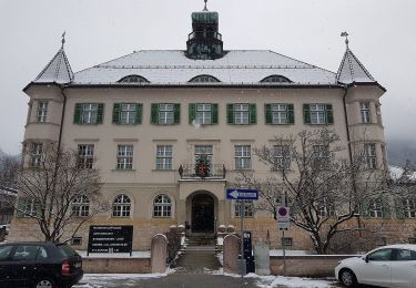
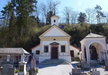
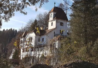
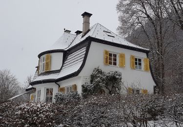
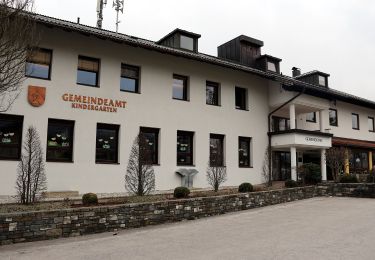
Randonnée A pied de 6,1 km à découvrir à Tyrol, Bezirk Kufstein, Stadt Kufstein. Cette randonnée est proposée par SityTrail - itinéraires balisés pédestres.
Description
Randonnée créée par Lauf- und Walking Kompetenzzentrum Kufstein.
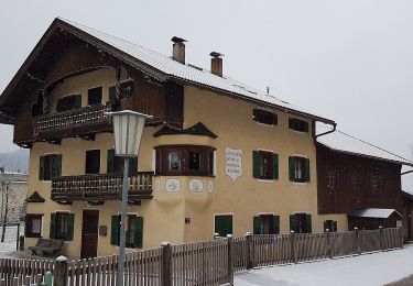
Symbole: Weiße Schilder mit Richtungspfeil und schwarzem Streifen mit dem Namen "Thierberg-Runde"
Localisation
Commentaires
Randonnées à proximité
![Randonnée A pied Kiefersfelden - Kaiser Max Weg - Photo](https://media.geolcdn.com/t/375/260/d9479138-c4d4-4de4-9913-7bba84071432.jpeg&format=jpg&maxdim=2)
![A pied A pied](https://static1.geolcdn.com/sitytour/trail-icons/100.png)
A pied
![](/images/other/stat-length.png)
![](https://static1.geolcdn.com/siteimages/upload/files/16400158638029165_repeat_loop_refresh_sync_direction_icon.png)
![Randonnée A pied Stadt Kufstein - Prinz Luitpold Weg - Photo](https://media.geolcdn.com/t/375/260/7aaf1793-4671-43af-9ad0-5e7767904bdf.jpeg&format=jpg&maxdim=2)
![A pied A pied](https://static1.geolcdn.com/sitytour/trail-icons/100.png)
A pied
![](/images/other/stat-length.png)
![](https://static1.geolcdn.com/siteimages/upload/files/16400158638029165_repeat_loop_refresh_sync_direction_icon.png)
![Randonnée A pied Stadt Kufstein - Kapellenweg - Photo](https://media.geolcdn.com/t/375/260/e7b6607e-c32c-4d8c-b4a0-d43dc902835a.jpeg&format=jpg&maxdim=2)
![A pied A pied](https://static1.geolcdn.com/sitytour/trail-icons/100.png)
A pied
![](/images/other/stat-length.png)
![](https://static1.geolcdn.com/siteimages/upload/files/16400158638029165_repeat_loop_refresh_sync_direction_icon.png)
![Randonnée A pied Stadt Kufstein - Denkmalwanderung - Photo](https://media.geolcdn.com/t/375/260/050b7c40-79f2-444c-adf3-bc878881d4c9.jpeg&format=jpg&maxdim=2)
![A pied A pied](https://static1.geolcdn.com/sitytour/trail-icons/100.png)
A pied
![](/images/other/stat-length.png)
![](https://static1.geolcdn.com/siteimages/upload/files/16400158638029165_repeat_loop_refresh_sync_direction_icon.png)
![Randonnée A pied Stadt Kufstein - Energieweg Kufstein - Photo](https://media.geolcdn.com/t/375/260/768c9069-4cc0-4c9d-965e-70eff8e8e6d4.jpeg&format=jpg&maxdim=2)
![A pied A pied](https://static1.geolcdn.com/sitytour/trail-icons/100.png)
A pied
![](/images/other/stat-length.png)
![](https://static1.geolcdn.com/siteimages/upload/files/16400158638029165_repeat_loop_refresh_sync_direction_icon.png)
![Randonnée A pied Stadt Kufstein - Rund um Kufstein - Photo](https://media.geolcdn.com/t/375/260/e1bd58f2-db1d-4ff1-908f-b08c89061459.jpeg&format=jpg&maxdim=2)
![A pied A pied](https://static1.geolcdn.com/sitytour/trail-icons/100.png)
A pied
![](/images/other/stat-length.png)
![](https://static1.geolcdn.com/siteimages/upload/files/16400158638029165_repeat_loop_refresh_sync_direction_icon.png)
![Randonnée A pied Stadt Kufstein - Elfenhain-Trail - Photo](https://media.geolcdn.com/t/375/260/bf877ae3-7b85-40db-872a-fc43df081ae7.jpeg&format=jpg&maxdim=2)
![A pied A pied](https://static1.geolcdn.com/sitytour/trail-icons/100.png)
A pied
![](/images/other/stat-length.png)
![](https://static1.geolcdn.com/siteimages/upload/files/16400158638029165_repeat_loop_refresh_sync_direction_icon.png)
![Randonnée A pied Gemeinde Ebbs - Inn Rundweg - Photo](https://media.geolcdn.com/t/375/260/daaecc59-bccf-4b5e-b34b-e9247f0a0214.jpeg&format=jpg&maxdim=2)
![A pied A pied](https://static1.geolcdn.com/sitytour/trail-icons/100.png)
A pied
![](/images/other/stat-length.png)
![](https://static1.geolcdn.com/siteimages/upload/files/16400158638029165_repeat_loop_refresh_sync_direction_icon.png)
![Randonnée A pied Stadt Kufstein - Brentenjoch-Trail - Photo](https://media.geolcdn.com/t/375/260/1c6a7877-1f15-44ce-859e-d53183c65a67.jpeg&format=jpg&maxdim=2)
![A pied A pied](https://static1.geolcdn.com/sitytour/trail-icons/100.png)
A pied
![](/images/other/stat-length.png)
![](https://static1.geolcdn.com/siteimages/upload/files/16400158638029165_repeat_loop_refresh_sync_direction_icon.png)