![](/images/other/stat-length.png)
![Randonnée A pied Münzbach - Pechölstein - Photo](https://media.geolcdn.com/t/1900/400/67b2a4c2-8f48-4bcb-b548-95484f9d1ba7.jpeg&format=pjpeg&maxdim=2)
Pechölstein
SityTrail - itinéraires balisés pédestres
Tous les sentiers balisés d’Europe GUIDE+
![Longueur](/images/other/stat-length.png)
Longueur
11,1 km
![Altitude max](https://static1.geolcdn.com/siteimages/upload/files/1508320355ic_sort_altitude_max_24dp.png)
Altitude max
706 m
![Dénivelé positif](https://static1.geolcdn.com/siteimages/upload/files/1508320355ic_sort_den_pos_24dp.png)
Dénivelé positif
449 m
![Km-Effort](/images/other/stat-length.png)
Km-Effort
16,9 km
![Altitude min](https://static1.geolcdn.com/siteimages/upload/files/1508320355ic_sort_altitude_min_24dp.png)
Altitude min
389 m
![Dénivelé négatif](https://static1.geolcdn.com/siteimages/upload/files/1508320355ic_sort_den_neg_24dp.png)
Dénivelé négatif
384 m
![Boucle](https://static1.geolcdn.com/siteimages/upload/files/16400158638029165_repeat_loop_refresh_sync_direction_icon.png)
Boucle
Non
Balise
Date de création :
2022-02-16 16:38:02.984
Dernière modification :
2022-03-03 10:10:12.888
![A pied](https://static1.geolcdn.com/sitytour/trail-icons/100.png)
3h49
Difficulté : Facile
![Scannez ce code QR pour ouvrir la randonnée dans l'application SityTrail](https://capi.geolives.com/qq0zvz2zws4bq2lad0pu/sitytour/trails/3127446/qr.png?size=200)
Application GPS de randonnée GRATUITE
À propos
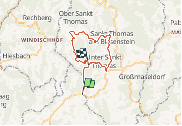
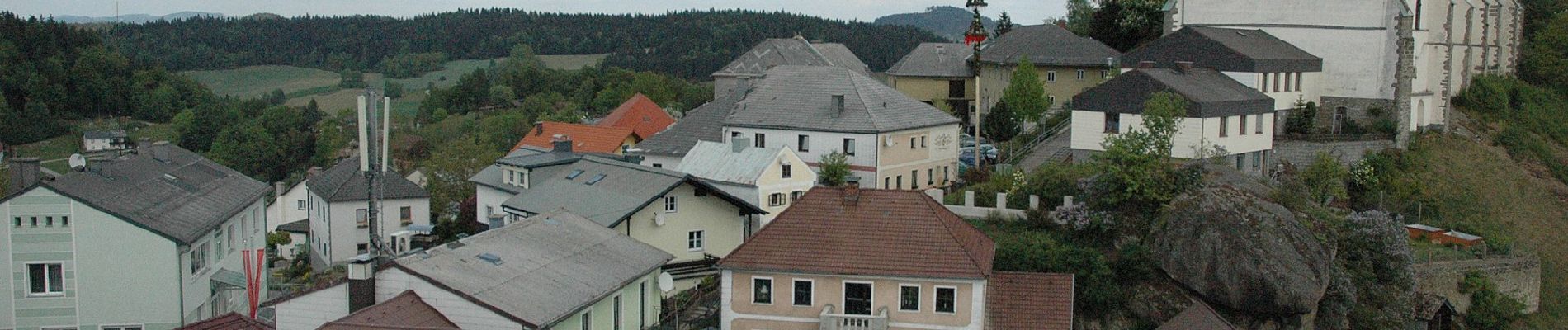
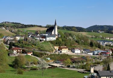
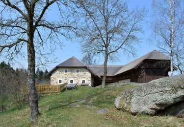
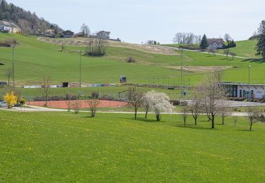
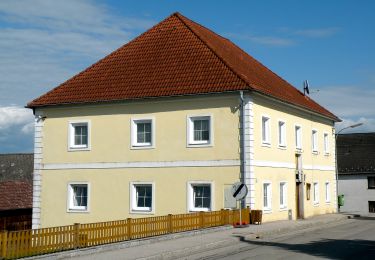
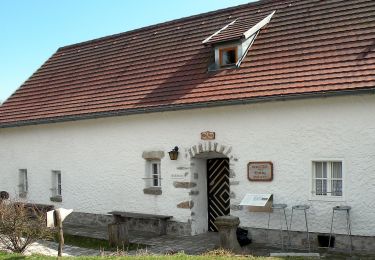
Randonnée A pied de 11,1 km à découvrir à Haute-Autriche, Bezirk Perg, Münzbach. Cette randonnée est proposée par SityTrail - itinéraires balisés pédestres.
Description
Randonnée créée par Gemeinde Sankt Thomas am Blasenstein.
Symbole: grüne Tafel mit weißem Text S4
Localisation
Pays :
Autriche
Région :
Haute-Autriche
Département/Province :
Bezirk Perg
Commune :
Münzbach
Localité :
Unknown
Départ:(Dec)
Départ:(UTM)
480863 ; 5348191 (33U) N.
Commentaires
Randonnées à proximité
![Randonnée A pied Bad Kreuzen - Kneipp-Weg - Photo](https://media.geolcdn.com/t/375/260/9400c472-a79c-4c42-9f82-cf214a296dc0.jpeg&format=jpg&maxdim=2)
![A pied A pied](https://static1.geolcdn.com/sitytour/trail-icons/100.png)
Kneipp-Weg
A pied
Facile
Bad Kreuzen,
Haute-Autriche,
Bezirk Perg,
Autriche
![](/images/other/stat-length.png)
4,1 km | 6 km-effort
1h 22min
![](https://static1.geolcdn.com/siteimages/upload/files/16400158638029165_repeat_loop_refresh_sync_direction_icon.png)
Oui
![Randonnée A pied Bad Kreuzen - Anton Bruckner Weg - Photo](https://media.geolcdn.com/t/375/260/084c1519-9d1f-4ac4-987f-f4f8f94859ba.jpeg&format=jpg&maxdim=2)
![A pied A pied](https://static1.geolcdn.com/sitytour/trail-icons/100.png)
Anton Bruckner Weg
A pied
Facile
Bad Kreuzen,
Haute-Autriche,
Bezirk Perg,
Autriche
![](/images/other/stat-length.png)
3,1 km | 4,1 km-effort
56min
![](https://static1.geolcdn.com/siteimages/upload/files/16400158638029165_repeat_loop_refresh_sync_direction_icon.png)
Oui
![Randonnée A pied Pabneukirchen - Unter-Pabneukirchen Rundweg - Photo](https://media.geolcdn.com/t/375/260/baad22a6-9f57-4109-9b39-0d5f1204fa7a.jpeg&format=jpg&maxdim=2)
![A pied A pied](https://static1.geolcdn.com/sitytour/trail-icons/100.png)
Unter-Pabneukirchen Rundweg
A pied
Facile
Pabneukirchen,
Haute-Autriche,
Bezirk Perg,
Autriche
![](/images/other/stat-length.png)
5,3 km | 7,8 km-effort
1h 46min
![](https://static1.geolcdn.com/siteimages/upload/files/16400158638029165_repeat_loop_refresh_sync_direction_icon.png)
Non
![Randonnée A pied Pabneukirchen - Stilles Tal Rundweg - Photo](https://media.geolcdn.com/t/375/260/7a95d285-03dc-48f5-b1b5-139c93e1019b.jpeg&format=jpg&maxdim=2)
![A pied A pied](https://static1.geolcdn.com/sitytour/trail-icons/100.png)
Stilles Tal Rundweg
A pied
Facile
Pabneukirchen,
Haute-Autriche,
Bezirk Perg,
Autriche
![](/images/other/stat-length.png)
3,6 km | 5,5 km-effort
1h 14min
![](https://static1.geolcdn.com/siteimages/upload/files/16400158638029165_repeat_loop_refresh_sync_direction_icon.png)
Oui
![Randonnée A pied Pabneukirchen - Romantiktal-Maseldorf - Photo](https://media.geolcdn.com/t/375/260/78e6f358-d850-4ce0-ae6b-02b51479020e.jpeg&format=jpg&maxdim=2)
![A pied A pied](https://static1.geolcdn.com/sitytour/trail-icons/100.png)
Romantiktal-Maseldorf
A pied
Facile
Pabneukirchen,
Haute-Autriche,
Bezirk Perg,
Autriche
![](/images/other/stat-length.png)
7,1 km | 10 km-effort
2h 15min
![](https://static1.geolcdn.com/siteimages/upload/files/16400158638029165_repeat_loop_refresh_sync_direction_icon.png)
Non
![Randonnée A pied Rechberg - Der Naturparkweg - Photo](https://media.geolcdn.com/t/375/260/00512289-f987-447a-ab17-ceceb9e1f3a0.jpeg&format=jpg&maxdim=2)
![A pied A pied](https://static1.geolcdn.com/sitytour/trail-icons/100.png)
Der Naturparkweg
A pied
Facile
Rechberg,
Haute-Autriche,
Bezirk Perg,
Autriche
![](/images/other/stat-length.png)
7,5 km | 11,2 km-effort
2h 32min
![](https://static1.geolcdn.com/siteimages/upload/files/16400158638029165_repeat_loop_refresh_sync_direction_icon.png)
Oui
![Randonnée A pied Rechberg - Weg Schwammerling - Photo](https://media.geolcdn.com/t/375/260/8ad41e96-6c1e-442a-b845-0992d1acc119.jpeg&format=jpg&maxdim=2)
![A pied A pied](https://static1.geolcdn.com/sitytour/trail-icons/100.png)
Weg Schwammerling
A pied
Facile
Rechberg,
Haute-Autriche,
Bezirk Perg,
Autriche
![](/images/other/stat-length.png)
4 km | 5,6 km-effort
1h 16min
![](https://static1.geolcdn.com/siteimages/upload/files/16400158638029165_repeat_loop_refresh_sync_direction_icon.png)
Oui
![Randonnée A pied Windhaag bei Perg - Route IV Schwertmühle - Photo](https://media.geolcdn.com/t/375/260/21383be9-9604-4cab-b26e-efc7d15a0996.jpeg&format=jpg&maxdim=2)
![A pied A pied](https://static1.geolcdn.com/sitytour/trail-icons/100.png)
Route IV Schwertmühle
A pied
Facile
Windhaag bei Perg,
Haute-Autriche,
Bezirk Perg,
Autriche
![](/images/other/stat-length.png)
6,4 km | 9,3 km-effort
2h 6min
![](https://static1.geolcdn.com/siteimages/upload/files/16400158638029165_repeat_loop_refresh_sync_direction_icon.png)
Oui
![Randonnée A pied Windhaag bei Perg - Route III Hausbergbach - Photo](https://media.geolcdn.com/t/375/260/7c7eb67f-f880-4c43-9835-70b1a007e6a8.jpeg&format=jpg&maxdim=2)
![A pied A pied](https://static1.geolcdn.com/sitytour/trail-icons/100.png)
Route III Hausbergbach
A pied
Facile
Windhaag bei Perg,
Haute-Autriche,
Bezirk Perg,
Autriche
![](/images/other/stat-length.png)
4,5 km | 6,5 km-effort
1h 29min
![](https://static1.geolcdn.com/siteimages/upload/files/16400158638029165_repeat_loop_refresh_sync_direction_icon.png)
Oui