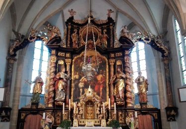
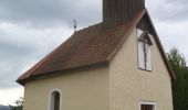
![](/images/other/stat-length.png)
![Randonnée A pied Auberg - Sagen- und Mythenwanderweg - Photo](https://media.geolcdn.com/t/1900/400/fa20a3f4-300f-4b7e-83a0-3d23fea09fd3.jpeg&format=pjpeg&maxdim=2)
Sagen- und Mythenwanderweg
SityTrail - itinéraires balisés pédestres
Tous les sentiers balisés d’Europe GUIDE+
![Longueur](/images/other/stat-length.png)
![Altitude max](https://static1.geolcdn.com/siteimages/upload/files/1508320355ic_sort_altitude_max_24dp.png)
![Dénivelé positif](https://static1.geolcdn.com/siteimages/upload/files/1508320355ic_sort_den_pos_24dp.png)
![Km-Effort](/images/other/stat-length.png)
![Altitude min](https://static1.geolcdn.com/siteimages/upload/files/1508320355ic_sort_altitude_min_24dp.png)
![Dénivelé négatif](https://static1.geolcdn.com/siteimages/upload/files/1508320355ic_sort_den_neg_24dp.png)
![Boucle](https://static1.geolcdn.com/siteimages/upload/files/16400158638029165_repeat_loop_refresh_sync_direction_icon.png)
![A pied](https://static1.geolcdn.com/sitytour/trail-icons/100.png)
3h22
Difficulté : Facile
![Scannez ce code QR pour ouvrir la randonnée dans l'application SityTrail](https://capi.geolives.com/qq0zvz2zws4bq2lad0pu/sitytour/trails/3126277/qr.png?size=200)
Application GPS de randonnée GRATUITE
À propos
Randonnée A pied de 10,4 km à découvrir à Haute-Autriche, Bezirk Rohrbach, Auberg. Cette randonnée est proposée par SityTrail - itinéraires balisés pédestres.
Description
Randonnée créée par Gemeinde Auberg.
http://wiki.openstreetmap.org/wiki/WikiProject_Austria/Wanderwege
Symbole: Schild mit Zwergerl drauf und einen Hexenbesen
Localisation
Commentaires
Randonnées à proximité
![Randonnée A pied Haslach an der Mühl - Tanzbodenweg - Photo](https://media.geolcdn.com/t/375/260/c6a002b1-66d3-492e-8553-227c580bc8c6.jpeg&format=jpg&maxdim=2)
![A pied A pied](https://static1.geolcdn.com/sitytour/trail-icons/100.png)
A pied
![](/images/other/stat-length.png)
![](https://static1.geolcdn.com/siteimages/upload/files/16400158638029165_repeat_loop_refresh_sync_direction_icon.png)
![Randonnée A pied Sankt Peter am Wimberg - Bachwanderweg - Photo](https://media.geolcdn.com/t/375/260/98b410ac-045a-4e12-a1bb-c89aa31eb48c.jpeg&format=jpg&maxdim=2)
![A pied A pied](https://static1.geolcdn.com/sitytour/trail-icons/100.png)
A pied
![](/images/other/stat-length.png)
![](https://static1.geolcdn.com/siteimages/upload/files/16400158638029165_repeat_loop_refresh_sync_direction_icon.png)
![Randonnée A pied Sankt Peter am Wimberg - Hunnenweg - Photo](https://media.geolcdn.com/t/375/260/98b410ac-045a-4e12-a1bb-c89aa31eb48c.jpeg&format=jpg&maxdim=2)
![A pied A pied](https://static1.geolcdn.com/sitytour/trail-icons/100.png)
A pied
![](/images/other/stat-length.png)
![](https://static1.geolcdn.com/siteimages/upload/files/16400158638029165_repeat_loop_refresh_sync_direction_icon.png)
![Randonnée A pied Haslach an der Mühl - Michlweg - Photo](https://media.geolcdn.com/t/375/260/79759b02-7db6-4e2b-94c6-de61a7964950.jpeg&format=jpg&maxdim=2)
![A pied A pied](https://static1.geolcdn.com/sitytour/trail-icons/100.png)
A pied
![](/images/other/stat-length.png)
![](https://static1.geolcdn.com/siteimages/upload/files/16400158638029165_repeat_loop_refresh_sync_direction_icon.png)
![Randonnée A pied Haslach an der Mühl - Naturerlebnisweg - Photo](https://media.geolcdn.com/t/375/260/bfc894e9-b133-4cea-8a6b-b83b4124a01f.jpeg&format=jpg&maxdim=2)
![A pied A pied](https://static1.geolcdn.com/sitytour/trail-icons/100.png)
A pied
![](/images/other/stat-length.png)
![](https://static1.geolcdn.com/siteimages/upload/files/16400158638029165_repeat_loop_refresh_sync_direction_icon.png)
![Randonnée A pied Haslach an der Mühl - Haslacher Rundumweg - Photo](https://media.geolcdn.com/t/375/260/dd17d5da-9fb2-4f32-a909-ec5de448f909.jpeg&format=jpg&maxdim=2)
![A pied A pied](https://static1.geolcdn.com/sitytour/trail-icons/100.png)
A pied
![](/images/other/stat-length.png)
![](https://static1.geolcdn.com/siteimages/upload/files/16400158638029165_repeat_loop_refresh_sync_direction_icon.png)
![Randonnée A pied Sankt Johann am Wimberg - Petersberg-Rundwanderweg - Photo](https://media.geolcdn.com/t/375/260/ca9bdbf9-78f1-4804-9809-da9b4659177c.jpeg&format=jpg&maxdim=2)
![A pied A pied](https://static1.geolcdn.com/sitytour/trail-icons/100.png)
A pied
![](/images/other/stat-length.png)
![](https://static1.geolcdn.com/siteimages/upload/files/16400158638029165_repeat_loop_refresh_sync_direction_icon.png)
![Randonnée A pied Sankt Peter am Wimberg - Waldwanderweg - Photo](https://media.geolcdn.com/t/375/260/f4c81e83-a399-4e73-916f-33e13619b5c8.jpeg&format=jpg&maxdim=2)
![A pied A pied](https://static1.geolcdn.com/sitytour/trail-icons/100.png)
A pied
![](/images/other/stat-length.png)
![](https://static1.geolcdn.com/siteimages/upload/files/16400158638029165_repeat_loop_refresh_sync_direction_icon.png)
![Randonnée A pied St. Stefan-Afiesl - Stifter Panoramasteig - Photo](https://media.geolcdn.com/t/375/260/374ea8ad-4935-4648-b8e1-74b34e665ddf.jpeg&format=jpg&maxdim=2)
![A pied A pied](https://static1.geolcdn.com/sitytour/trail-icons/100.png)
A pied
![](/images/other/stat-length.png)
![](https://static1.geolcdn.com/siteimages/upload/files/16400158638029165_repeat_loop_refresh_sync_direction_icon.png)