![](/images/other/stat-length.png)
![Randonnée A pied Oberneukirchen - Lobensteiner Runde - Photo](https://media.geolcdn.com/t/1900/400/6bc21aa0-4a28-4384-b4b8-2bc60eafb91d.jpeg&format=pjpeg&maxdim=2)
Lobensteiner Runde
SityTrail - itinéraires balisés pédestres
Tous les sentiers balisés d’Europe GUIDE+
![Longueur](/images/other/stat-length.png)
Longueur
7,7 km
![Altitude max](https://static1.geolcdn.com/siteimages/upload/files/1508320355ic_sort_altitude_max_24dp.png)
Altitude max
852 m
![Dénivelé positif](https://static1.geolcdn.com/siteimages/upload/files/1508320355ic_sort_den_pos_24dp.png)
Dénivelé positif
224 m
![Km-Effort](/images/other/stat-length.png)
Km-Effort
10,7 km
![Altitude min](https://static1.geolcdn.com/siteimages/upload/files/1508320355ic_sort_altitude_min_24dp.png)
Altitude min
708 m
![Dénivelé négatif](https://static1.geolcdn.com/siteimages/upload/files/1508320355ic_sort_den_neg_24dp.png)
Dénivelé négatif
222 m
![Boucle](https://static1.geolcdn.com/siteimages/upload/files/16400158638029165_repeat_loop_refresh_sync_direction_icon.png)
Boucle
Non
Balise
Date de création :
2022-02-16 16:08:24.695
Dernière modification :
2022-03-03 02:12:43.712
![A pied](https://static1.geolcdn.com/sitytour/trail-icons/100.png)
2h25
Difficulté : Facile
![Scannez ce code QR pour ouvrir la randonnée dans l'application SityTrail](https://capi.geolives.com/qq0zvz2zws4bq2lad0pu/sitytour/trails/3126084/qr.png?size=200)
Application GPS de randonnée GRATUITE
À propos
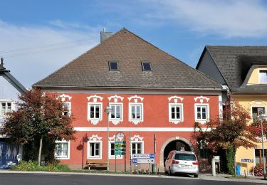
Randonnée A pied de 7,7 km à découvrir à Haute-Autriche, Bezirk Urfahr-Umgebung, Oberneukirchen. Cette randonnée est proposée par SityTrail - itinéraires balisés pédestres.
Description
Meta Beschreibung der Seite
Site web: http://www.oberneukirchen.ooe.gv.at/system/web/GetDocument.ashx?fileid=730719
Localisation
Pays :
Autriche
Région :
Haute-Autriche
Département/Province :
Bezirk Urfahr-Umgebung
Commune :
Oberneukirchen
Localité :
Unknown
Départ:(Dec)
Départ:(UTM)
443369 ; 5366079 (33U) N.
Commentaires
Randonnées à proximité
![Randonnée A pied Kirchschlag bei Linz - Speichmühle-Kirchschlag - Photo](https://media.geolcdn.com/t/375/260/347f3024-e410-4454-90c8-c8c5bfbe925d.jpeg&format=jpg&maxdim=2)
![A pied A pied](https://static1.geolcdn.com/sitytour/trail-icons/100.png)
Speichmühle-Kirchschlag
A pied
Facile
Kirchschlag bei Linz,
Haute-Autriche,
Bezirk Urfahr-Umgebung,
Autriche
![](/images/other/stat-length.png)
5,1 km | 6,8 km-effort
1h 32min
![](https://static1.geolcdn.com/siteimages/upload/files/16400158638029165_repeat_loop_refresh_sync_direction_icon.png)
Non
![Randonnée A pied Kirchschlag bei Linz - Kirchschlag 6er - Photo](https://media.geolcdn.com/t/375/260/89aeab92-5c1d-4f2d-86db-4abd9a2ec13e.jpeg&format=jpg&maxdim=2)
![A pied A pied](https://static1.geolcdn.com/sitytour/trail-icons/100.png)
Kirchschlag 6er
A pied
Facile
Kirchschlag bei Linz,
Haute-Autriche,
Bezirk Urfahr-Umgebung,
Autriche
![](/images/other/stat-length.png)
9,3 km | 12 km-effort
2h 43min
![](https://static1.geolcdn.com/siteimages/upload/files/16400158638029165_repeat_loop_refresh_sync_direction_icon.png)
Oui
![Randonnée A pied Kirchschlag bei Linz - Kirchschlag 1er - Photo](https://media.geolcdn.com/t/375/260/62c3f557-6379-4375-918c-d3ba7d06727b.jpeg&format=jpg&maxdim=2)
![A pied A pied](https://static1.geolcdn.com/sitytour/trail-icons/100.png)
Kirchschlag 1er
A pied
Facile
Kirchschlag bei Linz,
Haute-Autriche,
Bezirk Urfahr-Umgebung,
Autriche
![](/images/other/stat-length.png)
4,2 km | 5,2 km-effort
1h 11min
![](https://static1.geolcdn.com/siteimages/upload/files/16400158638029165_repeat_loop_refresh_sync_direction_icon.png)
Oui
![Randonnée A pied Kirchschlag bei Linz - Untergeng-Kirchschlag - Photo](https://media.geolcdn.com/t/375/260/34c105d1-90a2-464f-ba7f-d585ffbbf199.jpeg&format=jpg&maxdim=2)
![A pied A pied](https://static1.geolcdn.com/sitytour/trail-icons/100.png)
Untergeng-Kirchschlag
A pied
Facile
Kirchschlag bei Linz,
Haute-Autriche,
Bezirk Urfahr-Umgebung,
Autriche
![](/images/other/stat-length.png)
4,7 km | 6,2 km-effort
1h 25min
![](https://static1.geolcdn.com/siteimages/upload/files/16400158638029165_repeat_loop_refresh_sync_direction_icon.png)
Non
![Randonnée A pied Kirchschlag bei Linz - Kirchschlag 2er - Photo](https://media.geolcdn.com/t/375/260/b246ddb3-530e-427a-8a06-258dad3ce602.jpeg&format=jpg&maxdim=2)
![A pied A pied](https://static1.geolcdn.com/sitytour/trail-icons/100.png)
Kirchschlag 2er
A pied
Facile
Kirchschlag bei Linz,
Haute-Autriche,
Bezirk Urfahr-Umgebung,
Autriche
![](/images/other/stat-length.png)
7,5 km | 10,4 km-effort
2h 21min
![](https://static1.geolcdn.com/siteimages/upload/files/16400158638029165_repeat_loop_refresh_sync_direction_icon.png)
Oui
![Randonnée A pied Zwettl an der Rodl - Wanderweg 31 - Photo](https://media.geolcdn.com/t/375/260/61794fe5-6829-41e1-b091-04857efc6fea.jpeg&format=jpg&maxdim=2)
![A pied A pied](https://static1.geolcdn.com/sitytour/trail-icons/100.png)
Wanderweg 31
A pied
Facile
Zwettl an der Rodl,
Haute-Autriche,
Bezirk Urfahr-Umgebung,
Autriche
![](/images/other/stat-length.png)
10,2 km | 13,4 km-effort
3h 2min
![](https://static1.geolcdn.com/siteimages/upload/files/16400158638029165_repeat_loop_refresh_sync_direction_icon.png)
Non
![Randonnée A pied Hellmonsödt - AT-19 - Photo](https://media.geolcdn.com/t/375/260/02881a25-c23c-48f4-9933-335cb03edb79.jpeg&format=jpg&maxdim=2)
![A pied A pied](https://static1.geolcdn.com/sitytour/trail-icons/100.png)
AT-19
A pied
Facile
Hellmonsödt,
Haute-Autriche,
Bezirk Urfahr-Umgebung,
Autriche
![](/images/other/stat-length.png)
4,9 km | 7,8 km-effort
1h 46min
![](https://static1.geolcdn.com/siteimages/upload/files/16400158638029165_repeat_loop_refresh_sync_direction_icon.png)
Non
![Randonnée A pied Sonnberg im Mühlkreis - Mühlviertler Sterngartl Rundweg - Photo](https://media.geolcdn.com/t/375/260/5b99adca-b0b1-48c6-9f6c-32dc78115849.jpeg&format=jpg&maxdim=2)
![A pied A pied](https://static1.geolcdn.com/sitytour/trail-icons/100.png)
Mühlviertler Sterngartl Rundweg
A pied
Moyen
Sonnberg im Mühlkreis,
Haute-Autriche,
Bezirk Urfahr-Umgebung,
Autriche
![](/images/other/stat-length.png)
15,7 km | 23 km-effort
5h 11min
![](https://static1.geolcdn.com/siteimages/upload/files/16400158638029165_repeat_loop_refresh_sync_direction_icon.png)
Non
![Randonnée A pied Kirchschlag bei Linz - Speichmühle-Wildberg - Photo](https://media.geolcdn.com/t/375/260/5935fc67-3c82-42ab-9050-2dfa41ebd2bc.jpeg&format=jpg&maxdim=2)
![A pied A pied](https://static1.geolcdn.com/sitytour/trail-icons/100.png)
Speichmühle-Wildberg
A pied
Facile
Kirchschlag bei Linz,
Haute-Autriche,
Bezirk Urfahr-Umgebung,
Autriche
![](/images/other/stat-length.png)
3,1 km | 3,8 km-effort
51min
![](https://static1.geolcdn.com/siteimages/upload/files/16400158638029165_repeat_loop_refresh_sync_direction_icon.png)
Non