


3 km | 5,5 km-effort
![Randonnée A pied Gemeinde Thaur - Adlerweg [005] - Photo](https://media.geolcdn.com/t/1900/400/33cc7009-2e57-4d54-bf2e-591cc57fe342.jpeg&format=pjpeg&maxdim=2)

Tous les sentiers balisés d’Europe GUIDE+


Application GPS de randonnée GRATUITE
 SityTrail
IGN / Instituts géographiques
SityTrail World
Le monde est à vous
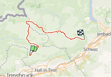
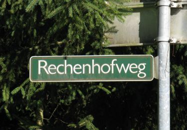
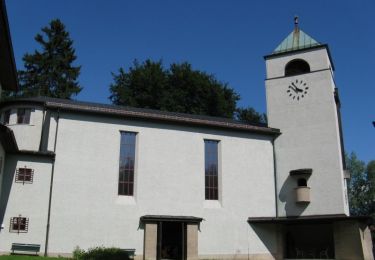
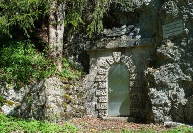
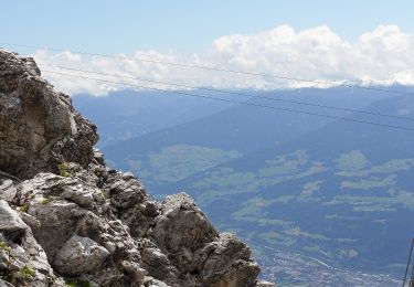
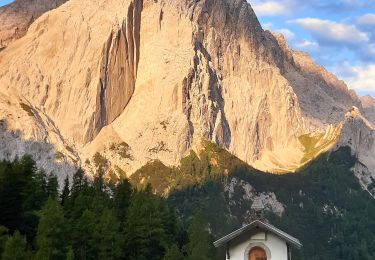
Randonnée A pied de 49 km à découvrir à Tyrol, Bezirk Innsbruck-Land, Gemeinde Thaur. Cette randonnée est proposée par SityTrail - itinéraires balisés pédestres.
![Randonnée A pied Gemeinde Thaur - Adlerweg [005] - Photo 1](https://media.geolcdn.com/t/2048/auto/7194c595-d291-4f8a-8c29-9ec9a346a2c8.jpeg&format=jpg&maxdim=0 "Randonnée A pied Gemeinde Thaur - Adlerweg [005] - Photo 1")
![Randonnée A pied Gemeinde Thaur - Adlerweg [005] - Photo 2](https://media.geolcdn.com/t/2048/auto/eee23b8a-e14d-4ca1-a8ff-cc66fcc93c3f.jpeg&format=jpg&maxdim=0 "Randonnée A pied Gemeinde Thaur - Adlerweg [005] - Photo 2")
![Randonnée A pied Gemeinde Thaur - Adlerweg [005] - Photo 3](https://media.geolcdn.com/t/2048/auto/447154a9-abdc-4445-b8c2-8d59142e5f8d.jpeg&format=jpg&maxdim=0 "Randonnée A pied Gemeinde Thaur - Adlerweg [005] - Photo 3")
![Randonnée A pied Gemeinde Thaur - Adlerweg [005] - Photo 4](https://media.geolcdn.com/t/2048/auto/b56d8669-8485-4c34-84ef-dc2fa8e4a470.jpeg&format=jpg&maxdim=0 "Randonnée A pied Gemeinde Thaur - Adlerweg [005] - Photo 4")
![Randonnée A pied Gemeinde Thaur - Adlerweg [005] - Photo 5](https://media.geolcdn.com/t/2048/auto/7877ec0a-8159-4a2e-bd64-6666d733bbf5.jpeg&format=jpg&maxdim=0 "Randonnée A pied Gemeinde Thaur - Adlerweg [005] - Photo 5")
![Randonnée A pied Gemeinde Thaur - Adlerweg [005] - Photo 6](https://media.geolcdn.com/t/2048/auto/6bc80b2c-88d4-4605-b94d-2f56c8f9f424.jpeg&format=jpg&maxdim=0 "Randonnée A pied Gemeinde Thaur - Adlerweg [005] - Photo 6")
![Randonnée A pied Gemeinde Thaur - Adlerweg [005] - Photo 7](https://media.geolcdn.com/t/2048/auto/bedb0a1f-3c22-4711-8c0c-3cbdd4d849d8.jpeg&format=jpg&maxdim=0 "Randonnée A pied Gemeinde Thaur - Adlerweg [005] - Photo 7")
![Randonnée A pied Gemeinde Thaur - Adlerweg [005] - Photo 8](https://media.geolcdn.com/t/2048/auto/3f9e1816-2357-4c70-8848-7d07a3371987.jpeg&format=jpg&maxdim=0 "Randonnée A pied Gemeinde Thaur - Adlerweg [005] - Photo 8")
![Randonnée A pied Gemeinde Thaur - Adlerweg [005] - Photo 9](https://media.geolcdn.com/t/2048/auto/8316f94c-ff80-4a65-9380-a8f5a15fe78b.jpeg&format=jpg&maxdim=0 "Randonnée A pied Gemeinde Thaur - Adlerweg [005] - Photo 9")
![Randonnée A pied Gemeinde Thaur - Adlerweg [005] - Photo 10](https://media.geolcdn.com/t/2048/auto/33cc7009-2e57-4d54-bf2e-591cc57fe342.jpeg&format=jpg&maxdim=0 "Randonnée A pied Gemeinde Thaur - Adlerweg [005] - Photo 10")
A pied
A pied
A pied
A pied
A pied
A pied
Marche

Marche