![](/images/other/stat-length.png)
![Randonnée A pied Martigues - Mer et colline Valestéloué - Photo](https://media.geolcdn.com/t/1900/400/21e84c92-a2fb-4448-a2ca-dfd7aed22fbc.jpeg&format=pjpeg&maxdim=2)
Mer et colline Valestéloué
SityTrail - itinéraires balisés pédestres
Tous les sentiers balisés d’Europe GUIDE+
![Longueur](/images/other/stat-length.png)
![Altitude max](https://static1.geolcdn.com/siteimages/upload/files/1508320355ic_sort_altitude_max_24dp.png)
![Dénivelé positif](https://static1.geolcdn.com/siteimages/upload/files/1508320355ic_sort_den_pos_24dp.png)
![Km-Effort](/images/other/stat-length.png)
![Altitude min](https://static1.geolcdn.com/siteimages/upload/files/1508320355ic_sort_altitude_min_24dp.png)
![Dénivelé négatif](https://static1.geolcdn.com/siteimages/upload/files/1508320355ic_sort_den_neg_24dp.png)
![Boucle](https://static1.geolcdn.com/siteimages/upload/files/16400158638029165_repeat_loop_refresh_sync_direction_icon.png)
![A pied](https://static1.geolcdn.com/sitytour/trail-icons/100.png)
4h02
Difficulté : Facile
![Scannez ce code QR pour ouvrir la randonnée dans l'application SityTrail](https://capi.geolives.com/qq0zvz2zws4bq2lad0pu/sitytour/trails/3121928/qr.png?size=200)
Application GPS de randonnée GRATUITE
À propos
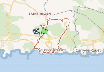
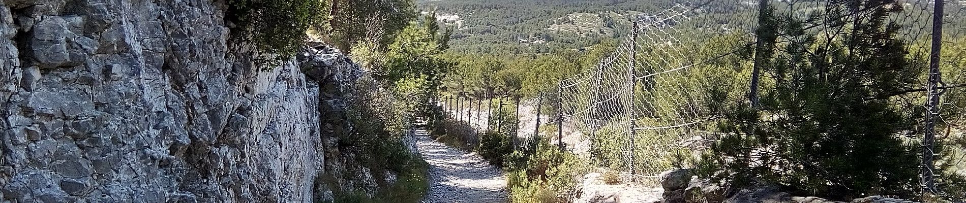
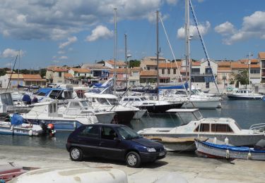
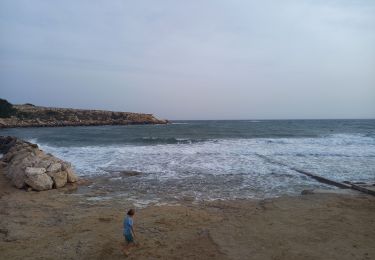
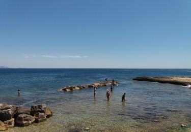
Randonnée A pied de 14,5 km à découvrir à Provence-Alpes-Côte d'Azur, Bouches-du-Rhône, Martigues. Cette randonnée est proposée par SityTrail - itinéraires balisés pédestres.
Description
Préparez votre séjour dans les Bouches-du Rhône. My Provence a sélectionné pour vous le meilleur de l'offre touristique du département.
Site web: https://www.myprovence.fr/circuits/randonnees/sausset-les-pins/149425-mer-et-colline-valestoue
Localisation
Commentaires
Randonnées à proximité
![Marche Marche](https://static1.geolcdn.com/sitytour/trail-icons/101.png)
Marche
![](/images/other/stat-length.png)
![](https://static1.geolcdn.com/siteimages/upload/files/16400158638029165_repeat_loop_refresh_sync_direction_icon.png)
![Randonnée Marche Martigues - Cap couronne - Photo](https://media.geolcdn.com/t/375/260/a311f26f-67e9-4722-b5dc-a3c3bf8cdd1f.jpg&format=jpg&maxdim=2)
![Marche Marche](https://static1.geolcdn.com/sitytour/trail-icons/101.png)
Marche
![](/images/other/stat-length.png)
![](https://static1.geolcdn.com/siteimages/upload/files/16400158638029165_repeat_loop_refresh_sync_direction_icon.png)
![Randonnée A pied Martigues - Les carrières de pierre de La Couronne - Photo](https://media.geolcdn.com/t/375/260/26fea46b-0136-4e03-82e5-aa4d3d222ff5.jpeg&format=jpg&maxdim=2)
![A pied A pied](https://static1.geolcdn.com/sitytour/trail-icons/100.png)
A pied
![](/images/other/stat-length.png)
![](https://static1.geolcdn.com/siteimages/upload/files/16400158638029165_repeat_loop_refresh_sync_direction_icon.png)
![Randonnée A pied Martigues - Boucle de Boumandariel - Photo](https://media.geolcdn.com/t/375/260/952ba8e0-5d66-42a5-803d-b742aff43050.jpeg&format=jpg&maxdim=2)
![A pied A pied](https://static1.geolcdn.com/sitytour/trail-icons/100.png)
A pied
![](/images/other/stat-length.png)
![](https://static1.geolcdn.com/siteimages/upload/files/16400158638029165_repeat_loop_refresh_sync_direction_icon.png)
![Randonnée A pied Martigues - Sentier botanique de la plaine de Carro - Photo](https://media.geolcdn.com/t/375/260/6e507b0b-ffdb-4c7c-b8fe-ce4599d1b5df.jpeg&format=jpg&maxdim=2)
![A pied A pied](https://static1.geolcdn.com/sitytour/trail-icons/100.png)
A pied
![](/images/other/stat-length.png)
![](https://static1.geolcdn.com/siteimages/upload/files/16400158638029165_repeat_loop_refresh_sync_direction_icon.png)
![Randonnée A pied Martigues - Le Cap Couronne - Photo](https://media.geolcdn.com/t/375/260/2e60c5c0-e67b-4759-bf81-6d72ec0d7ebf.jpeg&format=jpg&maxdim=2)
![A pied A pied](https://static1.geolcdn.com/sitytour/trail-icons/100.png)
A pied
![](/images/other/stat-length.png)
![](https://static1.geolcdn.com/siteimages/upload/files/16400158638029165_repeat_loop_refresh_sync_direction_icon.png)
![Randonnée A pied Sausset-les-Pins - Mer et Pinéde Valapoux - Photo](https://media.geolcdn.com/t/375/260/ec105952-3cc0-4c7a-8d8b-51e1ce146bb7.jpeg&format=jpg&maxdim=2)
![A pied A pied](https://static1.geolcdn.com/sitytour/trail-icons/100.png)
A pied
![](/images/other/stat-length.png)
![](https://static1.geolcdn.com/siteimages/upload/files/16400158638029165_repeat_loop_refresh_sync_direction_icon.png)
![Randonnée A pied Carry-le-Rouet - Le Vallon de Jaume par les Grottes - Photo](https://media.geolcdn.com/t/375/260/0b2898cd-0732-4408-b545-ff0a18859a39.jpeg&format=jpg&maxdim=2)
![A pied A pied](https://static1.geolcdn.com/sitytour/trail-icons/100.png)
A pied
![](/images/other/stat-length.png)
![](https://static1.geolcdn.com/siteimages/upload/files/16400158638029165_repeat_loop_refresh_sync_direction_icon.png)
![Randonnée A pied Carry-le-Rouet - Le Tour du Romaron - Photo](https://media.geolcdn.com/t/375/260/1a32f56d-69e4-4cf2-b186-82726e0bad5b.jpeg&format=jpg&maxdim=2)
![A pied A pied](https://static1.geolcdn.com/sitytour/trail-icons/100.png)
A pied
![](/images/other/stat-length.png)
![](https://static1.geolcdn.com/siteimages/upload/files/16400158638029165_repeat_loop_refresh_sync_direction_icon.png)