![](/images/other/stat-length.png)
![Randonnée A pied Ameglia - Alta Via del Golfo: Bocca di Magra - Il Termo - Photo](https://media.geolcdn.com/t/1900/400/91145c2a-bb6c-4a98-a95f-74b9963415fb.jpeg&format=pjpeg&maxdim=2)
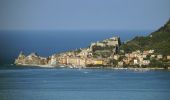
Alta Via del Golfo: Bocca di Magra - Il Termo
SityTrail - itinéraires balisés pédestres
Tous les sentiers balisés d’Europe GUIDE+
![Longueur](/images/other/stat-length.png)
Longueur
17,6 km
![Altitude max](https://static1.geolcdn.com/siteimages/upload/files/1508320355ic_sort_altitude_max_24dp.png)
Altitude max
383 m
![Dénivelé positif](https://static1.geolcdn.com/siteimages/upload/files/1508320355ic_sort_den_pos_24dp.png)
Dénivelé positif
792 m
![Km-Effort](/images/other/stat-length.png)
Km-Effort
28 km
![Altitude min](https://static1.geolcdn.com/siteimages/upload/files/1508320355ic_sort_altitude_min_24dp.png)
Altitude min
-1 m
![Dénivelé négatif](https://static1.geolcdn.com/siteimages/upload/files/1508320355ic_sort_den_neg_24dp.png)
Dénivelé négatif
743 m
![Boucle](https://static1.geolcdn.com/siteimages/upload/files/16400158638029165_repeat_loop_refresh_sync_direction_icon.png)
Boucle
Non
Balise
Date de création :
2022-02-15 13:51:43.825
Dernière modification :
2022-03-01 13:20:37.455
![A pied](https://static1.geolcdn.com/sitytour/trail-icons/100.png)
6h22
Difficulté : Moyen
![Scannez ce code QR pour ouvrir la randonnée dans l'application SityTrail](https://capi.geolives.com/qq0zvz2zws4bq2lad0pu/sitytour/trails/3119583/qr.png?size=200)
Application GPS de randonnée GRATUITE
À propos
Randonnée A pied de 17,6 km à découvrir à Ligurie, La Spezia, Ameglia. Cette randonnée est proposée par SityTrail - itinéraires balisés pédestres.
Description
relation mantained by AlfredoSP (CAI-SP)
Symbole: AVG on white ref flag
Site web: https://www.cailaspezia.it/
Localisation
Pays :
Italie
Région :
Ligurie
Département/Province :
La Spezia
Commune :
Ameglia
Localité :
Unknown
Départ:(Dec)
Départ:(UTM)
578866 ; 4877654 (32T) N.
Commentaires
Randonnées à proximité
![Randonnée A pied Lerici - Fornola – Senato (percorso fluviale) - Photo](https://media.geolcdn.com/t/375/260/b4b9300e-2228-4e6b-9c90-124177370540.jpeg&format=jpg&maxdim=2)
![A pied A pied](https://static1.geolcdn.com/sitytour/trail-icons/100.png)
Fornola – Senato (percorso fluviale)
A pied
Facile
Lerici,
Ligurie,
La Spezia,
Italie
![](/images/other/stat-length.png)
7 km | 7,6 km-effort
1h 43min
![](https://static1.geolcdn.com/siteimages/upload/files/16400158638029165_repeat_loop_refresh_sync_direction_icon.png)
Non
![Randonnée A pied Ameglia - Tellaro – Punta Bianca - Photo](https://media.geolcdn.com/t/375/260/54b61895-c346-4124-a438-eb1cca72afcf.jpeg&format=jpg&maxdim=2)
![A pied A pied](https://static1.geolcdn.com/sitytour/trail-icons/100.png)
Tellaro – Punta Bianca
A pied
Facile
Ameglia,
Ligurie,
La Spezia,
Italie
![](/images/other/stat-length.png)
3,6 km | 6 km-effort
1h 21min
![](https://static1.geolcdn.com/siteimages/upload/files/16400158638029165_repeat_loop_refresh_sync_direction_icon.png)
Non
![Randonnée A pied Lerici - Bocca Di Magra - Montemarcello - Zanego – Lerici - Photo](https://media.geolcdn.com/t/375/260/cf18f3f4-9fd8-4156-a139-22fd53547865.jpeg&format=jpg&maxdim=2)
![A pied A pied](https://static1.geolcdn.com/sitytour/trail-icons/100.png)
Bocca Di Magra - Montemarcello - Zanego – Lerici
A pied
Facile
Lerici,
Ligurie,
La Spezia,
Italie
![](/images/other/stat-length.png)
4,9 km | 8 km-effort
1h 49min
![](https://static1.geolcdn.com/siteimages/upload/files/16400158638029165_repeat_loop_refresh_sync_direction_icon.png)
Non
![Randonnée A pied Lerici - La Ferrara - Foce di Lizzano - Ameglia - Rocchetta - La Serra - Photo](https://media.geolcdn.com/t/375/260/54b61895-c346-4124-a438-eb1cca72afcf.jpeg&format=jpg&maxdim=2)
![A pied A pied](https://static1.geolcdn.com/sitytour/trail-icons/100.png)
La Ferrara - Foce di Lizzano - Ameglia - Rocchetta - La Serra
A pied
Facile
Lerici,
Ligurie,
La Spezia,
Italie
![](/images/other/stat-length.png)
7,1 km | 11,3 km-effort
2h 34min
![](https://static1.geolcdn.com/siteimages/upload/files/16400158638029165_repeat_loop_refresh_sync_direction_icon.png)
Non
![Randonnée A pied Lerici - Montemarcello – Zanego – Trebiano - Photo](https://media.geolcdn.com/t/375/260/6310cab5-08ac-4700-bbde-70d1c057af88.jpeg&format=jpg&maxdim=2)
![A pied A pied](https://static1.geolcdn.com/sitytour/trail-icons/100.png)
Montemarcello – Zanego – Trebiano
A pied
Facile
Lerici,
Ligurie,
La Spezia,
Italie
![](/images/other/stat-length.png)
5,9 km | 8,8 km-effort
2h 0min
![](https://static1.geolcdn.com/siteimages/upload/files/16400158638029165_repeat_loop_refresh_sync_direction_icon.png)
Non
![Randonnée A pied Ameglia - Anfiteatro Di Luni – Tenuta di Marinella – Fiumaretta - Photo](https://media.geolcdn.com/t/375/260/8f1832e3-b176-4fcc-b470-8cf489200e0b.jpeg&format=jpg&maxdim=2)
![A pied A pied](https://static1.geolcdn.com/sitytour/trail-icons/100.png)
Anfiteatro Di Luni – Tenuta di Marinella – Fiumaretta
A pied
Facile
Ameglia,
Ligurie,
La Spezia,
Italie
![](/images/other/stat-length.png)
5,1 km | 5,4 km-effort
1h 13min
![](https://static1.geolcdn.com/siteimages/upload/files/16400158638029165_repeat_loop_refresh_sync_direction_icon.png)
Non
![Randonnée A pied Castelnuovo Magra - Coll. VF - Olmarello - Sarticola – Monticello – C. Bertella - Photo](https://media.geolcdn.com/t/375/260/73740ca8-1c10-41d4-8912-da423521fc9d.jpeg&format=jpg&maxdim=2)
![A pied A pied](https://static1.geolcdn.com/sitytour/trail-icons/100.png)
Coll. VF - Olmarello - Sarticola – Monticello – C. Bertella
A pied
Facile
Castelnuovo Magra,
Ligurie,
La Spezia,
Italie
![](/images/other/stat-length.png)
6,1 km | 11,5 km-effort
2h 36min
![](https://static1.geolcdn.com/siteimages/upload/files/16400158638029165_repeat_loop_refresh_sync_direction_icon.png)
Non
![Randonnée A pied Castelnuovo Magra - M.no del Piano - Castelnuovo Magra - Casala - Photo](https://media.geolcdn.com/t/375/260/6db36747-1726-4fff-942f-3ef282794b69.jpeg&format=jpg&maxdim=2)
![A pied A pied](https://static1.geolcdn.com/sitytour/trail-icons/100.png)
M.no del Piano - Castelnuovo Magra - Casala
A pied
Facile
Castelnuovo Magra,
Ligurie,
La Spezia,
Italie
![](/images/other/stat-length.png)
4,6 km | 8,1 km-effort
1h 50min
![](https://static1.geolcdn.com/siteimages/upload/files/16400158638029165_repeat_loop_refresh_sync_direction_icon.png)
Non
![Marche Marche](https://static1.geolcdn.com/sitytour/trail-icons/101.png)
Promenade au dessus du golfe des poètes
Marche
Facile
Lerici,
Ligurie,
La Spezia,
Italie
![](/images/other/stat-length.png)
10,8 km | 17,1 km-effort
2h 50min
![](https://static1.geolcdn.com/siteimages/upload/files/16400158638029165_repeat_loop_refresh_sync_direction_icon.png)
Oui