![](/images/other/stat-length.png)
![Randonnée A pied Bairo - Aglie', S. Maria in Zinzolano-Torre Canavese, bivio TOP100 - Photo](https://media.geolcdn.com/t/1900/400/ext.pjpeg?maxdim=2&url=https%3A%2F%2Fstatic1.geolcdn.com%2Fsiteimages%2Fupload%2Ffiles%2F1545311037marcheuse_200dpi.jpg)
Aglie', S. Maria in Zinzolano-Torre Canavese, bivio TOP100
SityTrail - itinéraires balisés pédestres
Tous les sentiers balisés d’Europe GUIDE+
![Longueur](/images/other/stat-length.png)
Longueur
6,1 km
![Altitude max](https://static1.geolcdn.com/siteimages/upload/files/1508320355ic_sort_altitude_max_24dp.png)
Altitude max
403 m
![Dénivelé positif](https://static1.geolcdn.com/siteimages/upload/files/1508320355ic_sort_den_pos_24dp.png)
Dénivelé positif
134 m
![Km-Effort](/images/other/stat-length.png)
Km-Effort
7,6 km
![Altitude min](https://static1.geolcdn.com/siteimages/upload/files/1508320355ic_sort_altitude_min_24dp.png)
Altitude min
312 m
![Dénivelé négatif](https://static1.geolcdn.com/siteimages/upload/files/1508320355ic_sort_den_neg_24dp.png)
Dénivelé négatif
46 m
![Boucle](https://static1.geolcdn.com/siteimages/upload/files/16400158638029165_repeat_loop_refresh_sync_direction_icon.png)
Boucle
Non
Balise
Date de création :
2022-02-15 09:35:28.613
Dernière modification :
2022-03-01 07:05:29.461
![A pied](https://static1.geolcdn.com/sitytour/trail-icons/100.png)
1h44
Difficulté : Facile
![Scannez ce code QR pour ouvrir la randonnée dans l'application SityTrail](https://capi.geolives.com/qq0zvz2zws4bq2lad0pu/sitytour/trails/3117364/qr.png?size=200)
Application GPS de randonnée GRATUITE
À propos
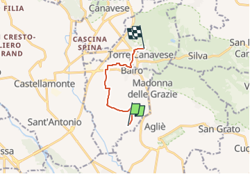
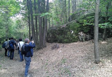
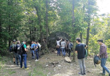
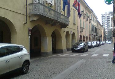
Randonnée A pied de 6,1 km à découvrir à Piémont, Turin, Bairo. Cette randonnée est proposée par SityTrail - itinéraires balisés pédestres.
Description
relation mantained by gianfox (CAI-IVREA)
Symbole: unmarked
Localisation
Pays :
Italie
Région :
Piémont
Département/Province :
Turin
Commune :
Bairo
Localité :
Unknown
Départ:(Dec)
Départ:(UTM)
402407 ; 5024524 (32T) N.
Commentaires
Randonnées à proximité
![Randonnée A pied San Giorgio Canavese - ETOP1320000 - Photo](https://media.geolcdn.com/t/375/260/fb035e0f-1086-4f18-ba97-e1d3bed2eb0f.jpeg&format=jpg&maxdim=2)
![A pied A pied](https://static1.geolcdn.com/sitytour/trail-icons/100.png)
ETOP1320000
A pied
Facile
San Giorgio Canavese,
Piémont,
Turin,
Italie
![](/images/other/stat-length.png)
13,7 km | 15,3 km-effort
3h 28min
![](https://static1.geolcdn.com/siteimages/upload/files/16400158638029165_repeat_loop_refresh_sync_direction_icon.png)
Non
![Randonnée A pied Castellamonte - ETOP103000A - Photo](https://media.geolcdn.com/t/375/260/63015f0a-04a9-4a7e-8c85-e40af8987184.jpeg&format=jpg&maxdim=2)
![A pied A pied](https://static1.geolcdn.com/sitytour/trail-icons/100.png)
ETOP103000A
A pied
Facile
Castellamonte,
Piémont,
Turin,
Italie
![](/images/other/stat-length.png)
9,1 km | 12,7 km-effort
2h 53min
![](https://static1.geolcdn.com/siteimages/upload/files/16400158638029165_repeat_loop_refresh_sync_direction_icon.png)
Non
![Randonnée A pied Vialfrè - Castellamonte fraz. Pricco, bivio TOP100 - Vialfre', bivio TOP100-TOP101 - Photo](https://media.geolcdn.com/t/375/260/9208ca07-9281-4e8f-abb2-762b7048c1d1.jpeg&format=jpg&maxdim=2)
![A pied A pied](https://static1.geolcdn.com/sitytour/trail-icons/100.png)
Castellamonte fraz. Pricco, bivio TOP100 - Vialfre', bivio TOP100-TOP101
A pied
Facile
Vialfrè,
Piémont,
Turin,
Italie
![](/images/other/stat-length.png)
6,2 km | 7,2 km-effort
1h 38min
![](https://static1.geolcdn.com/siteimages/upload/files/16400158638029165_repeat_loop_refresh_sync_direction_icon.png)
Non
![Randonnée A pied Vialfrè - Strambinello -Vialfrè - Photo](https://media.geolcdn.com/t/375/260/430909ee-a21e-4ca5-9086-77cc105a86a8.jpeg&format=jpg&maxdim=2)
![A pied A pied](https://static1.geolcdn.com/sitytour/trail-icons/100.png)
Strambinello -Vialfrè
A pied
Moyen
Vialfrè,
Piémont,
Turin,
Italie
![](/images/other/stat-length.png)
16,5 km | 22 km-effort
4h 55min
![](https://static1.geolcdn.com/siteimages/upload/files/16400158638029165_repeat_loop_refresh_sync_direction_icon.png)
Non
![Randonnée A pied Vialfrè - Candia Canavese, bivio102-Vialfre', bivio103 - Photo](https://media.geolcdn.com/t/375/260/ac389d80-78e4-4588-9c36-72769b9c2fc4.jpeg&format=jpg&maxdim=2)
![A pied A pied](https://static1.geolcdn.com/sitytour/trail-icons/100.png)
Candia Canavese, bivio102-Vialfre', bivio103
A pied
Facile
Vialfrè,
Piémont,
Turin,
Italie
![](/images/other/stat-length.png)
11,6 km | 14,3 km-effort
3h 14min
![](https://static1.geolcdn.com/siteimages/upload/files/16400158638029165_repeat_loop_refresh_sync_direction_icon.png)
Non
![Randonnée A pied Agliè - Alta Via dell’Anfiteatro Morenico di Ivrea - Itinerario di Collegamento di Agliè - Photo](https://media.geolcdn.com/t/375/260/0ec7e7cc-74f3-4dcc-b809-34a0f0219c58.jpeg&format=jpg&maxdim=2)
![A pied A pied](https://static1.geolcdn.com/sitytour/trail-icons/100.png)
Alta Via dell’Anfiteatro Morenico di Ivrea - Itinerario di Collegamento di Agliè
A pied
Facile
Agliè,
Piémont,
Turin,
Italie
![](/images/other/stat-length.png)
4,1 km | 5,7 km-effort
1h 17min
![](https://static1.geolcdn.com/siteimages/upload/files/16400158638029165_repeat_loop_refresh_sync_direction_icon.png)
Non
![Randonnée A pied Torre Canavese - Alta Via dell'Anfiteatro Morenico di Ivrea - Photo](https://media.geolcdn.com/t/375/260/aab52108-3181-4f7d-8729-387e20b6d5a2.jpeg&format=jpg&maxdim=2)
![A pied A pied](https://static1.geolcdn.com/sitytour/trail-icons/100.png)
Alta Via dell'Anfiteatro Morenico di Ivrea
A pied
Moyen
Torre Canavese,
Piémont,
Turin,
Italie
![](/images/other/stat-length.png)
17,1 km | 22 km-effort
5h 0min
![](https://static1.geolcdn.com/siteimages/upload/files/16400158638029165_repeat_loop_refresh_sync_direction_icon.png)
Non
![Randonnée A pied Rivarolo Canavese - ETOP130000A - Photo](https://media.geolcdn.com/t/375/260/2adc18aa-ce02-4ed3-b30a-dfd0195405b2.jpeg&format=jpg&maxdim=2)
![A pied A pied](https://static1.geolcdn.com/sitytour/trail-icons/100.png)
ETOP130000A
A pied
Facile
Rivarolo Canavese,
Piémont,
Turin,
Italie
![](/images/other/stat-length.png)
4,9 km | 5,3 km-effort
1h 12min
![](https://static1.geolcdn.com/siteimages/upload/files/16400158638029165_repeat_loop_refresh_sync_direction_icon.png)
Non
![Randonnée A pied San Giorgio Canavese - ETOP135000A - Photo](https://media.geolcdn.com/t/375/260/ext.jpg?maxdim=2&url=https%3A%2F%2Fstatic1.geolcdn.com%2Fsiteimages%2Fupload%2Ffiles%2F1545311037marcheuse_200dpi.jpg)
![A pied A pied](https://static1.geolcdn.com/sitytour/trail-icons/100.png)
ETOP135000A
A pied
Facile
San Giorgio Canavese,
Piémont,
Turin,
Italie
![](/images/other/stat-length.png)
6,3 km | 8,2 km-effort
1h 52min
![](https://static1.geolcdn.com/siteimages/upload/files/16400158638029165_repeat_loop_refresh_sync_direction_icon.png)
Non