Sentier de la Terre à Cloque
SityTrail - itinéraires balisés pédestres
Tous les sentiers balisés d’Europe GUIDE+
Longueur
11,7 km
Altitude max
94 m
Dénivelé positif
187 m
Km-Effort
14,2 km
Altitude min
9 m
Dénivelé négatif
187 m
Boucle
Oui
Balise
Date de création :
2022-02-15 04:31:54.988
Dernière modification :
2022-03-02 12:45:06.901
3h14
Difficulté : Facile
Application GPS de randonnée GRATUITE
À propos
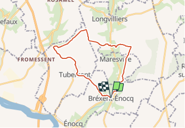
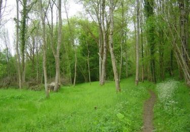
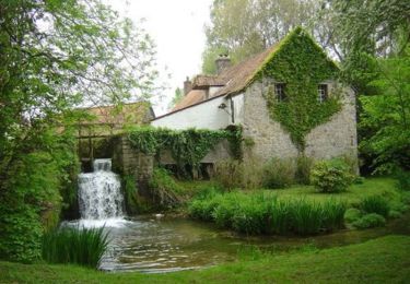
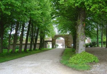
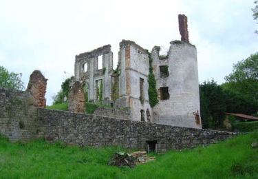
Randonnée A pied de 11,7 km à découvrir à Hauts-de-France, Pas-de-Calais, Bréxent-Énocq. Cette randonnée est proposée par SityTrail - itinéraires balisés pédestres.
Description
By ZeHilkers
Localisation
Pays :
France
Région :
Hauts-de-France
Département/Province :
Pas-de-Calais
Commune :
Bréxent-Énocq
Localité :
Unknown
Départ:(Dec)
Départ:(UTM)
409867 ; 5596069 (31U) N.
Commentaires
Randonnées à proximité
De la Course à la Canche
Marche
Difficile
(1)
Montreuil,
Hauts-de-France,
Pas-de-Calais,
France
25 km | 30 km-effort
6h 0min
Oui
Circuit Montreuil sur Mer
Marche
Moyen
Montreuil,
Hauts-de-France,
Pas-de-Calais,
France
7,6 km | 8,8 km-effort
1h 55min
Oui
Sentier des Briqueteries - Saint Josse
Marche
Facile
(1)
Saint-Josse,
Hauts-de-France,
Pas-de-Calais,
France
7,4 km | 8,7 km-effort
2h 0min
Oui
Le bois de Longvilliers
V.T.T.
Moyen
Longvilliers,
Hauts-de-France,
Pas-de-Calais,
France
11,2 km | 13,5 km-effort
1h 19min
Oui
Le bois de Longvilliers
Marche
Moyen
Longvilliers,
Hauts-de-France,
Pas-de-Calais,
France
11,2 km | 13,5 km-effort
2h 49min
Oui
Les Hauts de Tubersent
V.T.T.
Facile
Tubersent,
Hauts-de-France,
Pas-de-Calais,
France
8,6 km | 10,1 km-effort
1h 0min
Oui
Les Hauts de Tubersent
Marche
Moyen
Tubersent,
Hauts-de-France,
Pas-de-Calais,
France
8,6 km | 10,1 km-effort
2h 4min
Oui
Sentier de la terre à Cloque - Bréxent-Enocq
V.T.T.
Moyen
Bréxent-Énocq,
Hauts-de-France,
Pas-de-Calais,
France
11,7 km | 14,2 km-effort
1h 30min
Oui
Sentier de la terre à Cloque - Bréxent-Enocq
Marche
Moyen
(1)
Bréxent-Énocq,
Hauts-de-France,
Pas-de-Calais,
France
11,7 km | 14,2 km-effort
2h 55min
Oui