![](/images/other/stat-length.png)
![Randonnée A pied Lajen - Laion - IT-4 - Photo](https://media.geolcdn.com/t/1900/400/98fd87ab-0854-4dc6-8ded-bed50afdf47f.jpeg&format=pjpeg&maxdim=2)
IT-4
SityTrail - itinéraires balisés pédestres
Tous les sentiers balisés d’Europe GUIDE+
![Longueur](/images/other/stat-length.png)
Longueur
7,8 km
![Altitude max](https://static1.geolcdn.com/siteimages/upload/files/1508320355ic_sort_altitude_max_24dp.png)
Altitude max
1239 m
![Dénivelé positif](https://static1.geolcdn.com/siteimages/upload/files/1508320355ic_sort_den_pos_24dp.png)
Dénivelé positif
177 m
![Km-Effort](/images/other/stat-length.png)
Km-Effort
11,4 km
![Altitude min](https://static1.geolcdn.com/siteimages/upload/files/1508320355ic_sort_altitude_min_24dp.png)
Altitude min
724 m
![Dénivelé négatif](https://static1.geolcdn.com/siteimages/upload/files/1508320355ic_sort_den_neg_24dp.png)
Dénivelé négatif
550 m
![Boucle](https://static1.geolcdn.com/siteimages/upload/files/16400158638029165_repeat_loop_refresh_sync_direction_icon.png)
Boucle
Non
Balise
Date de création :
2022-02-15 02:33:47.618
Dernière modification :
2022-02-28 23:10:26.547
![A pied](https://static1.geolcdn.com/sitytour/trail-icons/100.png)
2h35
Difficulté : Facile
![Scannez ce code QR pour ouvrir la randonnée dans l'application SityTrail](https://capi.geolives.com/qq0zvz2zws4bq2lad0pu/sitytour/trails/3114082/qr.png?size=200)
Application GPS de randonnée GRATUITE
À propos
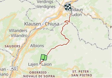
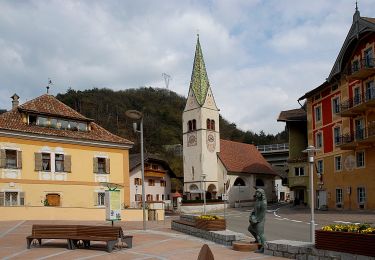
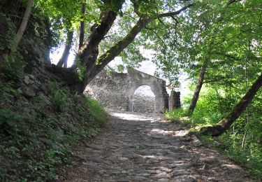
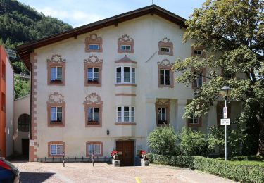
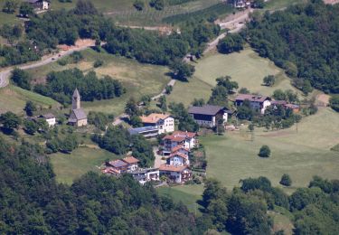
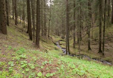
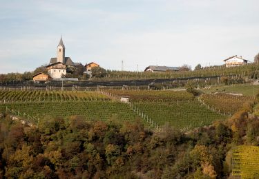
Randonnée A pied de 7,8 km à découvrir à Trentin-Haut-Adige, Haut-Adige, Lajen - Laion. Cette randonnée est proposée par SityTrail - itinéraires balisés pédestres.
Description
Symbole: rot - weiß - Rot mit 4
Localisation
Pays :
Italie
Région :
Trentin-Haut-Adige
Département/Province :
Haut-Adige
Commune :
Lajen - Laion
Localité :
Unknown
Départ:(Dec)
Départ:(UTM)
696352 ; 5164932 (32T) N.
Commentaires
Randonnées à proximité
![Randonnée A pied Kastelruth - Castelrotto - IT-10 - Photo](https://media.geolcdn.com/t/375/260/452074b7-2546-4dda-b2aa-124f39c83e52.jpeg&format=jpg&maxdim=2)
![A pied A pied](https://static1.geolcdn.com/sitytour/trail-icons/100.png)
IT-10
A pied
Facile
Kastelruth - Castelrotto,
Trentin-Haut-Adige,
Haut-Adige,
Italie
![](/images/other/stat-length.png)
7,1 km | 9,4 km-effort
2h 8min
![](https://static1.geolcdn.com/siteimages/upload/files/16400158638029165_repeat_loop_refresh_sync_direction_icon.png)
Non
![Randonnée A pied Kastelruth - Castelrotto - 2B - Photo](https://media.geolcdn.com/t/375/260/ae8c64e8-a647-4e23-abe2-411e544afb44.jpeg&format=jpg&maxdim=2)
![A pied A pied](https://static1.geolcdn.com/sitytour/trail-icons/100.png)
2B
A pied
Facile
Kastelruth - Castelrotto,
Trentin-Haut-Adige,
Haut-Adige,
Italie
![](/images/other/stat-length.png)
3,1 km | 4,2 km-effort
57min
![](https://static1.geolcdn.com/siteimages/upload/files/16400158638029165_repeat_loop_refresh_sync_direction_icon.png)
Non
![Randonnée A pied Waidbruck - Ponte Gardena - IT-2 - Photo](https://media.geolcdn.com/t/375/260/e0ac3740-6bb0-4363-b8ea-fef33f89412d.jpeg&format=jpg&maxdim=2)
![A pied A pied](https://static1.geolcdn.com/sitytour/trail-icons/100.png)
IT-2
A pied
Facile
Waidbruck - Ponte Gardena,
Trentin-Haut-Adige,
Haut-Adige,
Italie
![](/images/other/stat-length.png)
6,5 km | 14,5 km-effort
3h 17min
![](https://static1.geolcdn.com/siteimages/upload/files/16400158638029165_repeat_loop_refresh_sync_direction_icon.png)
Non
![Randonnée A pied Waidbruck - Ponte Gardena - IT-1 - Photo](https://media.geolcdn.com/t/375/260/d03168ec-935b-417c-aac3-34eee0cb4b06.jpeg&format=jpg&maxdim=2)
![A pied A pied](https://static1.geolcdn.com/sitytour/trail-icons/100.png)
IT-1
A pied
Facile
Waidbruck - Ponte Gardena,
Trentin-Haut-Adige,
Haut-Adige,
Italie
![](/images/other/stat-length.png)
6 km | 10,7 km-effort
2h 26min
![](https://static1.geolcdn.com/siteimages/upload/files/16400158638029165_repeat_loop_refresh_sync_direction_icon.png)
Non
![Randonnée A pied Klausen - Chiusa - IT-10 - Photo](https://media.geolcdn.com/t/375/260/3a073c4b-61e8-41c8-96f6-409400ee8595.jpeg&format=jpg&maxdim=2)
![A pied A pied](https://static1.geolcdn.com/sitytour/trail-icons/100.png)
IT-10
A pied
Facile
Klausen - Chiusa,
Trentin-Haut-Adige,
Haut-Adige,
Italie
![](/images/other/stat-length.png)
7,2 km | 13,2 km-effort
2h 59min
![](https://static1.geolcdn.com/siteimages/upload/files/16400158638029165_repeat_loop_refresh_sync_direction_icon.png)
Non
![Randonnée A pied Lajen - Laion - Vogelweider Rundweg - Photo](https://media.geolcdn.com/t/375/260/9a455e4c-3cb1-4cc0-a415-c3b3bd86d0da.jpeg&format=jpg&maxdim=2)
![A pied A pied](https://static1.geolcdn.com/sitytour/trail-icons/100.png)
Vogelweider Rundweg
A pied
Facile
Lajen - Laion,
Trentin-Haut-Adige,
Haut-Adige,
Italie
![](/images/other/stat-length.png)
7,2 km | 12,6 km-effort
2h 52min
![](https://static1.geolcdn.com/siteimages/upload/files/16400158638029165_repeat_loop_refresh_sync_direction_icon.png)
Oui
![Randonnée A pied Barbian - Barbiano - TV Nr.34 - Photo](https://media.geolcdn.com/t/375/260/21cb09f2-586c-476b-9459-109e023933cf.jpeg&format=jpg&maxdim=2)
![A pied A pied](https://static1.geolcdn.com/sitytour/trail-icons/100.png)
TV Nr.34
A pied
Facile
Barbian - Barbiano,
Trentin-Haut-Adige,
Haut-Adige,
Italie
![](/images/other/stat-length.png)
3,5 km | 5,4 km-effort
1h 13min
![](https://static1.geolcdn.com/siteimages/upload/files/16400158638029165_repeat_loop_refresh_sync_direction_icon.png)
Non
![Randonnée A pied Klausen - Chiusa - IT-7A - Photo](https://media.geolcdn.com/t/375/260/b9f5b409-fbaa-40e3-ba3b-f2b1d6563fd1.jpeg&format=jpg&maxdim=2)
![A pied A pied](https://static1.geolcdn.com/sitytour/trail-icons/100.png)
IT-7A
A pied
Facile
Klausen - Chiusa,
Trentin-Haut-Adige,
Haut-Adige,
Italie
![](/images/other/stat-length.png)
5,2 km | 7,1 km-effort
1h 36min
![](https://static1.geolcdn.com/siteimages/upload/files/16400158638029165_repeat_loop_refresh_sync_direction_icon.png)
Non
![Randonnée A pied Klausen - Chiusa - IT-2 - Photo](https://media.geolcdn.com/t/375/260/0508c92e-e115-4685-a770-c3b67ac1dd15.jpeg&format=jpg&maxdim=2)
![A pied A pied](https://static1.geolcdn.com/sitytour/trail-icons/100.png)
IT-2
A pied
Facile
Klausen - Chiusa,
Trentin-Haut-Adige,
Haut-Adige,
Italie
![](/images/other/stat-length.png)
3,8 km | 8,1 km-effort
1h 51min
![](https://static1.geolcdn.com/siteimages/upload/files/16400158638029165_repeat_loop_refresh_sync_direction_icon.png)
Non