![](/images/other/stat-length.png)
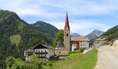
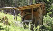
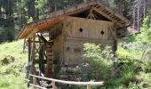
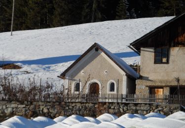
![Randonnée A pied Franzensfeste - Fortezza - IT-3A - Photo](https://media.geolcdn.com/t/1900/400/9e27f23e-8016-43a8-b80c-2c619c7ca043.jpeg&format=pjpeg&maxdim=2)
IT-3A
SityTrail - itinéraires balisés pédestres
Tous les sentiers balisés d’Europe GUIDE+
![Longueur](/images/other/stat-length.png)
Longueur
7,3 km
![Altitude max](https://static1.geolcdn.com/siteimages/upload/files/1508320355ic_sort_altitude_max_24dp.png)
Altitude max
1338 m
![Dénivelé positif](https://static1.geolcdn.com/siteimages/upload/files/1508320355ic_sort_den_pos_24dp.png)
Dénivelé positif
526 m
![Km-Effort](/images/other/stat-length.png)
Km-Effort
13,5 km
![Altitude min](https://static1.geolcdn.com/siteimages/upload/files/1508320355ic_sort_altitude_min_24dp.png)
Altitude min
974 m
![Dénivelé négatif](https://static1.geolcdn.com/siteimages/upload/files/1508320355ic_sort_den_neg_24dp.png)
Dénivelé négatif
300 m
![Boucle](https://static1.geolcdn.com/siteimages/upload/files/16400158638029165_repeat_loop_refresh_sync_direction_icon.png)
Boucle
Non
Balise
Date de création :
2022-02-15 02:26:06.683
Dernière modification :
2022-02-28 22:42:19.142
![A pied](https://static1.geolcdn.com/sitytour/trail-icons/100.png)
3h04
Difficulté : Facile
![Scannez ce code QR pour ouvrir la randonnée dans l'application SityTrail](https://capi.geolives.com/qq0zvz2zws4bq2lad0pu/sitytour/trails/3113928/qr.png?size=200)
Application GPS de randonnée GRATUITE
À propos
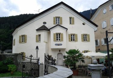
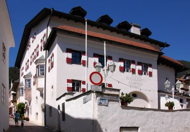
Randonnée A pied de 7,3 km à découvrir à Trentin-Haut-Adige, Haut-Adige, Franzensfeste - Fortezza. Cette randonnée est proposée par SityTrail - itinéraires balisés pédestres.
Description
Randonnée créée par Alpenverein Südtirol.
Localisation
Pays :
Italie
Région :
Trentin-Haut-Adige
Département/Province :
Haut-Adige
Commune :
Franzensfeste - Fortezza
Localité :
Unknown
Départ:(Dec)
Départ:(UTM)
699533 ; 5183983 (32T) N.
Commentaires
Randonnées à proximité
![Randonnée A pied Mühlbach - Rio di Pusteria - 14 - Photo](https://media.geolcdn.com/t/375/260/1944eaa7-fdea-49e8-9354-4c387c640f30.jpeg&format=jpg&maxdim=2)
![A pied A pied](https://static1.geolcdn.com/sitytour/trail-icons/100.png)
14
A pied
Facile
Mühlbach - Rio di Pusteria,
Trentin-Haut-Adige,
Haut-Adige,
Italie
![](/images/other/stat-length.png)
6,3 km | 9,2 km-effort
2h 5min
![](https://static1.geolcdn.com/siteimages/upload/files/16400158638029165_repeat_loop_refresh_sync_direction_icon.png)
Non
![Randonnée A pied Mühlbach - Rio di Pusteria - IT-6 - Photo](https://media.geolcdn.com/t/375/260/cc4e8081-d2b0-4df3-b982-98510577b9fd.jpeg&format=jpg&maxdim=2)
![A pied A pied](https://static1.geolcdn.com/sitytour/trail-icons/100.png)
IT-6
A pied
Difficile
Mühlbach - Rio di Pusteria,
Trentin-Haut-Adige,
Haut-Adige,
Italie
![](/images/other/stat-length.png)
17,1 km | 35 km-effort
7h 51min
![](https://static1.geolcdn.com/siteimages/upload/files/16400158638029165_repeat_loop_refresh_sync_direction_icon.png)
Non
![Randonnée A pied Vahrn - Varna - AVS 5 - Vahrn - Bad Schalders - Lorenzischarte - Fortschellscharte - Durnholz - Photo](https://media.geolcdn.com/t/375/260/1268f6ea-3311-481d-b8b1-9e427f0280a9.jpeg&format=jpg&maxdim=2)
![A pied A pied](https://static1.geolcdn.com/sitytour/trail-icons/100.png)
AVS 5 - Vahrn - Bad Schalders - Lorenzischarte - Fortschellscharte - Durnholz
A pied
Très difficile
Vahrn - Varna,
Trentin-Haut-Adige,
Haut-Adige,
Italie
![](/images/other/stat-length.png)
23 km | 44 km-effort
9h 55min
![](https://static1.geolcdn.com/siteimages/upload/files/16400158638029165_repeat_loop_refresh_sync_direction_icon.png)
Non
![Randonnée A pied Franzensfeste - Fortezza - AVS 16 - Durnholz - Flaggerscharte - Mittewald / Franzensfeste - Photo](https://media.geolcdn.com/t/375/260/6eb42dda-4a2b-4811-87f4-5d0e651d809f.jpeg&format=jpg&maxdim=2)
![A pied A pied](https://static1.geolcdn.com/sitytour/trail-icons/100.png)
AVS 16 - Durnholz - Flaggerscharte - Mittewald / Franzensfeste
A pied
Difficile
Franzensfeste - Fortezza,
Trentin-Haut-Adige,
Haut-Adige,
Italie
![](/images/other/stat-length.png)
17,4 km | 37 km-effort
8h 19min
![](https://static1.geolcdn.com/siteimages/upload/files/16400158638029165_repeat_loop_refresh_sync_direction_icon.png)
Non
![Randonnée A pied Vahrn - Varna - IT-3 - Photo](https://media.geolcdn.com/t/375/260/b81cb401-37ee-4b8b-bf59-e9905e882b27.jpeg&format=jpg&maxdim=2)
![A pied A pied](https://static1.geolcdn.com/sitytour/trail-icons/100.png)
IT-3
A pied
Moyen
Vahrn - Varna,
Trentin-Haut-Adige,
Haut-Adige,
Italie
![](/images/other/stat-length.png)
10,8 km | 21 km-effort
4h 41min
![](https://static1.geolcdn.com/siteimages/upload/files/16400158638029165_repeat_loop_refresh_sync_direction_icon.png)
Non
![Randonnée A pied Vahrn - Varna - IT-6 - Photo](https://media.geolcdn.com/t/375/260/05c6196e-9a9d-4478-b148-9400d6abf374.jpeg&format=jpg&maxdim=2)
![A pied A pied](https://static1.geolcdn.com/sitytour/trail-icons/100.png)
IT-6
A pied
Facile
Vahrn - Varna,
Trentin-Haut-Adige,
Haut-Adige,
Italie
![](/images/other/stat-length.png)
5,4 km | 8,3 km-effort
1h 53min
![](https://static1.geolcdn.com/siteimages/upload/files/16400158638029165_repeat_loop_refresh_sync_direction_icon.png)
Non
![Randonnée A pied Mühlbach - Rio di Pusteria - 10a - Photo](https://media.geolcdn.com/t/375/260/b498bece-6523-478e-91d5-2e57d1b380a1.jpeg&format=jpg&maxdim=2)
![A pied A pied](https://static1.geolcdn.com/sitytour/trail-icons/100.png)
10a
A pied
Facile
Mühlbach - Rio di Pusteria,
Trentin-Haut-Adige,
Haut-Adige,
Italie
![](/images/other/stat-length.png)
3 km | 4,5 km-effort
1h 0min
![](https://static1.geolcdn.com/siteimages/upload/files/16400158638029165_repeat_loop_refresh_sync_direction_icon.png)
Non
![Randonnée A pied Mühlbach - Rio di Pusteria - 12 - Photo](https://media.geolcdn.com/t/375/260/4b698fca-8c34-40c0-b107-d56c8857e04e.jpeg&format=jpg&maxdim=2)
![A pied A pied](https://static1.geolcdn.com/sitytour/trail-icons/100.png)
12
A pied
Facile
Mühlbach - Rio di Pusteria,
Trentin-Haut-Adige,
Haut-Adige,
Italie
![](/images/other/stat-length.png)
3,5 km | 9,2 km-effort
2h 5min
![](https://static1.geolcdn.com/siteimages/upload/files/16400158638029165_repeat_loop_refresh_sync_direction_icon.png)
Non
![Randonnée A pied Vahrn - Varna - IT-2A - Photo](https://media.geolcdn.com/t/375/260/5cf5e2c3-ecf7-4c00-8601-a41b198dc17c.jpeg&format=jpg&maxdim=2)
![A pied A pied](https://static1.geolcdn.com/sitytour/trail-icons/100.png)
IT-2A
A pied
Facile
Vahrn - Varna,
Trentin-Haut-Adige,
Haut-Adige,
Italie
![](/images/other/stat-length.png)
6,2 km | 11,5 km-effort
2h 36min
![](https://static1.geolcdn.com/siteimages/upload/files/16400158638029165_repeat_loop_refresh_sync_direction_icon.png)
Non