![](/images/other/stat-length.png)
![Randonnée A pied Magione - S. Arcangelo - Monte Marzolana - Montali - Photo](https://media.geolcdn.com/t/1900/400/f7244c3b-3f73-4a6e-a30b-29d1c7eb3948.jpeg&format=pjpeg&maxdim=2)
S. Arcangelo - Monte Marzolana - Montali
SityTrail - itinéraires balisés pédestres
Tous les sentiers balisés d’Europe GUIDE+
![Longueur](/images/other/stat-length.png)
![Altitude max](https://static1.geolcdn.com/siteimages/upload/files/1508320355ic_sort_altitude_max_24dp.png)
![Dénivelé positif](https://static1.geolcdn.com/siteimages/upload/files/1508320355ic_sort_den_pos_24dp.png)
![Km-Effort](/images/other/stat-length.png)
![Altitude min](https://static1.geolcdn.com/siteimages/upload/files/1508320355ic_sort_altitude_min_24dp.png)
![Dénivelé négatif](https://static1.geolcdn.com/siteimages/upload/files/1508320355ic_sort_den_neg_24dp.png)
![Boucle](https://static1.geolcdn.com/siteimages/upload/files/16400158638029165_repeat_loop_refresh_sync_direction_icon.png)
![A pied](https://static1.geolcdn.com/sitytour/trail-icons/100.png)
3h14
Difficulté : Facile
![Scannez ce code QR pour ouvrir la randonnée dans l'application SityTrail](https://capi.geolives.com/qq0zvz2zws4bq2lad0pu/sitytour/trails/3112888/qr.png?size=200)
Application GPS de randonnée GRATUITE
À propos
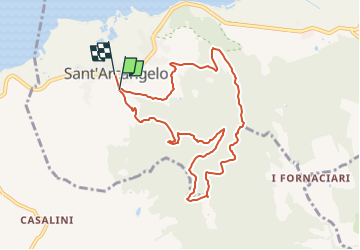
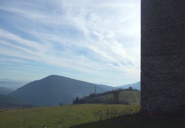
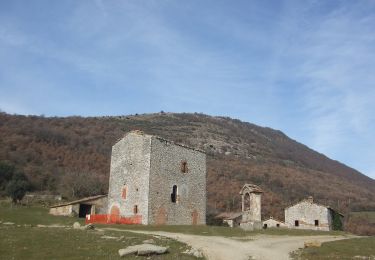
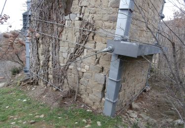
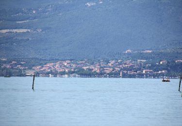
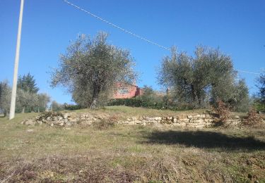
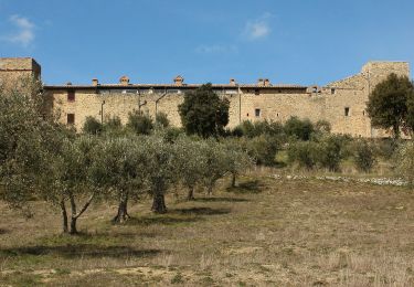
Randonnée A pied de 9,5 km à découvrir à Ombrie, Perugia, Magione. Cette randonnée est proposée par SityTrail - itinéraires balisés pédestres.
Description
Randonnée créée par Parco regionale del Lago Trasimeno.
number of itinerary being updated Umbria Excursion Network
Symbole: 907 on white and red trail signs
Site web: http://www.caiperugia.it/
Localisation
Commentaires
Randonnées à proximité
![Randonnée A pied Umbertide - Galera - Monte Acuto - Photo](https://media.geolcdn.com/t/375/260/2207cd07-cee1-4c8d-ad34-c7b19758ea24.jpeg&format=jpg&maxdim=2)
![A pied A pied](https://static1.geolcdn.com/sitytour/trail-icons/100.png)
A pied
![](/images/other/stat-length.png)
![](https://static1.geolcdn.com/siteimages/upload/files/16400158638029165_repeat_loop_refresh_sync_direction_icon.png)
![Randonnée A pied Umbertide - Traversata di Monte Acuto - Photo](https://media.geolcdn.com/t/375/260/3b9eb271-5a99-45ce-bdf8-371425508782.jpeg&format=jpg&maxdim=2)
![A pied A pied](https://static1.geolcdn.com/sitytour/trail-icons/100.png)
A pied
![](/images/other/stat-length.png)
![](https://static1.geolcdn.com/siteimages/upload/files/16400158638029165_repeat_loop_refresh_sync_direction_icon.png)
![Randonnée A pied Tuoro sul Trasimeno - Sentiero Frassati - Photo](https://media.geolcdn.com/t/375/260/77d63a1c-c3f6-4c18-9821-aa0652df2b0a.jpeg&format=jpg&maxdim=2)
![A pied A pied](https://static1.geolcdn.com/sitytour/trail-icons/100.png)
A pied
![](/images/other/stat-length.png)
![](https://static1.geolcdn.com/siteimages/upload/files/16400158638029165_repeat_loop_refresh_sync_direction_icon.png)
![Randonnée A pied Passignano sul Trasimeno - La Martinella - Photo](https://media.geolcdn.com/t/375/260/22482be0-2b01-4200-a1ff-5d94143c7216.jpeg&format=jpg&maxdim=2)
![A pied A pied](https://static1.geolcdn.com/sitytour/trail-icons/100.png)
A pied
![](/images/other/stat-length.png)
![](https://static1.geolcdn.com/siteimages/upload/files/16400158638029165_repeat_loop_refresh_sync_direction_icon.png)
![Randonnée A pied Collazzone - Collepepe-Miniera - Photo](https://media.geolcdn.com/t/375/260/824624c1-d83b-493b-8602-8159e0ff647f.jpeg&format=jpg&maxdim=2)
![A pied A pied](https://static1.geolcdn.com/sitytour/trail-icons/100.png)
A pied
![](/images/other/stat-length.png)
![](https://static1.geolcdn.com/siteimages/upload/files/16400158638029165_repeat_loop_refresh_sync_direction_icon.png)
![Randonnée A pied Passignano sul Trasimeno - Castel Rigone - Torre Fiume - Photo](https://media.geolcdn.com/t/375/260/9409bc5f-69fc-47cd-9ab7-8dfa80803df1.jpeg&format=jpg&maxdim=2)
![A pied A pied](https://static1.geolcdn.com/sitytour/trail-icons/100.png)
A pied
![](/images/other/stat-length.png)
![](https://static1.geolcdn.com/siteimages/upload/files/16400158638029165_repeat_loop_refresh_sync_direction_icon.png)
![Randonnée A pied Marsciano - Migliano - Fersinone - Fibbino - Photo](https://media.geolcdn.com/t/375/260/34e62cdf-ac07-4a05-8b44-95eccc15f38f.jpeg&format=jpg&maxdim=2)
![A pied A pied](https://static1.geolcdn.com/sitytour/trail-icons/100.png)
A pied
![](/images/other/stat-length.png)
![](https://static1.geolcdn.com/siteimages/upload/files/16400158638029165_repeat_loop_refresh_sync_direction_icon.png)
![Randonnée A pied Marsciano - Compignano - Monte Lagello - Mercatello - Photo](https://media.geolcdn.com/t/375/260/eb9fa763-b59d-4cd9-99c8-ca12c3eb3449.jpeg&format=jpg&maxdim=2)
![A pied A pied](https://static1.geolcdn.com/sitytour/trail-icons/100.png)
A pied
![](/images/other/stat-length.png)
![](https://static1.geolcdn.com/siteimages/upload/files/16400158638029165_repeat_loop_refresh_sync_direction_icon.png)
![Randonnée A pied Città della Pieve - Città della Pieve - Fosso Molinella - Photo](https://media.geolcdn.com/t/375/260/1f8c7f25-61a1-48e7-b201-7bace27086b0.jpeg&format=jpg&maxdim=2)
![A pied A pied](https://static1.geolcdn.com/sitytour/trail-icons/100.png)
A pied
![](/images/other/stat-length.png)
![](https://static1.geolcdn.com/siteimages/upload/files/16400158638029165_repeat_loop_refresh_sync_direction_icon.png)