![](/images/other/stat-length.png)
![Randonnée A pied Besalú - Besalú-Beuda - Photo](https://media.geolcdn.com/t/1900/400/027c608a-ef9d-47db-8df1-f79bfa409fdd.jpeg&format=pjpeg&maxdim=2)
Besalú-Beuda
SityTrail - itinéraires balisés pédestres
Tous les sentiers balisés d’Europe GUIDE+
![Longueur](/images/other/stat-length.png)
![Altitude max](https://static1.geolcdn.com/siteimages/upload/files/1508320355ic_sort_altitude_max_24dp.png)
![Dénivelé positif](https://static1.geolcdn.com/siteimages/upload/files/1508320355ic_sort_den_pos_24dp.png)
![Km-Effort](/images/other/stat-length.png)
![Altitude min](https://static1.geolcdn.com/siteimages/upload/files/1508320355ic_sort_altitude_min_24dp.png)
![Dénivelé négatif](https://static1.geolcdn.com/siteimages/upload/files/1508320355ic_sort_den_neg_24dp.png)
![Boucle](https://static1.geolcdn.com/siteimages/upload/files/16400158638029165_repeat_loop_refresh_sync_direction_icon.png)
![A pied](https://static1.geolcdn.com/sitytour/trail-icons/100.png)
4h11
Difficulté : Facile
![Scannez ce code QR pour ouvrir la randonnée dans l'application SityTrail](https://capi.geolives.com/qq0zvz2zws4bq2lad0pu/sitytour/trails/3110624/qr.png?size=200)
Application GPS de randonnée GRATUITE
À propos
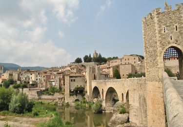
Randonnée A pied de 13,6 km à découvrir à Catalogne, Gérone, Besalú. Cette randonnée est proposée par SityTrail - itinéraires balisés pédestres.
Description
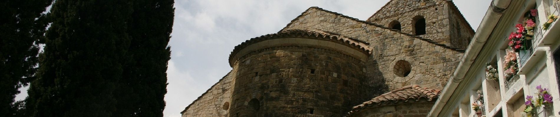
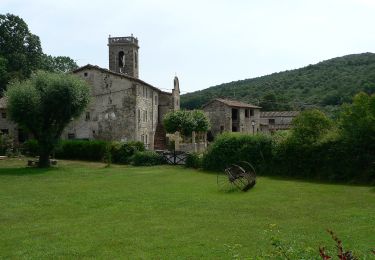
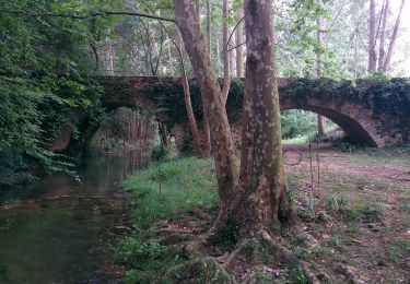
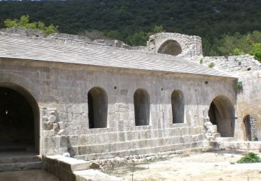
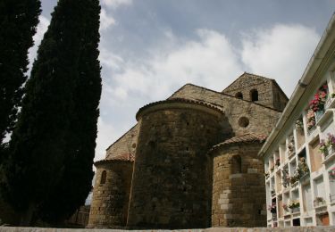
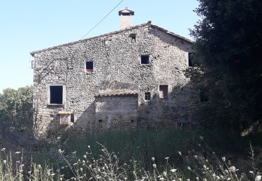
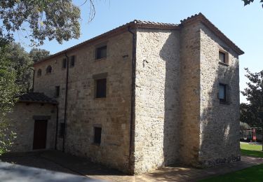
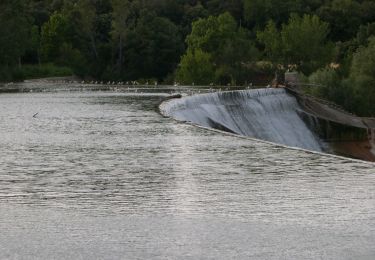
Breu introducció. Ruta pels voltants de Besalú, que ens permet conèixer el patrimoni arquitectònic de Sta.Maria de Palera i el Sepulcre de Palera i el poble de Beuda. Es una caminada senzilla i agradable de fer. Dades tècniques: Durada de la ruta. Aproximadament unes 3.30 hores per a una persona acostumada a caminar, i sense…
Site web: https://senderismegirona.org/2018/08/17/ruta-besalu-a-beuda-per-palera/
Localisation
Commentaires
Randonnées à proximité
![Randonnée A pied Sant Ferriol - El Santuari del Collell: Presó de Guerra - Photo](https://media.geolcdn.com/t/375/260/d99155fb-0b90-41f2-88f0-967efb98deaf.jpeg&format=jpg&maxdim=2)
![A pied A pied](https://static1.geolcdn.com/sitytour/trail-icons/100.png)
A pied
![](/images/other/stat-length.png)
![](https://static1.geolcdn.com/siteimages/upload/files/16400158638029165_repeat_loop_refresh_sync_direction_icon.png)
![Randonnée A pied Besalú - Besalú-Dosquers - Photo](https://media.geolcdn.com/t/375/260/d00a477c-6daa-462e-8a73-2684ff091a77.jpeg&format=jpg&maxdim=2)
![A pied A pied](https://static1.geolcdn.com/sitytour/trail-icons/100.png)
A pied
![](/images/other/stat-length.png)
![](https://static1.geolcdn.com/siteimages/upload/files/16400158638029165_repeat_loop_refresh_sync_direction_icon.png)
![Randonnée A pied Maià de Montcal - Ruta del romaní - Photo](https://media.geolcdn.com/t/375/260/2c173b61-e6ce-4bbd-b16b-b8d172bb0f25.jpeg&format=jpg&maxdim=2)
![A pied A pied](https://static1.geolcdn.com/sitytour/trail-icons/100.png)
A pied
![](/images/other/stat-length.png)
![](https://static1.geolcdn.com/siteimages/upload/files/16400158638029165_repeat_loop_refresh_sync_direction_icon.png)
![Randonnée A pied Beuda - Mitja Marató Mare de Déu del Mont (MdM) - Photo](https://media.geolcdn.com/t/375/260/fd8eaf84-117f-4300-ace9-8441f466d75b.jpeg&format=jpg&maxdim=2)
![A pied A pied](https://static1.geolcdn.com/sitytour/trail-icons/100.png)
A pied
![](/images/other/stat-length.png)
![](https://static1.geolcdn.com/siteimages/upload/files/16400158638029165_repeat_loop_refresh_sync_direction_icon.png)
![Randonnée A pied Besalú - Circuit de Besalú - Photo](https://media.geolcdn.com/t/375/260/027c608a-ef9d-47db-8df1-f79bfa409fdd.jpeg&format=jpg&maxdim=2)
![A pied A pied](https://static1.geolcdn.com/sitytour/trail-icons/100.png)
A pied
![](/images/other/stat-length.png)
![](https://static1.geolcdn.com/siteimages/upload/files/16400158638029165_repeat_loop_refresh_sync_direction_icon.png)
![Randonnée A pied Maià de Montcal - Balcó de la Garrotxa - Photo](https://media.geolcdn.com/t/375/260/727141d5-2c9d-48b1-8444-e50cc7feda29.jpeg&format=jpg&maxdim=2)
![A pied A pied](https://static1.geolcdn.com/sitytour/trail-icons/100.png)
A pied
![](/images/other/stat-length.png)
![](https://static1.geolcdn.com/siteimages/upload/files/16400158638029165_repeat_loop_refresh_sync_direction_icon.png)
![Randonnée A pied Serinyà - Itinerari Mitjà - Serinyà - Photo](https://media.geolcdn.com/t/375/260/5db1764c-cfad-4689-8bf0-466d4a67092f.jpeg&format=jpg&maxdim=2)
![A pied A pied](https://static1.geolcdn.com/sitytour/trail-icons/100.png)
A pied
![](/images/other/stat-length.png)
![](https://static1.geolcdn.com/siteimages/upload/files/16400158638029165_repeat_loop_refresh_sync_direction_icon.png)
![Randonnée A pied Serinyà - Itinerari Llarg - Serinyà - Photo](https://media.geolcdn.com/t/375/260/dc157c92-fc6d-468a-8d4d-11d6001e0514.jpeg&format=jpg&maxdim=2)
![A pied A pied](https://static1.geolcdn.com/sitytour/trail-icons/100.png)
A pied
![](/images/other/stat-length.png)
![](https://static1.geolcdn.com/siteimages/upload/files/16400158638029165_repeat_loop_refresh_sync_direction_icon.png)
![Randonnée A pied Serinyà - Pla de Martís i Fluvià - Photo](https://media.geolcdn.com/t/375/260/50065d0a-cf30-42ce-aae7-26cf203acadb.jpeg&format=jpg&maxdim=2)
![A pied A pied](https://static1.geolcdn.com/sitytour/trail-icons/100.png)
A pied
![](/images/other/stat-length.png)
![](https://static1.geolcdn.com/siteimages/upload/files/16400158638029165_repeat_loop_refresh_sync_direction_icon.png)