![](/images/other/stat-length.png)
![Randonnée A pied Ogassa - Ogassa-Sant Martí Surroca - Photo](https://media.geolcdn.com/t/1900/400/2ef72cfb-0091-4776-88d2-62072d2bd9aa.jpeg&format=pjpeg&maxdim=2)
Ogassa-Sant Martí Surroca
SityTrail - itinéraires balisés pédestres
Tous les sentiers balisés d’Europe GUIDE+
![Longueur](/images/other/stat-length.png)
![Altitude max](https://static1.geolcdn.com/siteimages/upload/files/1508320355ic_sort_altitude_max_24dp.png)
![Dénivelé positif](https://static1.geolcdn.com/siteimages/upload/files/1508320355ic_sort_den_pos_24dp.png)
![Km-Effort](/images/other/stat-length.png)
![Altitude min](https://static1.geolcdn.com/siteimages/upload/files/1508320355ic_sort_altitude_min_24dp.png)
![Dénivelé négatif](https://static1.geolcdn.com/siteimages/upload/files/1508320355ic_sort_den_neg_24dp.png)
![Boucle](https://static1.geolcdn.com/siteimages/upload/files/16400158638029165_repeat_loop_refresh_sync_direction_icon.png)
![A pied](https://static1.geolcdn.com/sitytour/trail-icons/100.png)
2h57
Difficulté : Facile
![Scannez ce code QR pour ouvrir la randonnée dans l'application SityTrail](https://capi.geolives.com/qq0zvz2zws4bq2lad0pu/sitytour/trails/3110606/qr.png?size=200)
Application GPS de randonnée GRATUITE
À propos
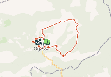
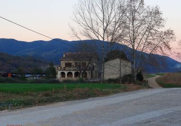
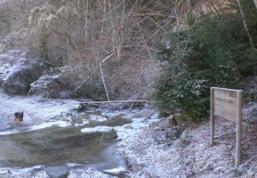
Randonnée A pied de 7,9 km à découvrir à Catalogne, Gérone, Ogassa. Cette randonnée est proposée par SityTrail - itinéraires balisés pédestres.
Description
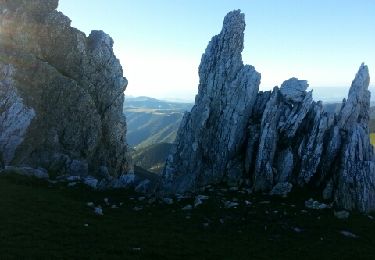
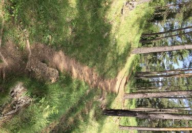
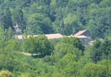
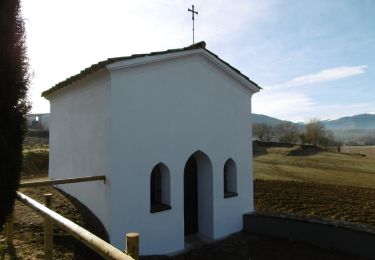
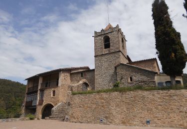
Breu introducció. Ruta matinal per les rodalies del municipi d´Ogassa( Ripollès), que arriba a l´esglèsia romànica de Sant Martí de Surroca i ens permet gaudir dels boscos de la zona, fent baixada pel camí de Roqueters. Dades tècniques: Durada de la ruta. Aproximadament unes 2.30 hores, per a persones acostumades a caminar, i sense comptar…
Site web: https://senderismegirona.org/2019/09/20/ruta-86-ogassa-a-sant-marti-de-surroca/
Localisation
Commentaires
Randonnées à proximité
![Randonnée Marche Prats-de-Mollo-la-Preste - Pic de Costabonne par les Conques_T - Photo](https://media.geolcdn.com/t/375/260/ext.jpg?maxdim=2&url=https%3A%2F%2Fservices.sitytrail.com%2FGeolivesWS%2FDownloadMedia.ashx%3FTrailID%3D209493%26Media%3Dfix__20130801075840.jpg)
![Marche Marche](https://static1.geolcdn.com/sitytour/trail-icons/101.png)
Marche
![](/images/other/stat-length.png)
![](https://static1.geolcdn.com/siteimages/upload/files/16400158638029165_repeat_loop_refresh_sync_direction_icon.png)
![Randonnée A pied Campdevànol - itinerari de natura dels Gorgs del Torrent de la Cabana - Photo](https://media.geolcdn.com/t/375/260/ba4fac2b-81f9-4e2b-8fd9-b58340688d3e.jpeg&format=jpg&maxdim=2)
![A pied A pied](https://static1.geolcdn.com/sitytour/trail-icons/100.png)
A pied
![](/images/other/stat-length.png)
![](https://static1.geolcdn.com/siteimages/upload/files/16400158638029165_repeat_loop_refresh_sync_direction_icon.png)
![Randonnée A pied Vilallonga de Ter - Vilallonga de Ter-Llanars - Photo](https://media.geolcdn.com/t/375/260/fdebadc5-cf33-488d-a0d4-0f8b2a13c42a.jpeg&format=jpg&maxdim=2)
![A pied A pied](https://static1.geolcdn.com/sitytour/trail-icons/100.png)
A pied
![](/images/other/stat-length.png)
![](https://static1.geolcdn.com/siteimages/upload/files/16400158638029165_repeat_loop_refresh_sync_direction_icon.png)
![Randonnée A pied la Vall de Bianya - Hostalnou de Bianya-Sant Miquel del Mont - Photo](https://media.geolcdn.com/t/375/260/af9a8c34-e2ee-4ee6-85cf-a01b10bc5c9d.jpeg&format=jpg&maxdim=2)
![A pied A pied](https://static1.geolcdn.com/sitytour/trail-icons/100.png)
A pied
![](/images/other/stat-length.png)
![](https://static1.geolcdn.com/siteimages/upload/files/16400158638029165_repeat_loop_refresh_sync_direction_icon.png)
![Randonnée A pied Ripoll - Llaés, balmes - Photo](https://media.geolcdn.com/t/375/260/7fd2fa7e-5dfc-4fc3-ab58-d624fed6db7b.jpeg&format=jpg&maxdim=2)
![A pied A pied](https://static1.geolcdn.com/sitytour/trail-icons/100.png)
A pied
![](/images/other/stat-length.png)
![](https://static1.geolcdn.com/siteimages/upload/files/16400158638029165_repeat_loop_refresh_sync_direction_icon.png)
![Randonnée A pied Ribes de Freser - Ribes de Freser-El Baell-Campelles - Photo](https://media.geolcdn.com/t/375/260/f770ef61-22c6-43ab-a790-78e5de165ca9.jpeg&format=jpg&maxdim=2)
![A pied A pied](https://static1.geolcdn.com/sitytour/trail-icons/100.png)
A pied
![](/images/other/stat-length.png)
![](https://static1.geolcdn.com/siteimages/upload/files/16400158638029165_repeat_loop_refresh_sync_direction_icon.png)
![Randonnée A pied Olot - Vells camins de Batet - Photo](https://media.geolcdn.com/t/375/260/fee58355-adf9-4ae6-aee3-73244a38236a.jpeg&format=jpg&maxdim=2)
![A pied A pied](https://static1.geolcdn.com/sitytour/trail-icons/100.png)
A pied
![](/images/other/stat-length.png)
![](https://static1.geolcdn.com/siteimages/upload/files/16400158638029165_repeat_loop_refresh_sync_direction_icon.png)
![Randonnée A pied Olot - Volcà Racó i Parc Nou - Photo](https://media.geolcdn.com/t/375/260/213d8610-59d2-4bef-9299-c2400a89efa1.jpeg&format=jpg&maxdim=2)
![A pied A pied](https://static1.geolcdn.com/sitytour/trail-icons/100.png)
A pied
![](/images/other/stat-length.png)
![](https://static1.geolcdn.com/siteimages/upload/files/16400158638029165_repeat_loop_refresh_sync_direction_icon.png)
![Randonnée A pied les Llosses - Riera de les Llosses - Photo](https://media.geolcdn.com/t/375/260/92e0991e-aff1-4b7d-89d8-814ecaef33b8.jpeg&format=jpg&maxdim=2)
![A pied A pied](https://static1.geolcdn.com/sitytour/trail-icons/100.png)
A pied
![](/images/other/stat-length.png)
![](https://static1.geolcdn.com/siteimages/upload/files/16400158638029165_repeat_loop_refresh_sync_direction_icon.png)