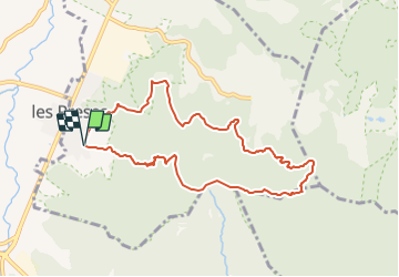
![](/images/other/stat-length.png)
![Randonnée A pied les Preses - Ermites del Corb - Photo](https://media.geolcdn.com/t/1900/400/0fb801a8-893d-44a1-841b-eb19e7e06469.jpeg&format=pjpeg&maxdim=2)
Ermites del Corb
SityTrail - itinéraires balisés pédestres
Tous les sentiers balisés d’Europe GUIDE+
![Longueur](/images/other/stat-length.png)
![Altitude max](https://static1.geolcdn.com/siteimages/upload/files/1508320355ic_sort_altitude_max_24dp.png)
![Dénivelé positif](https://static1.geolcdn.com/siteimages/upload/files/1508320355ic_sort_den_pos_24dp.png)
![Km-Effort](/images/other/stat-length.png)
![Altitude min](https://static1.geolcdn.com/siteimages/upload/files/1508320355ic_sort_altitude_min_24dp.png)
![Dénivelé négatif](https://static1.geolcdn.com/siteimages/upload/files/1508320355ic_sort_den_neg_24dp.png)
![Boucle](https://static1.geolcdn.com/siteimages/upload/files/16400158638029165_repeat_loop_refresh_sync_direction_icon.png)
![A pied](https://static1.geolcdn.com/sitytour/trail-icons/100.png)
3h51
Difficulté : Facile
![Scannez ce code QR pour ouvrir la randonnée dans l'application SityTrail](https://capi.geolives.com/qq0zvz2zws4bq2lad0pu/sitytour/trails/3110541/qr.png?size=200)
Application GPS de randonnée GRATUITE
À propos
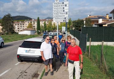
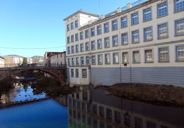
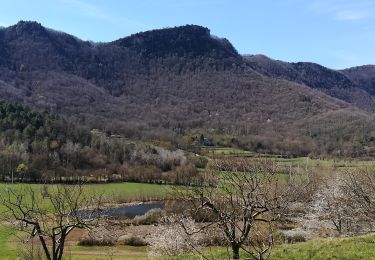
Randonnée A pied de 9,4 km à découvrir à Catalogne, Gérone, les Preses. Cette randonnée est proposée par SityTrail - itinéraires balisés pédestres.
Description
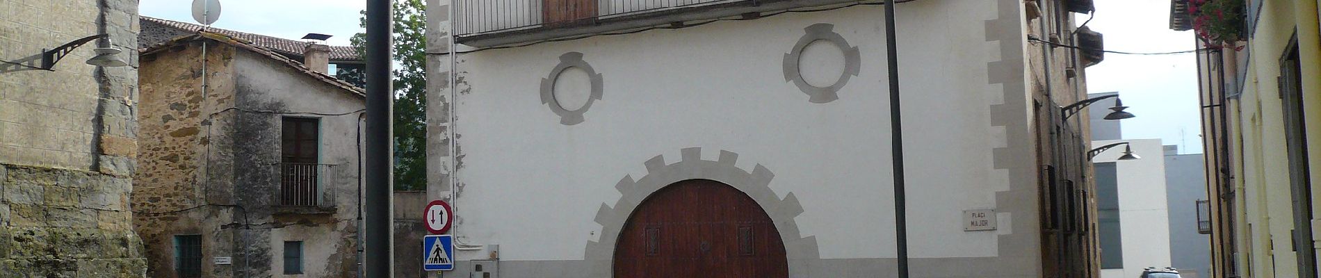
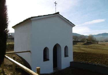
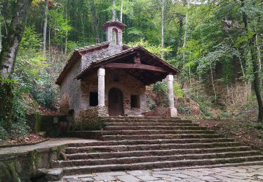
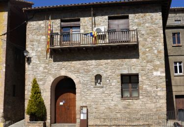
En aquesta ruta es pot descobrir Sant Miquel i Sant Martí del Corb, petites ermites que conformen el romànic més secret i amagat de la Garrotxa
Site web: https://www.itinerannia.net/ca/itineraris/ruta-de-les-ermites-del-corb-ruta-4-les-preses/
Localisation
Commentaires
Randonnées à proximité
![Randonnée A pied Olot - Vells camins de Batet - Photo](https://media.geolcdn.com/t/375/260/fee58355-adf9-4ae6-aee3-73244a38236a.jpeg&format=jpg&maxdim=2)
![A pied A pied](https://static1.geolcdn.com/sitytour/trail-icons/100.png)
A pied
![](/images/other/stat-length.png)
![](https://static1.geolcdn.com/siteimages/upload/files/16400158638029165_repeat_loop_refresh_sync_direction_icon.png)
![Randonnée A pied Olot - Volcà Racó i Parc Nou - Photo](https://media.geolcdn.com/t/375/260/213d8610-59d2-4bef-9299-c2400a89efa1.jpeg&format=jpg&maxdim=2)
![A pied A pied](https://static1.geolcdn.com/sitytour/trail-icons/100.png)
A pied
![](/images/other/stat-length.png)
![](https://static1.geolcdn.com/siteimages/upload/files/16400158638029165_repeat_loop_refresh_sync_direction_icon.png)
![Randonnée A pied Olot - Camins de Pedra Tosca - Photo](https://media.geolcdn.com/t/375/260/c5e4111a-b285-4599-900a-4bfdc81d391e.jpeg&format=jpg&maxdim=2)
![A pied A pied](https://static1.geolcdn.com/sitytour/trail-icons/100.png)
A pied
![](/images/other/stat-length.png)
![](https://static1.geolcdn.com/siteimages/upload/files/16400158638029165_repeat_loop_refresh_sync_direction_icon.png)
![Randonnée A pied la Vall d'en Bas - L'altiplà de Collsacabra - Photo](https://media.geolcdn.com/t/375/260/9c0f392b-debf-4f1f-83d3-e449334c7854.jpeg&format=jpg&maxdim=2)
![A pied A pied](https://static1.geolcdn.com/sitytour/trail-icons/100.png)
A pied
![](/images/other/stat-length.png)
![](https://static1.geolcdn.com/siteimages/upload/files/16400158638029165_repeat_loop_refresh_sync_direction_icon.png)
![Randonnée A pied Olot - Cuursa de la Moixina - Photo](https://media.geolcdn.com/t/375/260/d10c444b-4e4f-459e-bd54-f203b1c609f6.jpeg&format=jpg&maxdim=2)
![A pied A pied](https://static1.geolcdn.com/sitytour/trail-icons/100.png)
A pied
![](/images/other/stat-length.png)
![](https://static1.geolcdn.com/siteimages/upload/files/16400158638029165_repeat_loop_refresh_sync_direction_icon.png)
![Randonnée A pied Olot - Camí dels Carlins - Photo](https://media.geolcdn.com/t/375/260/41a712f2-9290-4b2b-8d0f-bf0d1c78fea6.jpeg&format=jpg&maxdim=2)
![A pied A pied](https://static1.geolcdn.com/sitytour/trail-icons/100.png)
A pied
![](/images/other/stat-length.png)
![](https://static1.geolcdn.com/siteimages/upload/files/16400158638029165_repeat_loop_refresh_sync_direction_icon.png)
![Randonnée Marche Olot - Les volcans de la GARROTXES (Espagne) (30/05/2019) - Photo](https://media.geolcdn.com/t/375/260/f008fea3-bb90-4f55-a39a-f318fdcd5fa2.jpg&format=jpg&maxdim=2)
![Marche Marche](https://static1.geolcdn.com/sitytour/trail-icons/101.png)
Marche
![](/images/other/stat-length.png)
![](https://static1.geolcdn.com/siteimages/upload/files/16400158638029165_repeat_loop_refresh_sync_direction_icon.png)
![Randonnée Marche Olot - Olot j6 - Photo](https://media.geolcdn.com/t/375/260/a0e988ad-1e28-4b84-a73b-df8dcc909cd4.jpg&format=jpg&maxdim=2)
![Marche Marche](https://static1.geolcdn.com/sitytour/trail-icons/101.png)
![Randonnée Marche Olot - olot j1 - Photo](https://media.geolcdn.com/t/375/260/2022fac7-60d0-4649-aef8-8abff40305b3.jpg&format=jpg&maxdim=2)
![Marche Marche](https://static1.geolcdn.com/sitytour/trail-icons/101.png)