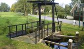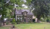

Albapad
SityTrail - itinéraires balisés pédestres
Tous les sentiers balisés d’Europe GUIDE+

Longueur
10,8 km

Altitude max
31 m

Dénivelé positif
56 m

Km-Effort
11,6 km

Altitude min
8 m

Dénivelé négatif
55 m
Boucle
Oui
Balise
Date de création :
2022-02-14 15:41:29.953
Dernière modification :
2022-02-14 15:41:29.953
2h37
Difficulté : Facile

Application GPS de randonnée GRATUITE
À propos
Randonnée A pied de 10,8 km à découvrir à Gueldre, Inconnu, Apeldoorn. Cette randonnée est proposée par SityTrail - itinéraires balisés pédestres.
Description
Randonnée créée par Stichting Landschapsbeheer Gelderland.
Localisation
Pays :
Pays-Bas
Région :
Gueldre
Département/Province :
Inconnu
Commune :
Apeldoorn
Localité :
Unknown
Départ:(Dec)
Départ:(UTM)
295188 ; 5782808 (32U) N.
Commentaires
Randonnées à proximité
Klarenbeeksepad (Klompenpad)


A pied
Facile
Voorst,
Gueldre,
Inconnu,
Pays-Bas

12,5 km | 13,2 km-effort
3h 0min
Non
Loenense Enkenpad


A pied
Facile
Apeldoorn,
Gueldre,
Inconnu,
Pays-Bas

9,3 km | 10,6 km-effort
2h 24min
Non

Reeëndal in Loenen (gld)


Marche
Facile
(1)
Apeldoorn,
Gueldre,
Inconnu,
Pays-Bas

5 km | 5,4 km-effort
1h 13min
Oui

a-gelderland-rondje-apeldoorn


Moteur
Très facile
Apeldoorn,
Gueldre,
Inconnu,
Pays-Bas

94 km | 105 km-effort
Inconnu
Oui

f-gelderland-loenen-posbank


Vélo
Très facile
Apeldoorn,
Gueldre,
Inconnu,
Pays-Bas

44 km | 49 km-effort
Inconnu
Oui

m-gelderland-single-tracks-op-de-bakenberg


V.T.T.
Très facile
Apeldoorn,
Gueldre,
Inconnu,
Pays-Bas

18,5 km | 22 km-effort
Inconnu
Oui

m-gelderland-mtbroute-vanuit-landal-heideheuvel


V.T.T.
Très facile
Apeldoorn,
Gueldre,
Inconnu,
Pays-Bas

32 km | 36 km-effort
Inconnu
Oui

m-gelderland-atbtocht-klarenbeek


V.T.T.
Très facile
Voorst,
Gueldre,
Inconnu,
Pays-Bas

40 km | 44 km-effort
Inconnu
Oui

w-gelderland-grenspalenpad-klarenbeek


Marche
Très facile
Voorst,
Gueldre,
Inconnu,
Pays-Bas

9,8 km | 10,2 km-effort
Inconnu
Oui


 SityTrail


