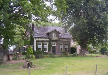
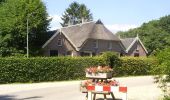
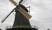
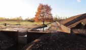
Randonnée A pied Voorst - Klarenbeeksepad (Klompenpad) - Photo

Klarenbeeksepad (Klompenpad)

Tous les sentiers balisés d’Europe GUIDE+

© OpenStreetMap contributors
Longueur
Longueur
12,5 km
Altitude max
Altitude max
21 m
Dénivelé positif
Dénivelé positif
58 m
Km-Effort
Km-Effort  
13,2 km
Altitude min
Altitude min
5 m
Dénivelé négatif
Dénivelé négatif
54 m
Boucle
Boucle
Non
Balise
Balise
Date de création :
2022-02-14 15:36:23.72
Dernière modification :
2022-02-14 15:36:23.72

(0 Avis)

A pied
A pied
3h00
Difficulté : Facile

Scannez ce code QR pour ouvrir la randonnée dans l'application SityTrail

Application GPS de randonnée GRATUITE

Logo SityTrail SityTrail
IGN / Instituts géographiques

Télécharger SityTrail sur l'App Store Télécharger SityTrail sur Google Play

Logo SityTrail SityTrail World
Le monde est à vous

Télécharger SityTrail sur l'App Store Télécharger SityTrail sur Google Play Télécharger SityTrail sur Huawei AppGallery

À propos

Randonnée A pied de 12,5 km à découvrir à Gueldre, Inconnu, Voorst. Cette randonnée est proposée par SityTrail - itinéraires balisés pédestres.

Description

Randonnée créée par klompenpad.nl.

Het wandelpad loopt gedeeltelijk over particulier terrein, waar soms vee loopt. Om de dieren niet te verstoren en verspreiding van dierziekten te voorkomen zijn honden verboden. We vragen hiervoor uw begrip.

Symbole: klompen


Site web: https://klompenpaden.nl/klompenpad/klarenbeeksepad/

Profil altimétrique

Photos

Localisation

Pays :
Pays-Bas
Région :
Gueldre
Département/Province :
Inconnu
Commune :
Voorst
Localité :
Unknown
Départ:(UTM)
299418 ; 5783928 (32U) N.

Randonnées à proximité

Randonnée A pied Apeldoorn - Albapad - Photo
A pied
GUIDE+

A pied

Facile
Apeldoorn, Gueldre, Inconnu, Pays-Bas
10,8 km | 11,6 km-effort
2h 37min
Oui
Randonnée Marche Voorst - w-gelderland-wandeling-gietelo-met-hond - Photo
Marche
gpstracks

Marche

Très facile
(1)
Voorst, Gueldre, Inconnu, Pays-Bas
8,4 km | 9,4 km-effort
Inconnu
Oui
Randonnée Vélo Apeldoorn - f-gelderland-racefietsroute-apeldoorn - Photo
Vélo
gpstracks

Vélo

Très facile
Apeldoorn, Gueldre, Inconnu, Pays-Bas
70 km | 76 km-effort
Inconnu
Oui
Randonnée Vélo Apeldoorn - f-gelderland-loenen-posbank - Photo
Vélo
gpstracks

Vélo

Très facile
Apeldoorn, Gueldre, Inconnu, Pays-Bas
44 km | 49 km-effort
Inconnu
Oui
Randonnée V.T.T. Apeldoorn - m-gelderland-mtbroute-vanuit-landal-heideheuvel - Photo
V.T.T.
gpstracks

V.T.T.

Très facile
Apeldoorn, Gueldre, Inconnu, Pays-Bas
32 km | 36 km-effort
Inconnu
Oui
Randonnée V.T.T. Voorst - m-gelderland-atbtocht-klarenbeek - Photo
V.T.T.
gpstracks

V.T.T.

Très facile
Voorst, Gueldre, Inconnu, Pays-Bas
40 km | 44 km-effort
Inconnu
Oui
Randonnée Marche Voorst - w-gelderland-wandeling-gietelo - Photo
Marche
gpstracks

Marche

Très facile
Voorst, Gueldre, Inconnu, Pays-Bas
10,2 km | 11,2 km-effort
Inconnu
Oui
Randonnée Marche Voorst - w-gelderland-grenspalenpad-klarenbeek - Photo
Marche
gpstracks

Marche

Très facile
Voorst, Gueldre, Inconnu, Pays-Bas
9,8 km | 10,2 km-effort
Inconnu
Oui
Randonnée Marche Voorst - Gelderland - TourActief Klarenbeek - Photo
Marche
gpstracks

Marche

Très facile
Voorst, Gueldre, Inconnu, Pays-Bas
13,3 km | 14,4 km-effort
Inconnu
Oui


Fermer
Mes abonnements