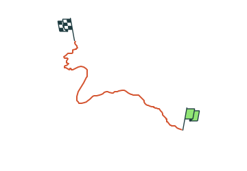
![](/images/other/stat-length.png)
![Randonnée A pied Vilassar de Dalt - SL-C 113 Cabrils-Les Artigasses - Photo](https://media.geolcdn.com/t/1900/400/b6da6149-dbb3-495e-be10-8fa4416447b1.jpeg&format=pjpeg&maxdim=2)
SL-C 113 Cabrils-Les Artigasses
SityTrail - itinéraires balisés pédestres
Tous les sentiers balisés d’Europe GUIDE+
![Longueur](/images/other/stat-length.png)
![Altitude max](https://static1.geolcdn.com/siteimages/upload/files/1508320355ic_sort_altitude_max_24dp.png)
![Dénivelé positif](https://static1.geolcdn.com/siteimages/upload/files/1508320355ic_sort_den_pos_24dp.png)
![Km-Effort](/images/other/stat-length.png)
![Altitude min](https://static1.geolcdn.com/siteimages/upload/files/1508320355ic_sort_altitude_min_24dp.png)
![Dénivelé négatif](https://static1.geolcdn.com/siteimages/upload/files/1508320355ic_sort_den_neg_24dp.png)
![Boucle](https://static1.geolcdn.com/siteimages/upload/files/16400158638029165_repeat_loop_refresh_sync_direction_icon.png)
![A pied](https://static1.geolcdn.com/sitytour/trail-icons/100.png)
1h44
Difficulté : Facile
![Scannez ce code QR pour ouvrir la randonnée dans l'application SityTrail](https://capi.geolives.com/qq0zvz2zws4bq2lad0pu/sitytour/trails/3109678/qr.png?size=200)
Application GPS de randonnée GRATUITE
À propos
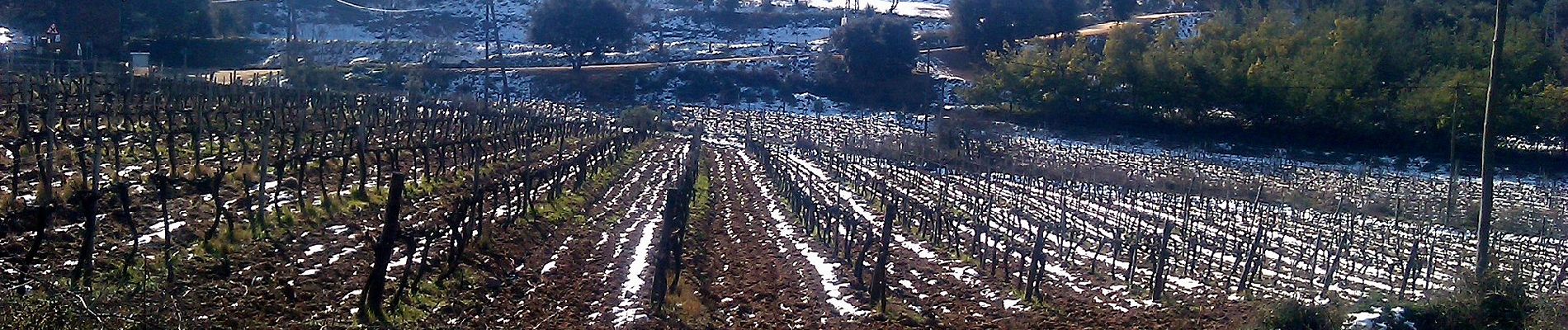
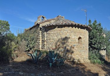
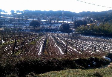
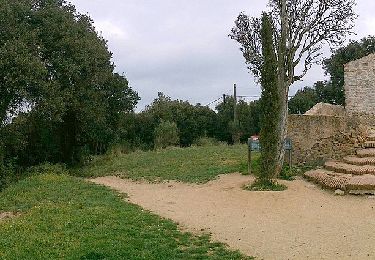
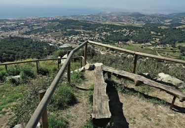
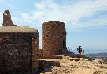
Randonnée A pied de 4,8 km à découvrir à Catalogne, Barcelone, Vilassar de Dalt. Cette randonnée est proposée par SityTrail - itinéraires balisés pédestres.
Description
Randonnée créée par Diputació de Barcelona.
Symbole: green:white:green_lower:1003:black
Site web: https://itineraris-senyalitzats.diba.cat/dibaparcs/routes/view/sl-c-113-a-la-roca-d-en-toni-des-de-cabrils
Localisation
Commentaires
Randonnées à proximité
![Randonnée A pied la Roca del Vallès - Ruta Prehistòrica I : Can Gol-Céllecs - Photo](https://media.geolcdn.com/t/375/260/107a470e-beab-49de-92d9-6c5096af7584.jpeg&format=jpg&maxdim=2)
![A pied A pied](https://static1.geolcdn.com/sitytour/trail-icons/100.png)
A pied
![](/images/other/stat-length.png)
![](https://static1.geolcdn.com/siteimages/upload/files/16400158638029165_repeat_loop_refresh_sync_direction_icon.png)
![Randonnée A pied Vilassar de Dalt - Vilasar de Dalt-Roca d'en Toni - Photo](https://media.geolcdn.com/t/375/260/b6da6149-dbb3-495e-be10-8fa4416447b1.jpeg&format=jpg&maxdim=2)
![A pied A pied](https://static1.geolcdn.com/sitytour/trail-icons/100.png)
A pied
![](/images/other/stat-length.png)
![](https://static1.geolcdn.com/siteimages/upload/files/16400158638029165_repeat_loop_refresh_sync_direction_icon.png)
![Randonnée A pied Premià de Dalt - SL-C 112 Ruta de l'Esquirol - Photo](https://media.geolcdn.com/t/375/260/d1bbe626-5017-4669-80e9-ac39c22a3bad.jpeg&format=jpg&maxdim=2)
![A pied A pied](https://static1.geolcdn.com/sitytour/trail-icons/100.png)
A pied
![](/images/other/stat-length.png)
![](https://static1.geolcdn.com/siteimages/upload/files/16400158638029165_repeat_loop_refresh_sync_direction_icon.png)
![Randonnée A pied Teià - SL-C 111 Ruta del Vedat - Photo](https://media.geolcdn.com/t/375/260/46748aa0-c343-4506-a9cb-9af28e298feb.jpeg&format=jpg&maxdim=2)
![A pied A pied](https://static1.geolcdn.com/sitytour/trail-icons/100.png)
A pied
![](/images/other/stat-length.png)
![](https://static1.geolcdn.com/siteimages/upload/files/16400158638029165_repeat_loop_refresh_sync_direction_icon.png)
![Randonnée A pied Cabrera de Mar - SL-C 115 Cabrera de Mar-Castell de Burriac - Photo](https://media.geolcdn.com/t/375/260/ce608d58-136a-4518-bd96-ab20a17f815d.jpeg&format=jpg&maxdim=2)
![A pied A pied](https://static1.geolcdn.com/sitytour/trail-icons/100.png)
A pied
![](/images/other/stat-length.png)
![](https://static1.geolcdn.com/siteimages/upload/files/16400158638029165_repeat_loop_refresh_sync_direction_icon.png)