![](/images/other/stat-length.png)
![Randonnée A pied Bronckhorst - Markepad - Photo](https://media.geolcdn.com/t/1900/400/81fc5e44-4832-48d2-84ab-ddc398c267d0.jpeg&format=pjpeg&maxdim=2)
Markepad
SityTrail - itinéraires balisés pédestres
Tous les sentiers balisés d’Europe GUIDE+
![Longueur](/images/other/stat-length.png)
Longueur
5,6 km
![Altitude max](https://static1.geolcdn.com/siteimages/upload/files/1508320355ic_sort_altitude_max_24dp.png)
Altitude max
27 m
![Dénivelé positif](https://static1.geolcdn.com/siteimages/upload/files/1508320355ic_sort_den_pos_24dp.png)
Dénivelé positif
38 m
![Km-Effort](/images/other/stat-length.png)
Km-Effort
6,1 km
![Altitude min](https://static1.geolcdn.com/siteimages/upload/files/1508320355ic_sort_altitude_min_24dp.png)
Altitude min
12 m
![Dénivelé négatif](https://static1.geolcdn.com/siteimages/upload/files/1508320355ic_sort_den_neg_24dp.png)
Dénivelé négatif
38 m
![Boucle](https://static1.geolcdn.com/siteimages/upload/files/16400158638029165_repeat_loop_refresh_sync_direction_icon.png)
Boucle
Oui
Balise
Date de création :
2022-02-14 14:41:48.129
Dernière modification :
2022-02-14 14:41:48.129
![A pied](https://static1.geolcdn.com/sitytour/trail-icons/100.png)
1h23
Difficulté : Facile
![Scannez ce code QR pour ouvrir la randonnée dans l'application SityTrail](https://capi.geolives.com/qq0zvz2zws4bq2lad0pu/sitytour/trails/3109076/qr.png?size=200)
Application GPS de randonnée GRATUITE
À propos
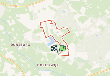
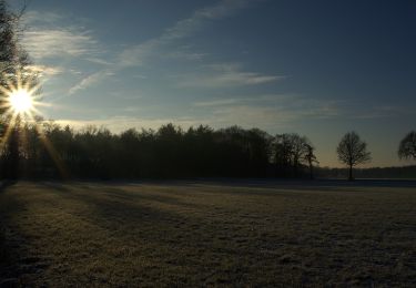
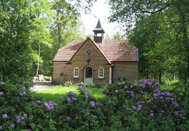
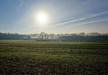
Randonnée A pied de 5,6 km à découvrir à Gueldre, Inconnu, Bronckhorst. Cette randonnée est proposée par SityTrail - itinéraires balisés pédestres.
Description
Symbole: Witte bordjes met rode pijl
Site web: http://www.recreatieschap.nl/routes.aspx
Localisation
Pays :
Pays-Bas
Région :
Gueldre
Département/Province :
Inconnu
Commune :
Bronckhorst
Localité :
Unknown
Départ:(Dec)
Départ:(UTM)
318153 ; 5767873 (32U) N.
Commentaires
Randonnées à proximité
![Randonnée A pied Bronckhorst - Um de olden spoorbaan route - Photo](https://media.geolcdn.com/t/375/260/f58de8f1-7535-463c-a610-f26470de493b.jpeg&format=jpg&maxdim=2)
![A pied A pied](https://static1.geolcdn.com/sitytour/trail-icons/100.png)
Um de olden spoorbaan route
A pied
Facile
Bronckhorst,
Gueldre,
Inconnu,
Pays-Bas
![](/images/other/stat-length.png)
10,5 km | 11,2 km-effort
2h 32min
![](https://static1.geolcdn.com/siteimages/upload/files/16400158638029165_repeat_loop_refresh_sync_direction_icon.png)
Oui
![Randonnée A pied Bronckhorst - Keijenborg Route - Photo](https://media.geolcdn.com/t/375/260/94c59f66-5341-4e6f-86f3-49d970e9a41a.jpeg&format=jpg&maxdim=2)
![A pied A pied](https://static1.geolcdn.com/sitytour/trail-icons/100.png)
Keijenborg Route
A pied
Facile
Bronckhorst,
Gueldre,
Inconnu,
Pays-Bas
![](/images/other/stat-length.png)
11,9 km | 12,5 km-effort
2h 50min
![](https://static1.geolcdn.com/siteimages/upload/files/16400158638029165_repeat_loop_refresh_sync_direction_icon.png)
Oui
![Randonnée A pied Bronckhorst - Veldhoekroute - Photo](https://media.geolcdn.com/t/375/260/62fda71b-a40a-4182-93fe-75dcae07c8bc.jpeg&format=jpg&maxdim=2)
![A pied A pied](https://static1.geolcdn.com/sitytour/trail-icons/100.png)
Veldhoekroute
A pied
Facile
Bronckhorst,
Gueldre,
Inconnu,
Pays-Bas
![](/images/other/stat-length.png)
8,3 km | 8,9 km-effort
2h 1min
![](https://static1.geolcdn.com/siteimages/upload/files/16400158638029165_repeat_loop_refresh_sync_direction_icon.png)
Oui
![Randonnée A pied Bronckhorst - Elzeboomroute - Photo](https://media.geolcdn.com/t/375/260/622d5faf-8028-4965-8c57-131bfdc570b5.jpeg&format=jpg&maxdim=2)
![A pied A pied](https://static1.geolcdn.com/sitytour/trail-icons/100.png)
Elzeboomroute
A pied
Facile
Bronckhorst,
Gueldre,
Inconnu,
Pays-Bas
![](/images/other/stat-length.png)
9,3 km | 9,9 km-effort
2h 15min
![](https://static1.geolcdn.com/siteimages/upload/files/16400158638029165_repeat_loop_refresh_sync_direction_icon.png)
Oui
![Randonnée A pied Bronckhorst - Varsselroute - Photo](https://media.geolcdn.com/t/375/260/7c5d23cf-0fbc-4d5a-8f9c-25dc5ddbacd8.jpeg&format=jpg&maxdim=2)
![A pied A pied](https://static1.geolcdn.com/sitytour/trail-icons/100.png)
Varsselroute
A pied
Facile
Bronckhorst,
Gueldre,
Inconnu,
Pays-Bas
![](/images/other/stat-length.png)
9,9 km | 10,9 km-effort
2h 27min
![](https://static1.geolcdn.com/siteimages/upload/files/16400158638029165_repeat_loop_refresh_sync_direction_icon.png)
Oui
![Randonnée A pied Bronckhorst - De Pinselroute - Photo](https://media.geolcdn.com/t/375/260/81fc5e44-4832-48d2-84ab-ddc398c267d0.jpeg&format=jpg&maxdim=2)
![A pied A pied](https://static1.geolcdn.com/sitytour/trail-icons/100.png)
De Pinselroute
A pied
Facile
Bronckhorst,
Gueldre,
Inconnu,
Pays-Bas
![](/images/other/stat-length.png)
8,3 km | 9 km-effort
2h 2min
![](https://static1.geolcdn.com/siteimages/upload/files/16400158638029165_repeat_loop_refresh_sync_direction_icon.png)
Oui
![Randonnée A pied Bronckhorst - Boelekeerlspad - Photo](https://media.geolcdn.com/t/375/260/ext.jpg?maxdim=2&url=https%3A%2F%2Fstatic1.geolcdn.com%2Fsiteimages%2Fupload%2Ffiles%2F1545311037marcheuse_200dpi.jpg)
![A pied A pied](https://static1.geolcdn.com/sitytour/trail-icons/100.png)
Boelekeerlspad
A pied
Facile
Bronckhorst,
Gueldre,
Inconnu,
Pays-Bas
![](/images/other/stat-length.png)
5,9 km | 6,4 km-effort
1h 27min
![](https://static1.geolcdn.com/siteimages/upload/files/16400158638029165_repeat_loop_refresh_sync_direction_icon.png)
Oui
![Randonnée Moteur Bronckhorst - a-nederland-5-daagse-tocht-naar-andalucia - Photo](https://media.geolcdn.com/t/375/260/ext.jpg?maxdim=2&url=https%3A%2F%2Fstatic1.geolcdn.com%2Fsiteimages%2Fupload%2Ffiles%2F15247431544x4.jpg)
![Moteur Moteur](https://static1.geolcdn.com/sitytour/trail-icons/400.png)
a-nederland-5-daagse-tocht-naar-andalucia
Moteur
Très facile
Bronckhorst,
Gueldre,
Inconnu,
Pays-Bas
![](/images/other/stat-length.png)
1801 km | 2602 km-effort
Inconnu
![](https://static1.geolcdn.com/siteimages/upload/files/16400158638029165_repeat_loop_refresh_sync_direction_icon.png)
Non
![Randonnée Vélo Bronckhorst - f-gelderland-smoks-hanne - Photo](https://media.geolcdn.com/t/375/260/ext.jpg?maxdim=2&url=https%3A%2F%2Fstatic1.geolcdn.com%2Fsiteimages%2Fupload%2Ffiles%2F1524743154velo.jpg)
![Vélo Vélo](https://static1.geolcdn.com/sitytour/trail-icons/200.png)
f-gelderland-smoks-hanne
Vélo
Très facile
Bronckhorst,
Gueldre,
Inconnu,
Pays-Bas
![](/images/other/stat-length.png)
10,8 km | 11,6 km-effort
Inconnu
![](https://static1.geolcdn.com/siteimages/upload/files/16400158638029165_repeat_loop_refresh_sync_direction_icon.png)
Oui