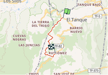
![](/images/other/stat-length.png)
![Randonnée A pied El Tanque - SL-TF 151.3 El Tanque Alto- Ruigómez-San José de Los Llanos - Photo](https://media.geolcdn.com/t/1900/400/2df0f235-da7b-4d2a-b3d9-2cfb98eb7f45.jpeg&format=pjpeg&maxdim=2)
SL-TF 151.3 El Tanque Alto- Ruigómez-San José de Los Llanos
SityTrail - itinéraires balisés pédestres
Tous les sentiers balisés d’Europe GUIDE+
![Longueur](/images/other/stat-length.png)
![Altitude max](https://static1.geolcdn.com/siteimages/upload/files/1508320355ic_sort_altitude_max_24dp.png)
![Dénivelé positif](https://static1.geolcdn.com/siteimages/upload/files/1508320355ic_sort_den_pos_24dp.png)
![Km-Effort](/images/other/stat-length.png)
![Altitude min](https://static1.geolcdn.com/siteimages/upload/files/1508320355ic_sort_altitude_min_24dp.png)
![Dénivelé négatif](https://static1.geolcdn.com/siteimages/upload/files/1508320355ic_sort_den_neg_24dp.png)
![Boucle](https://static1.geolcdn.com/siteimages/upload/files/16400158638029165_repeat_loop_refresh_sync_direction_icon.png)
![A pied](https://static1.geolcdn.com/sitytour/trail-icons/100.png)
1h35
Difficulté : Facile
![Scannez ce code QR pour ouvrir la randonnée dans l'application SityTrail](https://capi.geolives.com/qq0zvz2zws4bq2lad0pu/sitytour/trails/3108875/qr.png?size=200)
Application GPS de randonnée GRATUITE
À propos
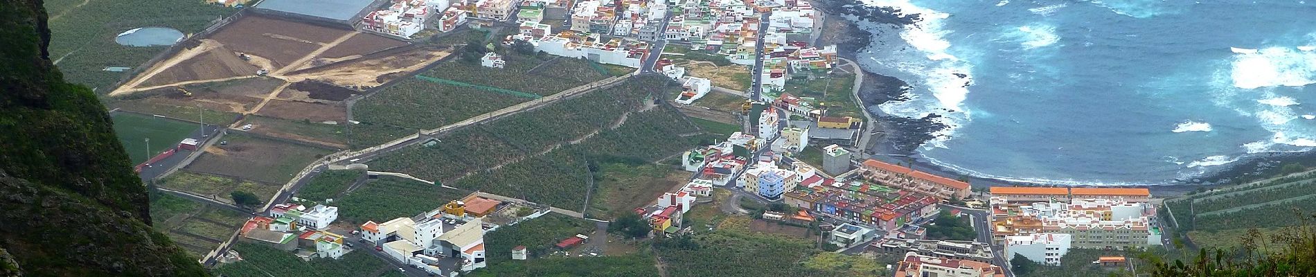
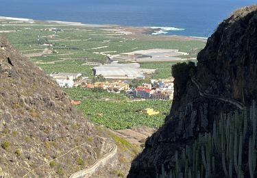
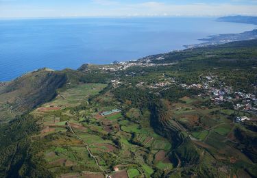
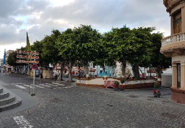
Randonnée A pied de 4,1 km à découvrir à Îles Canaries, Santa Cruz de Ténérife, El Tanque. Cette randonnée est proposée par SityTrail - itinéraires balisés pédestres.
Description
Randonnée créée par Cabildo Insular de Tenerife.
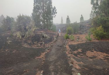
El paso por Camello Center está cerrado por ser privado y por vegetación
Symbole: parallel horizontal bars green white
Localisation
Commentaires
Randonnées à proximité
![Randonnée Marche El Tanque - San José de Los Lianos Arenas Negra Chinyero - Photo](https://media.geolcdn.com/t/375/260/e96ac2c2-9c83-4b11-a19c-b1c61051064f.jpg&format=jpg&maxdim=2)
![Marche Marche](https://static1.geolcdn.com/sitytour/trail-icons/101.png)
Marche
![](/images/other/stat-length.png)
![](https://static1.geolcdn.com/siteimages/upload/files/16400158638029165_repeat_loop_refresh_sync_direction_icon.png)
![Randonnée Marche Los Silos - Los Silos Cuevas Negra monte del Agua - Photo](https://media.geolcdn.com/t/375/260/bca2ca46-878d-4f23-a767-81c8c65719cb.jpg&format=jpg&maxdim=2)
![Marche Marche](https://static1.geolcdn.com/sitytour/trail-icons/101.png)
Marche
![](/images/other/stat-length.png)
![](https://static1.geolcdn.com/siteimages/upload/files/16400158638029165_repeat_loop_refresh_sync_direction_icon.png)
![Randonnée A pied El Tanque - SL-TF 151.2 Ruigómez - El Tanque - EL Tanque Bajo - La Atalaya - Photo](https://media.geolcdn.com/t/375/260/5d6e5983-32b2-4254-9759-cc8cb5c7ec40.jpeg&format=jpg&maxdim=2)
![A pied A pied](https://static1.geolcdn.com/sitytour/trail-icons/100.png)
A pied
![](/images/other/stat-length.png)
![](https://static1.geolcdn.com/siteimages/upload/files/16400158638029165_repeat_loop_refresh_sync_direction_icon.png)
![Randonnée A pied El Tanque - SL-TF 151 Ruigómez - Erjos - Ruigómez - Photo](https://media.geolcdn.com/t/375/260/5d6e5983-32b2-4254-9759-cc8cb5c7ec40.jpeg&format=jpg&maxdim=2)
![A pied A pied](https://static1.geolcdn.com/sitytour/trail-icons/100.png)
A pied
![](/images/other/stat-length.png)
![](https://static1.geolcdn.com/siteimages/upload/files/16400158638029165_repeat_loop_refresh_sync_direction_icon.png)
![Randonnée A pied Los Silos - Erjos Monte del Agua Erjos - Photo](https://media.geolcdn.com/t/375/260/ext.jpg?maxdim=2&url=https%3A%2F%2Fstatic1.geolcdn.com%2Fsiteimages%2Fupload%2Ffiles%2F1545311037marcheuse_200dpi.jpg)
![A pied A pied](https://static1.geolcdn.com/sitytour/trail-icons/100.png)
A pied
![](/images/other/stat-length.png)
![](https://static1.geolcdn.com/siteimages/upload/files/16400158638029165_repeat_loop_refresh_sync_direction_icon.png)
![Randonnée Marche El Tanque - Boucle volcan Chinyero à Tenerife - Photo](https://media.geolcdn.com/t/375/260/705e0ea7-430f-4e2e-835e-3fc7c2636c52.jpg&format=jpg&maxdim=2)
![Marche Marche](https://static1.geolcdn.com/sitytour/trail-icons/101.png)
Marche
![](/images/other/stat-length.png)
![](https://static1.geolcdn.com/siteimages/upload/files/16400158638029165_repeat_loop_refresh_sync_direction_icon.png)
![Randonnée Marche El Tanque - Los partidos - Photo](https://media.geolcdn.com/t/375/260/588a88dc-0d87-49f9-8019-9ae7e35d2d23.jpg&format=jpg&maxdim=2)
![Marche Marche](https://static1.geolcdn.com/sitytour/trail-icons/101.png)
Marche
![](/images/other/stat-length.png)
![](https://static1.geolcdn.com/siteimages/upload/files/16400158638029165_repeat_loop_refresh_sync_direction_icon.png)
![Randonnée Marche Garachico - Arenas Negras - Photo](https://media.geolcdn.com/t/375/260/3d7a6af4-f628-4ee2-b8d5-dca740c2599d.jpg&format=jpg&maxdim=2)
![Marche Marche](https://static1.geolcdn.com/sitytour/trail-icons/101.png)
Marche
![](/images/other/stat-length.png)
![](https://static1.geolcdn.com/siteimages/upload/files/16400158638029165_repeat_loop_refresh_sync_direction_icon.png)
![Randonnée Marche Los Silos - Los Silos - Erjos - los Silos - Photo](https://media.geolcdn.com/t/375/260/ext.jpg?maxdim=2&url=https%3A%2F%2Fservices.sitytrail.com%2FGeolivesWS%2FDownloadMedia.ashx%3FTrailID%3D874031%26Media%3Dfix__20171210172932.jpg)
![Marche Marche](https://static1.geolcdn.com/sitytour/trail-icons/101.png)
Marche
![](/images/other/stat-length.png)
![](https://static1.geolcdn.com/siteimages/upload/files/16400158638029165_repeat_loop_refresh_sync_direction_icon.png)