![](/images/other/stat-length.png)
![Randonnée A pied Epe - Welkom op Tongerense Heide en Wisselse Veen! Rode route - Photo](https://media.geolcdn.com/t/1900/400/e36d41f7-51e0-49d8-afe7-572c4771acdf.jpeg&format=pjpeg&maxdim=2)
Welkom op Tongerense Heide en Wisselse Veen! Rode route
SityTrail - itinéraires balisés pédestres
Tous les sentiers balisés d’Europe GUIDE+
![Longueur](/images/other/stat-length.png)
Longueur
5,4 km
![Altitude max](https://static1.geolcdn.com/siteimages/upload/files/1508320355ic_sort_altitude_max_24dp.png)
Altitude max
38 m
![Dénivelé positif](https://static1.geolcdn.com/siteimages/upload/files/1508320355ic_sort_den_pos_24dp.png)
Dénivelé positif
53 m
![Km-Effort](/images/other/stat-length.png)
Km-Effort
6,1 km
![Altitude min](https://static1.geolcdn.com/siteimages/upload/files/1508320355ic_sort_altitude_min_24dp.png)
Altitude min
23 m
![Dénivelé négatif](https://static1.geolcdn.com/siteimages/upload/files/1508320355ic_sort_den_neg_24dp.png)
Dénivelé négatif
54 m
![Boucle](https://static1.geolcdn.com/siteimages/upload/files/16400158638029165_repeat_loop_refresh_sync_direction_icon.png)
Boucle
Oui
Balise
Date de création :
2022-02-14 14:30:22.11
Dernière modification :
2022-02-14 14:30:22.11
![A pied](https://static1.geolcdn.com/sitytour/trail-icons/100.png)
1h23
Difficulté : Facile
![Scannez ce code QR pour ouvrir la randonnée dans l'application SityTrail](https://capi.geolives.com/qq0zvz2zws4bq2lad0pu/sitytour/trails/3108748/qr.png?size=200)
Application GPS de randonnée GRATUITE
À propos
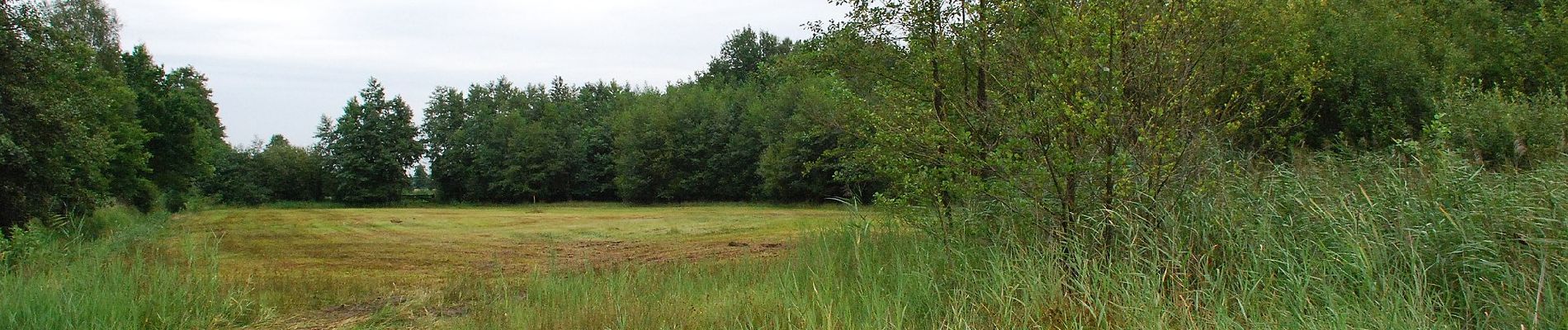
Randonnée A pied de 5,4 km à découvrir à Gueldre, Inconnu, Epe. Cette randonnée est proposée par SityTrail - itinéraires balisés pédestres.
Description
Meer dan 100 prachtige natuurgebieden, kastelen en landgoederen in Gelderland zijn aan de zorg toevertrouwd van Geldersch Landschap & Kasteelen.
Site web: https://www.glk.nl/
Localisation
Pays :
Pays-Bas
Région :
Gueldre
Département/Province :
Inconnu
Commune :
Epe
Localité :
Unknown
Départ:(Dec)
Départ:(UTM)
699512 ; 5802653 (31U) N.
Commentaires
Randonnées à proximité
![Randonnée A pied Epe - Welkom op Tongerense Heide en Wisselse Veen! Blauwe route - Photo](https://media.geolcdn.com/t/375/260/211c8a18-cc77-416f-b9e5-37178a00cee2.jpeg&format=jpg&maxdim=2)
![A pied A pied](https://static1.geolcdn.com/sitytour/trail-icons/100.png)
Welkom op Tongerense Heide en Wisselse Veen! Blauwe route
A pied
Facile
Epe,
Gueldre,
Inconnu,
Pays-Bas
![](/images/other/stat-length.png)
3,5 km | 3,8 km-effort
51min
![](https://static1.geolcdn.com/siteimages/upload/files/16400158638029165_repeat_loop_refresh_sync_direction_icon.png)
Oui
![Randonnée A pied Epe - Welkom op Scherpenberg en Majuba!, Gele route - Photo](https://media.geolcdn.com/t/375/260/bc5377e4-ce6c-425e-895c-9c95730396b6.jpeg&format=jpg&maxdim=2)
![A pied A pied](https://static1.geolcdn.com/sitytour/trail-icons/100.png)
Welkom op Scherpenberg en Majuba!, Gele route
A pied
Facile
Epe,
Gueldre,
Inconnu,
Pays-Bas
![](/images/other/stat-length.png)
5,1 km | 5,8 km-effort
1h 18min
![](https://static1.geolcdn.com/siteimages/upload/files/16400158638029165_repeat_loop_refresh_sync_direction_icon.png)
Oui
![Randonnée Marche Epe - Gortel - Photo](https://media.geolcdn.com/t/375/260/ext.jpg?maxdim=2&url=https%3A%2F%2Fstatic1.geolcdn.com%2Fsiteimages%2Fupload%2Ffiles%2F1553511878bg_sport_marche.png)
![Marche Marche](https://static1.geolcdn.com/sitytour/trail-icons/101.png)
![Randonnée Vélo Epe - Gelderland - Noord-Veluwe Epe-Vaassen - Photo](https://media.geolcdn.com/t/375/260/ext.jpg?maxdim=2&url=https%3A%2F%2Fstatic1.geolcdn.com%2Fsiteimages%2Fupload%2Ffiles%2F1524743154velo.jpg)
![Vélo Vélo](https://static1.geolcdn.com/sitytour/trail-icons/200.png)
Gelderland - Noord-Veluwe Epe-Vaassen
Vélo
Très facile
Epe,
Gueldre,
Inconnu,
Pays-Bas
![](/images/other/stat-length.png)
32 km | 35 km-effort
Inconnu
![](https://static1.geolcdn.com/siteimages/upload/files/16400158638029165_repeat_loop_refresh_sync_direction_icon.png)
Oui
![Randonnée Vélo Epe - Gelderland - Noord-Veluwe Epe-Nunspeet - Photo](https://media.geolcdn.com/t/375/260/ext.jpg?maxdim=2&url=https%3A%2F%2Fstatic1.geolcdn.com%2Fsiteimages%2Fupload%2Ffiles%2F1524743154velo.jpg)
![Vélo Vélo](https://static1.geolcdn.com/sitytour/trail-icons/200.png)
Gelderland - Noord-Veluwe Epe-Nunspeet
Vélo
Très facile
Epe,
Gueldre,
Inconnu,
Pays-Bas
![](/images/other/stat-length.png)
38 km | 42 km-effort
Inconnu
![](https://static1.geolcdn.com/siteimages/upload/files/16400158638029165_repeat_loop_refresh_sync_direction_icon.png)
Oui
![Randonnée Vélo Epe - Gelderland - Noord-Veluwe Epe-Elspeet - Photo](https://media.geolcdn.com/t/375/260/ext.jpg?maxdim=2&url=https%3A%2F%2Fstatic1.geolcdn.com%2Fsiteimages%2Fupload%2Ffiles%2F1524743154velo.jpg)
![Vélo Vélo](https://static1.geolcdn.com/sitytour/trail-icons/200.png)
Gelderland - Noord-Veluwe Epe-Elspeet
Vélo
Très facile
Epe,
Gueldre,
Inconnu,
Pays-Bas
![](/images/other/stat-length.png)
51 km | 57 km-effort
Inconnu
![](https://static1.geolcdn.com/siteimages/upload/files/16400158638029165_repeat_loop_refresh_sync_direction_icon.png)
Oui
![Randonnée Vélo Epe - f-gelderland-rondom-prinsenkuil - Photo](https://media.geolcdn.com/t/375/260/ext.jpg?maxdim=2&url=https%3A%2F%2Fstatic1.geolcdn.com%2Fsiteimages%2Fupload%2Ffiles%2F1524743154velo.jpg)
![Vélo Vélo](https://static1.geolcdn.com/sitytour/trail-icons/200.png)
f-gelderland-rondom-prinsenkuil
Vélo
Très facile
Epe,
Gueldre,
Inconnu,
Pays-Bas
![](/images/other/stat-length.png)
39 km | 44 km-effort
Inconnu
![](https://static1.geolcdn.com/siteimages/upload/files/16400158638029165_repeat_loop_refresh_sync_direction_icon.png)
Oui
![Randonnée Vélo Epe - f-gelderland-door-bos-hei-en-wei - Photo](https://media.geolcdn.com/t/375/260/ext.jpg?maxdim=2&url=https%3A%2F%2Fstatic1.geolcdn.com%2Fsiteimages%2Fupload%2Ffiles%2F1524743154velo.jpg)
![Vélo Vélo](https://static1.geolcdn.com/sitytour/trail-icons/200.png)
f-gelderland-door-bos-hei-en-wei
Vélo
Très facile
Epe,
Gueldre,
Inconnu,
Pays-Bas
![](/images/other/stat-length.png)
33 km | 36 km-effort
Inconnu
![](https://static1.geolcdn.com/siteimages/upload/files/16400158638029165_repeat_loop_refresh_sync_direction_icon.png)
Oui
![Randonnée Vélo Epe - f-gelderland-de-renderklippen - Photo](https://media.geolcdn.com/t/375/260/ext.jpg?maxdim=2&url=https%3A%2F%2Fstatic1.geolcdn.com%2Fsiteimages%2Fupload%2Ffiles%2F1524743154velo.jpg)
![Vélo Vélo](https://static1.geolcdn.com/sitytour/trail-icons/200.png)
f-gelderland-de-renderklippen
Vélo
Très facile
Epe,
Gueldre,
Inconnu,
Pays-Bas
![](/images/other/stat-length.png)
19,7 km | 22 km-effort
Inconnu
![](https://static1.geolcdn.com/siteimages/upload/files/16400158638029165_repeat_loop_refresh_sync_direction_icon.png)
Non