![](/images/other/stat-length.png)
![Randonnée A pied Zurich - Planetenweg - Photo](https://media.geolcdn.com/t/1900/400/ext.pjpeg?maxdim=2&url=https%3A%2F%2Fstatic1.geolcdn.com%2Fsiteimages%2Fupload%2Ffiles%2F1545311037marcheuse_200dpi.jpg)
Planetenweg
SityTrail - itinéraires balisés pédestres
Tous les sentiers balisés d’Europe GUIDE+
![Longueur](/images/other/stat-length.png)
Longueur
7,4 km
![Altitude max](https://static1.geolcdn.com/siteimages/upload/files/1508320355ic_sort_altitude_max_24dp.png)
Altitude max
857 m
![Dénivelé positif](https://static1.geolcdn.com/siteimages/upload/files/1508320355ic_sort_den_pos_24dp.png)
Dénivelé positif
200 m
![Km-Effort](/images/other/stat-length.png)
Km-Effort
10,2 km
![Altitude min](https://static1.geolcdn.com/siteimages/upload/files/1508320355ic_sort_altitude_min_24dp.png)
Altitude min
726 m
![Dénivelé négatif](https://static1.geolcdn.com/siteimages/upload/files/1508320355ic_sort_den_neg_24dp.png)
Dénivelé négatif
246 m
![Boucle](https://static1.geolcdn.com/siteimages/upload/files/16400158638029165_repeat_loop_refresh_sync_direction_icon.png)
Boucle
Non
Balise
Date de création :
2022-02-14 08:49:26.964
Dernière modification :
2022-02-14 08:49:26.964
![A pied](https://static1.geolcdn.com/sitytour/trail-icons/100.png)
2h18
Difficulté : Facile
![Scannez ce code QR pour ouvrir la randonnée dans l'application SityTrail](https://capi.geolives.com/qq0zvz2zws4bq2lad0pu/sitytour/trails/3106253/qr.png?size=200)
Application GPS de randonnée GRATUITE
À propos
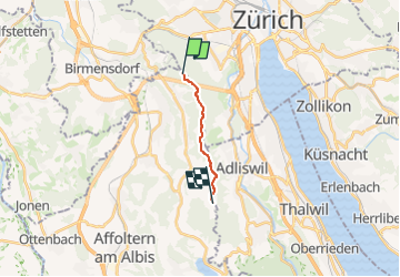
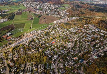
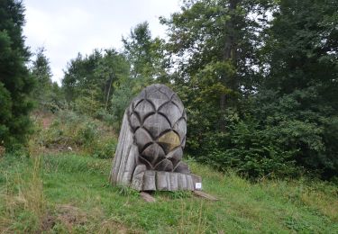
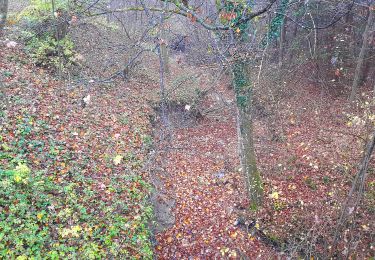
Randonnée A pied de 7,4 km à découvrir à Zurich, District de Zurich, Zurich. Cette randonnée est proposée par SityTrail - itinéraires balisés pédestres.
Description
Site web: http://uetlibergverein.ch/planetenweg/
Localisation
Pays :
Suisse
Région :
Zurich
Département/Province :
District de Zurich
Commune :
Zurich
Localité :
Wiedikon
Départ:(Dec)
Départ:(UTM)
461381 ; 5244383 (32T) N.
Commentaires
Randonnées à proximité
![Randonnée Marche Zurich - Uetliberg - Albispass - Türlersee - Photo](https://media.geolcdn.com/t/375/260/ext.jpg?maxdim=2&url=https%3A%2F%2Fstatic1.geolcdn.com%2Fsiteimages%2Fupload%2Ffiles%2F1553511878bg_sport_marche.png)
![Marche Marche](https://static1.geolcdn.com/sitytour/trail-icons/101.png)
Uetliberg - Albispass - Türlersee
Marche
Très facile
(1)
Zurich,
Zurich,
District de Zurich,
Suisse
![](/images/other/stat-length.png)
16 km | 22 km-effort
Inconnu
![](https://static1.geolcdn.com/siteimages/upload/files/16400158638029165_repeat_loop_refresh_sync_direction_icon.png)
Non
![Randonnée A pied Adliswil - Ober Leimbach - Waldi - Fixme - Photo](https://media.geolcdn.com/t/375/260/4b7b0b47-a069-40d5-8e4c-3d56220d8276.jpeg&format=jpg&maxdim=2)
![A pied A pied](https://static1.geolcdn.com/sitytour/trail-icons/100.png)
Ober Leimbach - Waldi - Fixme
A pied
Facile
Adliswil,
Zurich,
Bezirk Horgen,
Suisse
![](/images/other/stat-length.png)
3,5 km | 5,4 km-effort
1h 14min
![](https://static1.geolcdn.com/siteimages/upload/files/16400158638029165_repeat_loop_refresh_sync_direction_icon.png)
Non
![Randonnée A pied Zurich - Rigiblick - Stettbach Bahnhof - Photo](https://media.geolcdn.com/t/375/260/454baeef-2017-489f-b0cc-d51ac7dc03f1.jpeg&format=jpg&maxdim=2)
![A pied A pied](https://static1.geolcdn.com/sitytour/trail-icons/100.png)
Rigiblick - Stettbach Bahnhof
A pied
Facile
Zurich,
Zurich,
District de Zurich,
Suisse
![](/images/other/stat-length.png)
4,8 km | 6,5 km-effort
1h 28min
![](https://static1.geolcdn.com/siteimages/upload/files/16400158638029165_repeat_loop_refresh_sync_direction_icon.png)
Non
![Randonnée A pied Adliswil - Adliswil (Bahnhof) - Thalwil (Bahnhof) - Photo](https://media.geolcdn.com/t/375/260/1b61ea50-0c39-417f-b21d-594d58f81a4c.jpeg&format=jpg&maxdim=2)
![A pied A pied](https://static1.geolcdn.com/sitytour/trail-icons/100.png)
Adliswil (Bahnhof) - Thalwil (Bahnhof)
A pied
Facile
Adliswil,
Zurich,
Bezirk Horgen,
Suisse
![](/images/other/stat-length.png)
5,4 km | 7,2 km-effort
1h 38min
![](https://static1.geolcdn.com/siteimages/upload/files/16400158638029165_repeat_loop_refresh_sync_direction_icon.png)
Non
![Randonnée A pied Rüschlikon - Nidelbad - Thalwil (Bahnhof) - Photo](https://media.geolcdn.com/t/375/260/23f3114d-de5f-43ad-a9d6-f665cc724a68.jpeg&format=jpg&maxdim=2)
![A pied A pied](https://static1.geolcdn.com/sitytour/trail-icons/100.png)
Nidelbad - Thalwil (Bahnhof)
A pied
Facile
Rüschlikon,
Zurich,
Bezirk Horgen,
Suisse
![](/images/other/stat-length.png)
3 km | 3,5 km-effort
47min
![](https://static1.geolcdn.com/siteimages/upload/files/16400158638029165_repeat_loop_refresh_sync_direction_icon.png)
Non
![Randonnée A pied Stallikon - Uitikon Waldegg Station - Uetliberg Kulm - Photo](https://media.geolcdn.com/t/375/260/dev_a758ce6b-60a2-4471-b639-3fd48e07adc6.jpeg&format=jpg&maxdim=2)
![A pied A pied](https://static1.geolcdn.com/sitytour/trail-icons/100.png)
Uitikon Waldegg Station - Uetliberg Kulm
A pied
Facile
Stallikon,
Zurich,
Bezirk Affoltern,
Suisse
![](/images/other/stat-length.png)
3,4 km | 4,3 km-effort
58min
![](https://static1.geolcdn.com/siteimages/upload/files/16400158638029165_repeat_loop_refresh_sync_direction_icon.png)
Non
![Randonnée A pied Uitikon - Birmensdorf - Ringlikon - Photo](https://media.geolcdn.com/t/375/260/1c3d2f09-512b-49d3-aedf-b21de5c9fc70.jpeg&format=jpg&maxdim=2)
![A pied A pied](https://static1.geolcdn.com/sitytour/trail-icons/100.png)
Birmensdorf - Ringlikon
A pied
Facile
Uitikon,
Zurich,
Bezirk Dietikon,
Suisse
![](/images/other/stat-length.png)
3,3 km | 3,9 km-effort
53min
![](https://static1.geolcdn.com/siteimages/upload/files/16400158638029165_repeat_loop_refresh_sync_direction_icon.png)
Non
![Randonnée A pied Uitikon - Birmensdorf - Ringlikon Haltestelle - Photo](https://media.geolcdn.com/t/375/260/b2488650-92af-45a4-8c3f-0ddfecd0423e.jpeg&format=jpg&maxdim=2)
![A pied A pied](https://static1.geolcdn.com/sitytour/trail-icons/100.png)
Birmensdorf - Ringlikon Haltestelle
A pied
Facile
Uitikon,
Zurich,
Bezirk Dietikon,
Suisse
![](/images/other/stat-length.png)
3,9 km | 5 km-effort
1h 7min
![](https://static1.geolcdn.com/siteimages/upload/files/16400158638029165_repeat_loop_refresh_sync_direction_icon.png)
Non
![Randonnée A pied Wettswil am Albis - Birmensdorf - Wettswil - Photo](https://media.geolcdn.com/t/375/260/6876b5bc-0e6c-4b4c-b57e-4dd6d3c1fb20.jpeg&format=jpg&maxdim=2)
![A pied A pied](https://static1.geolcdn.com/sitytour/trail-icons/100.png)
Birmensdorf - Wettswil
A pied
Facile
Wettswil am Albis,
Zurich,
Bezirk Affoltern,
Suisse
![](/images/other/stat-length.png)
4,5 km | 5,8 km-effort
1h 19min
![](https://static1.geolcdn.com/siteimages/upload/files/16400158638029165_repeat_loop_refresh_sync_direction_icon.png)
Non