![](/images/other/stat-length.png)
![Randonnée A pied Rheinau - Brücke Rheinau - Strick - Photo](https://media.geolcdn.com/t/1900/400/edfdb82e-b4c7-4ec1-803b-fc0a6334a895.jpeg&format=pjpeg&maxdim=2)
Brücke Rheinau - Strick
SityTrail - itinéraires balisés pédestres
Tous les sentiers balisés d’Europe GUIDE+
![Longueur](/images/other/stat-length.png)
Longueur
3,8 km
![Altitude max](https://static1.geolcdn.com/siteimages/upload/files/1508320355ic_sort_altitude_max_24dp.png)
Altitude max
389 m
![Dénivelé positif](https://static1.geolcdn.com/siteimages/upload/files/1508320355ic_sort_den_pos_24dp.png)
Dénivelé positif
53 m
![Km-Effort](/images/other/stat-length.png)
Km-Effort
4,5 km
![Altitude min](https://static1.geolcdn.com/siteimages/upload/files/1508320355ic_sort_altitude_min_24dp.png)
Altitude min
352 m
![Dénivelé négatif](https://static1.geolcdn.com/siteimages/upload/files/1508320355ic_sort_den_neg_24dp.png)
Dénivelé négatif
64 m
![Boucle](https://static1.geolcdn.com/siteimages/upload/files/16400158638029165_repeat_loop_refresh_sync_direction_icon.png)
Boucle
Non
Balise
Date de création :
2022-02-14 08:47:23.954
Dernière modification :
2022-02-14 08:47:23.954
![A pied](https://static1.geolcdn.com/sitytour/trail-icons/100.png)
1h01
Difficulté : Facile
![Scannez ce code QR pour ouvrir la randonnée dans l'application SityTrail](https://capi.geolives.com/qq0zvz2zws4bq2lad0pu/sitytour/trails/3106069/qr.png?size=200)
Application GPS de randonnée GRATUITE
À propos
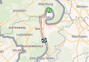
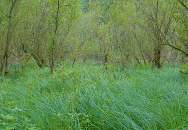
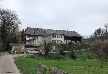
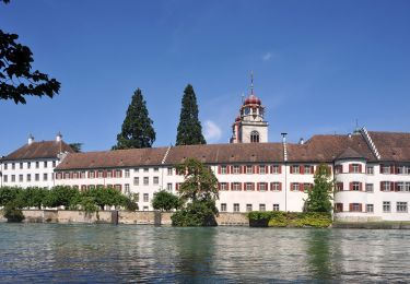
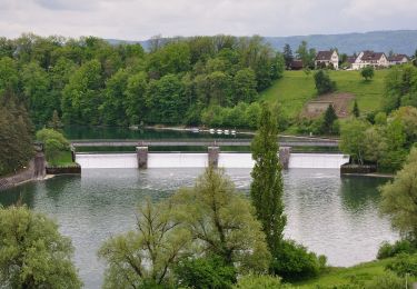
Randonnée A pied de 3,8 km à découvrir à Zurich, Bezirk Andelfingen, Rheinau. Cette randonnée est proposée par SityTrail - itinéraires balisés pédestres.
Description
Brücke Rheinau - Strick
Symbole: gelber Diamant (waagrecht)
Localisation
Pays :
Suisse
Région :
Zurich
Département/Province :
Bezirk Andelfingen
Commune :
Rheinau
Localité :
Unknown
Départ:(Dec)
Départ:(UTM)
470200 ; 5276904 (32T) N.
Commentaires
Randonnées à proximité
![Randonnée A pied Rafz - Rafz - Eglisau Bahnhof - Photo](https://media.geolcdn.com/t/375/260/db32595a-b7f7-4371-b947-c2ac8504042d.jpeg&format=jpg&maxdim=2)
![A pied A pied](https://static1.geolcdn.com/sitytour/trail-icons/100.png)
Rafz - Eglisau Bahnhof
A pied
Facile
Rafz,
Zurich,
Bezirk Bülach,
Suisse
![](/images/other/stat-length.png)
5,4 km | 6,3 km-effort
1h 26min
![](https://static1.geolcdn.com/siteimages/upload/files/16400158638029165_repeat_loop_refresh_sync_direction_icon.png)
Non
![Randonnée A pied Rafz - Rafz - Ellikon am Rhein - Photo](https://media.geolcdn.com/t/375/260/25c4e05d-745d-4279-a6b0-ba809d7600a9.jpeg&format=jpg&maxdim=2)
![A pied A pied](https://static1.geolcdn.com/sitytour/trail-icons/100.png)
Rafz - Ellikon am Rhein
A pied
Facile
Rafz,
Zurich,
Bezirk Bülach,
Suisse
![](/images/other/stat-length.png)
7,1 km | 9,5 km-effort
2h 9min
![](https://static1.geolcdn.com/siteimages/upload/files/16400158638029165_repeat_loop_refresh_sync_direction_icon.png)
Non
![Randonnée A pied Rafz - Rafz Bahnhof - Lottstetten - Photo](https://media.geolcdn.com/t/375/260/6f369ae1-d2f7-4e1f-be8b-70d0bbdeb91e.jpeg&format=jpg&maxdim=2)
![A pied A pied](https://static1.geolcdn.com/sitytour/trail-icons/100.png)
Rafz Bahnhof - Lottstetten
A pied
Facile
Rafz,
Zurich,
Bezirk Bülach,
Suisse
![](/images/other/stat-length.png)
5,4 km | 7,3 km-effort
1h 39min
![](https://static1.geolcdn.com/siteimages/upload/files/16400158638029165_repeat_loop_refresh_sync_direction_icon.png)
Non
![Randonnée A pied Rafz - Rafz Bahnhof - Nack - Photo](https://media.geolcdn.com/t/375/260/052bc02c-b012-4124-9cd6-58dc89d28dd1.jpeg&format=jpg&maxdim=2)
![A pied A pied](https://static1.geolcdn.com/sitytour/trail-icons/100.png)
Rafz Bahnhof - Nack
A pied
Facile
Rafz,
Zurich,
Bezirk Bülach,
Suisse
![](/images/other/stat-length.png)
5,4 km | 7,5 km-effort
1h 42min
![](https://static1.geolcdn.com/siteimages/upload/files/16400158638029165_repeat_loop_refresh_sync_direction_icon.png)
Non
![Randonnée A pied Lottstetten - Ziegelhütte - Fähre Ellikon am Rhein (Hochwasser Alternativroute) - Photo](https://media.geolcdn.com/t/375/260/daccca04-78af-4d11-ac2d-cc1fe3034220.jpeg&format=jpg&maxdim=2)
![A pied A pied](https://static1.geolcdn.com/sitytour/trail-icons/100.png)
Ziegelhütte - Fähre Ellikon am Rhein (Hochwasser Alternativroute)
A pied
Facile
Lottstetten,
Bade-Wurtemberg,
Landkreis Waldshut,
Allemagne
![](/images/other/stat-length.png)
5 km | 5,7 km-effort
1h 17min
![](https://static1.geolcdn.com/siteimages/upload/files/16400158638029165_repeat_loop_refresh_sync_direction_icon.png)
Non
![Randonnée A pied Laufen-Uhwiesen - Nohlbrücke - Wehrbrücke Rheinau - Photo](https://media.geolcdn.com/t/375/260/cff12f90-adb2-4075-82f2-1fb0bf9a06a8.jpeg&format=jpg&maxdim=2)
![A pied A pied](https://static1.geolcdn.com/sitytour/trail-icons/100.png)
Nohlbrücke - Wehrbrücke Rheinau
A pied
Facile
Laufen-Uhwiesen,
Zurich,
Bezirk Andelfingen,
Suisse
![](/images/other/stat-length.png)
5,6 km | 6,5 km-effort
1h 27min
![](https://static1.geolcdn.com/siteimages/upload/files/16400158638029165_repeat_loop_refresh_sync_direction_icon.png)
Non
![Randonnée A pied Rheinau - Brücke Rheinau - Strick - Photo](https://media.geolcdn.com/t/375/260/edfdb82e-b4c7-4ec1-803b-fc0a6334a895.jpeg&format=jpg&maxdim=2)
![A pied A pied](https://static1.geolcdn.com/sitytour/trail-icons/100.png)
Brücke Rheinau - Strick
A pied
Facile
Rheinau,
Zurich,
Bezirk Andelfingen,
Suisse
![](/images/other/stat-length.png)
3,8 km | 4,5 km-effort
1h 0min
![](https://static1.geolcdn.com/siteimages/upload/files/16400158638029165_repeat_loop_refresh_sync_direction_icon.png)
Non
![Randonnée A pied Rafz - Rafz - Wil - Photo](https://media.geolcdn.com/t/375/260/04242084-88ad-45e0-846a-5689a0216b40.jpeg&format=jpg&maxdim=2)
![A pied A pied](https://static1.geolcdn.com/sitytour/trail-icons/100.png)
![Randonnée A pied Dachsen - Mettli - EW Rheinau Wehrbrücke - Photo](https://media.geolcdn.com/t/375/260/e97a8f87-552d-4714-93de-b473f5c84261.jpeg&format=jpg&maxdim=2)
![A pied A pied](https://static1.geolcdn.com/sitytour/trail-icons/100.png)
Mettli - EW Rheinau Wehrbrücke
A pied
Facile
Dachsen,
Zurich,
Bezirk Andelfingen,
Suisse
![](/images/other/stat-length.png)
3,8 km | 4,6 km-effort
1h 2min
![](https://static1.geolcdn.com/siteimages/upload/files/16400158638029165_repeat_loop_refresh_sync_direction_icon.png)
Non