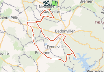
![](/images/other/stat-length.png)
![Randonnée Randonnée équestre Neuviller-lès-Badonviller - randonnée du 13 fevrier 2022 - Photo](https://media.geolcdn.com/t/1900/400/1085e6b6-34ac-4e9f-be64-df8e9e230f0c.jpg&format=pjpeg&maxdim=2)
randonnée du 13 fevrier 2022
ASSOCIATION DES CAVALIERS DU PAYS LUNEVILLOIS
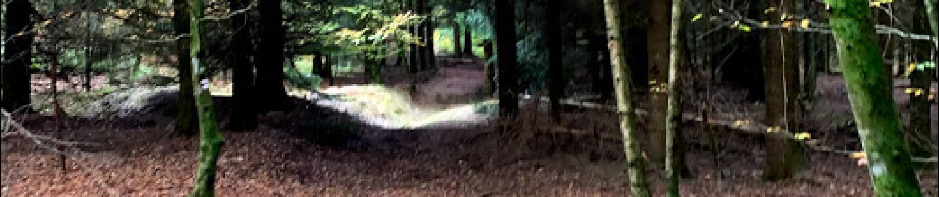
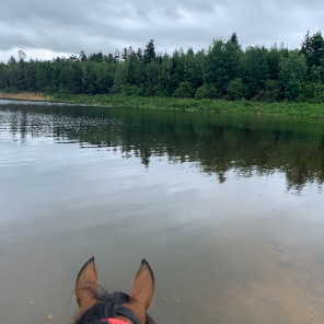
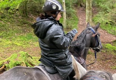
JOIE ET BONHEUR DE LA RANDONNEE A CHEVAL
![Longueur](/images/other/stat-length.png)
![Altitude max](https://static1.geolcdn.com/siteimages/upload/files/1508320355ic_sort_altitude_max_24dp.png)
![Dénivelé positif](https://static1.geolcdn.com/siteimages/upload/files/1508320355ic_sort_den_pos_24dp.png)
![Km-Effort](/images/other/stat-length.png)
![Altitude min](https://static1.geolcdn.com/siteimages/upload/files/1508320355ic_sort_altitude_min_24dp.png)
![Dénivelé négatif](https://static1.geolcdn.com/siteimages/upload/files/1508320355ic_sort_den_neg_24dp.png)
![Boucle](https://static1.geolcdn.com/siteimages/upload/files/16400158638029165_repeat_loop_refresh_sync_direction_icon.png)
![Randonnée équestre](https://static1.geolcdn.com/sitytour/trail-icons/301.png)
3h08
Difficulté : Moyen
![Scannez ce code QR pour ouvrir la randonnée dans l'application SityTrail](https://capi.geolives.com/qq0zvz2zws4bq2lad0pu/sitytour/trails/3102519/qr.png?size=200)
Application GPS de randonnée GRATUITE
À propos
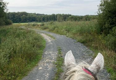
Randonnée Randonnée équestre de 19,5 km à découvrir à Grand Est, Meurthe-et-Moselle, Neuviller-lès-Badonviller. Cette randonnée est proposée par ASSOCIATION DES CAVALIERS DU PAYS LUNEVILLOIS.
Description
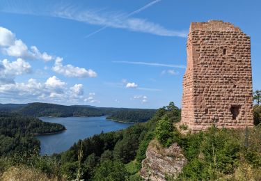
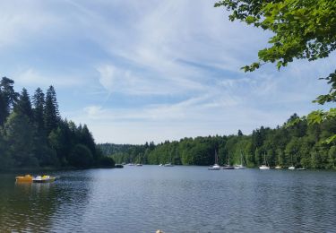
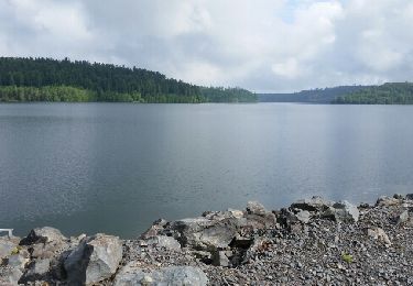
départ Neuviller via le lac de Pierre Percée, restaurant à Pexonne et retour à Neuviller
Localisation
Commentaires
Randonnées à proximité
![Randonnée équestre Randonnée équestre](https://static1.geolcdn.com/sitytour/trail-icons/301.png)
Randonnée équestre
![](/images/other/stat-length.png)
![](https://static1.geolcdn.com/siteimages/upload/files/16400158638029165_repeat_loop_refresh_sync_direction_icon.png)
![Randonnée Marche Badonviller - 2023-07-22 Marche Bivouac Lac de la pierre percee - Photo](https://media.geolcdn.com/t/375/260/122d3872-bd00-4b8d-bfcc-b1533062f5e9.jpg&format=jpg&maxdim=2)
![Marche Marche](https://static1.geolcdn.com/sitytour/trail-icons/101.png)
Marche
![](/images/other/stat-length.png)
![](https://static1.geolcdn.com/siteimages/upload/files/16400158638029165_repeat_loop_refresh_sync_direction_icon.png)
![Randonnée Randonnée équestre Badonviller - Lac de Pierre Percée 25 km - Photo](https://media.geolcdn.com/t/375/260/ext.jpg?maxdim=2&url=https%3A%2F%2Fstatic1.geolcdn.com%2Fsiteimages%2Fupload%2Ffiles%2F1524743154cheval.jpg)
![Randonnée équestre Randonnée équestre](https://static1.geolcdn.com/sitytour/trail-icons/301.png)
Randonnée équestre
![](/images/other/stat-length.png)
![](https://static1.geolcdn.com/siteimages/upload/files/16400158638029165_repeat_loop_refresh_sync_direction_icon.png)
![Randonnée V.T.T. Badonviller - sortie vtt du 03062018 rando pierre percée - Photo](https://media.geolcdn.com/t/375/260/dedf4087-0ad3-4005-8656-d44010bac430.jpg&format=jpg&maxdim=2)
![V.T.T. V.T.T.](https://static1.geolcdn.com/sitytour/trail-icons/202.png)
V.T.T.
![](/images/other/stat-length.png)
![](https://static1.geolcdn.com/siteimages/upload/files/16400158638029165_repeat_loop_refresh_sync_direction_icon.png)
![Randonnée V.T.T. Badonviller - rando des lacs 2016 - Photo](https://media.geolcdn.com/t/375/260/ext.jpg?maxdim=2&url=https%3A%2F%2Fservices.sitytrail.com%2FGeolivesWS%2FDownloadMedia.ashx%3FTrailID%3D579807%26Media%3Dfix__20160605092745.jpg)
![V.T.T. V.T.T.](https://static1.geolcdn.com/sitytour/trail-icons/202.png)
V.T.T.
![](/images/other/stat-length.png)
![](https://static1.geolcdn.com/siteimages/upload/files/16400158638029165_repeat_loop_refresh_sync_direction_icon.png)
![Randonnée Randonnée équestre Badonviller - Kalio joyeux - Photo](https://media.geolcdn.com/t/375/260/efdd057b-81ad-48f6-82c9-531661ce4000.jpg&format=jpg&maxdim=2)
![Randonnée équestre Randonnée équestre](https://static1.geolcdn.com/sitytour/trail-icons/301.png)
Randonnée équestre
![](/images/other/stat-length.png)
![](https://static1.geolcdn.com/siteimages/upload/files/16400158638029165_repeat_loop_refresh_sync_direction_icon.png)
![Randonnée Randonnée équestre Badonviller - Kalio Joyeux chapelotte grotte des poilus - Photo](https://media.geolcdn.com/t/375/260/8c4c95f2-f113-422f-b0cb-11a8870ba14a.jpg&format=jpg&maxdim=2)
![Randonnée équestre Randonnée équestre](https://static1.geolcdn.com/sitytour/trail-icons/301.png)
Randonnée équestre
![](/images/other/stat-length.png)
![](https://static1.geolcdn.com/siteimages/upload/files/16400158638029165_repeat_loop_refresh_sync_direction_icon.png)
![Randonnée Randonnée équestre Badonviller - Balade jeunes automne Elodie - Photo](https://media.geolcdn.com/t/375/260/667ba72e-6c90-4697-a1fe-fa64e64805ca.jpg&format=jpg&maxdim=2)
![Randonnée équestre Randonnée équestre](https://static1.geolcdn.com/sitytour/trail-icons/301.png)
Randonnée équestre
![](/images/other/stat-length.png)
![](https://static1.geolcdn.com/siteimages/upload/files/16400158638029165_repeat_loop_refresh_sync_direction_icon.png)
![Randonnée Randonnée équestre Domèvre-sur-Vezouze - Equiplaine 22 septembre 24 - Photo](https://media.geolcdn.com/t/375/260/86ea1585-3f8c-4a73-8da5-e487e51e3dd9.jpg&format=jpg&maxdim=2)
![Randonnée équestre Randonnée équestre](https://static1.geolcdn.com/sitytour/trail-icons/301.png)
Randonnée équestre
![](/images/other/stat-length.png)
![](https://static1.geolcdn.com/siteimages/upload/files/16400158638029165_repeat_loop_refresh_sync_direction_icon.png)