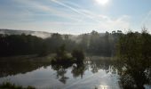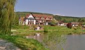

Ortswanderweg Rieneck 1
SityTrail - itinéraires balisés pédestres
Tous les sentiers balisés d’Europe GUIDE+

Longueur
5,4 km

Altitude max
243 m

Dénivelé positif
94 m

Km-Effort
6,8 km

Altitude min
170 m

Dénivelé négatif
120 m
Boucle
Non
Balise
Date de création :
2022-02-11 20:38:17.357
Dernière modification :
2022-02-11 20:38:17.357
1h32
Difficulté : Facile

Application GPS de randonnée GRATUITE
À propos
Randonnée A pied de 5,4 km à découvrir à Bavière, Landkreis Main-Spessart, Burgsinn. Cette randonnée est proposée par SityTrail - itinéraires balisés pédestres.
Description
Randonnée créée par Spessartbund.
Localisation
Pays :
Allemagne
Région :
Bavière
Département/Province :
Landkreis Main-Spessart
Commune :
Burgsinn
Localité :
Unknown
Départ:(Dec)
Départ:(UTM)
547142 ; 5553768 (32U) N.
Commentaires
Randonnées à proximité
Nordic Walking 2 Rieneck


A pied
Facile
Rieneck,
Bavière,
Landkreis Main-Spessart,
Allemagne

8,9 km | 11,8 km-effort
2h 41min
Oui

Ortswanderweg Rieneck 0


A pied
Difficile
Rieneck,
Bavière,
Landkreis Main-Spessart,
Allemagne

24 km | 32 km-effort
7h 18min
Oui
Schwarzer Keiler, Rundweg Burgsinn


A pied
Facile
Burgsinn,
Bavière,
Landkreis Main-Spessart,
Allemagne

7,9 km | 10,4 km-effort
2h 22min
Oui

Roter Hase, Rundwanderweg Rieneck


A pied
Facile
Rieneck,
Bavière,
Landkreis Main-Spessart,
Allemagne

4,2 km | 5,3 km-effort
1h 12min
Oui

Ortswanderweg Burgsinn 2


A pied
Facile
Burgsinn,
Bavière,
Landkreis Main-Spessart,
Allemagne

4,6 km | 5,4 km-effort
1h 13min
Non

Ortswanderweg Burgsinn 1


A pied
Facile
Fellen,
Bavière,
Landkreis Main-Spessart,
Allemagne

4,3 km | 4,8 km-effort
1h 5min
Non

Ortswanderweg Rieneck 2


A pied
Facile
Rieneck,
Bavière,
Landkreis Main-Spessart,
Allemagne

5,4 km | 8 km-effort
1h 48min
Non
Ortswanderweg Burgsinn 7


A pied
Facile
Burgsinn,
Bavière,
Landkreis Main-Spessart,
Allemagne

7,6 km | 10,6 km-effort
2h 24min
Non
Schwarzer Keiler Gräfendorf


A pied
Moyen
Gräfendorf,
Bavière,
Landkreis Main-Spessart,
Allemagne

15,4 km | 20 km-effort
4h 39min
Oui


 SityTrail


