![](/images/other/stat-length.png)
![Randonnée A pied Treuchtlingen - Streuobst-Erlebnis-Weg - Photo](https://media.geolcdn.com/t/1900/400/a57d6006-7345-4588-b342-be551e0456da.jpeg&format=pjpeg&maxdim=2)
Streuobst-Erlebnis-Weg
SityTrail - itinéraires balisés pédestres
Tous les sentiers balisés d’Europe GUIDE+
![Longueur](/images/other/stat-length.png)
![Altitude max](https://static1.geolcdn.com/siteimages/upload/files/1508320355ic_sort_altitude_max_24dp.png)
![Dénivelé positif](https://static1.geolcdn.com/siteimages/upload/files/1508320355ic_sort_den_pos_24dp.png)
![Km-Effort](/images/other/stat-length.png)
![Altitude min](https://static1.geolcdn.com/siteimages/upload/files/1508320355ic_sort_altitude_min_24dp.png)
![Dénivelé négatif](https://static1.geolcdn.com/siteimages/upload/files/1508320355ic_sort_den_neg_24dp.png)
![Boucle](https://static1.geolcdn.com/siteimages/upload/files/16400158638029165_repeat_loop_refresh_sync_direction_icon.png)
![A pied](https://static1.geolcdn.com/sitytour/trail-icons/100.png)
3h58
Difficulté : Facile
![Scannez ce code QR pour ouvrir la randonnée dans l'application SityTrail](https://capi.geolives.com/qq0zvz2zws4bq2lad0pu/sitytour/trails/3102026/qr.png?size=200)
Application GPS de randonnée GRATUITE
À propos
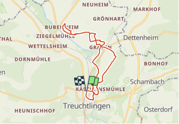
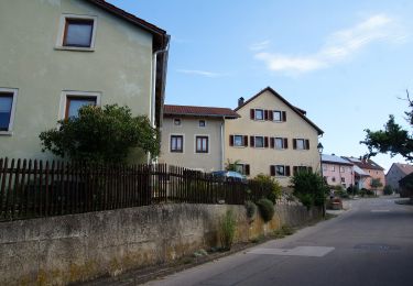
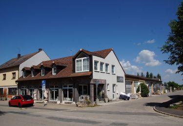
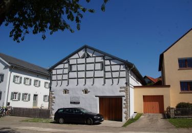
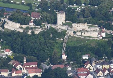
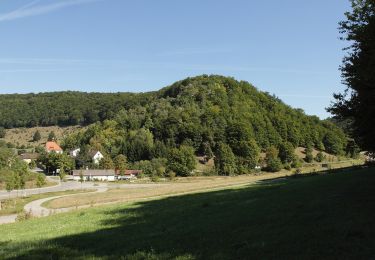
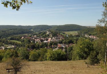
Randonnée A pied de 14,5 km à découvrir à Bavière, Weissenburg-Gunzenhausen, Treuchtlingen. Cette randonnée est proposée par SityTrail - itinéraires balisés pédestres.
Description
Randonnée créée par Landschaftspflegeverband Mittelfranken.
Site web: https://www.lpv-mittelfranken.de/index.php/wanderweg-treuchtlingen-graben-bubenheim.html
Localisation
Commentaires
Randonnées à proximité
![Randonnée A pied Treuchtlingen - Streuobst-Erlebnis-Weg Route Wettelsheim - Photo](https://media.geolcdn.com/t/375/260/dffd9b47-9279-4494-89ed-3c6b56244315.jpeg&format=jpg&maxdim=2)
![A pied A pied](https://static1.geolcdn.com/sitytour/trail-icons/100.png)
A pied
![](/images/other/stat-length.png)
![](https://static1.geolcdn.com/siteimages/upload/files/16400158638029165_repeat_loop_refresh_sync_direction_icon.png)
![Randonnée A pied Markt Berolzheim - Rundwanderweg Markt Berolzheim 2 - Photo](https://media.geolcdn.com/t/375/260/3642d49e-b951-4bcb-8a09-21873ca59111.jpeg&format=jpg&maxdim=2)
![A pied A pied](https://static1.geolcdn.com/sitytour/trail-icons/100.png)
A pied
![](/images/other/stat-length.png)
![](https://static1.geolcdn.com/siteimages/upload/files/16400158638029165_repeat_loop_refresh_sync_direction_icon.png)
![Randonnée A pied Langenaltheim - Rundwanderweg Langenaltheim 1 - Photo](https://media.geolcdn.com/t/375/260/77e9ad92-ac37-4101-a88b-9bdc192e2cc3.jpeg&format=jpg&maxdim=2)
![A pied A pied](https://static1.geolcdn.com/sitytour/trail-icons/100.png)
A pied
![](/images/other/stat-length.png)
![](https://static1.geolcdn.com/siteimages/upload/files/16400158638029165_repeat_loop_refresh_sync_direction_icon.png)
![Randonnée A pied Weißenburg i. Bay. - Naturlehrpfad Nagelberg - Photo](https://media.geolcdn.com/t/375/260/10272107-3913-40d2-a592-a69b41135a6f.jpeg&format=jpg&maxdim=2)
![A pied A pied](https://static1.geolcdn.com/sitytour/trail-icons/100.png)
A pied
![](/images/other/stat-length.png)
![](https://static1.geolcdn.com/siteimages/upload/files/16400158638029165_repeat_loop_refresh_sync_direction_icon.png)
![Randonnée A pied Treuchtlingen - Mühlenweg - Photo](https://media.geolcdn.com/t/375/260/5ab9cff7-3c3c-4699-8a5a-eb0c2039ca69.jpeg&format=jpg&maxdim=2)
![A pied A pied](https://static1.geolcdn.com/sitytour/trail-icons/100.png)
A pied
![](/images/other/stat-length.png)
![](https://static1.geolcdn.com/siteimages/upload/files/16400158638029165_repeat_loop_refresh_sync_direction_icon.png)
![Randonnée A pied Weißenburg i. Bay. - Sternschanzweg - Photo](https://media.geolcdn.com/t/375/260/c14a344c-ae81-4e23-a296-d5a7c5dc06c1.jpeg&format=jpg&maxdim=2)
![A pied A pied](https://static1.geolcdn.com/sitytour/trail-icons/100.png)
A pied
![](/images/other/stat-length.png)
![](https://static1.geolcdn.com/siteimages/upload/files/16400158638029165_repeat_loop_refresh_sync_direction_icon.png)
![Randonnée A pied Pappenheim - Ortswanderweg Pappenheim 5 - Photo](https://media.geolcdn.com/t/375/260/5a7f43fc-96a6-46fa-b081-2d4e20939863.jpeg&format=jpg&maxdim=2)
![A pied A pied](https://static1.geolcdn.com/sitytour/trail-icons/100.png)
A pied
![](/images/other/stat-length.png)
![](https://static1.geolcdn.com/siteimages/upload/files/16400158638029165_repeat_loop_refresh_sync_direction_icon.png)
![Randonnée A pied Pappenheim - Ortswanderweg Pappenheim - Photo](https://media.geolcdn.com/t/375/260/10c3f73e-1583-4e21-96a1-b84f7b5d3f13.jpeg&format=jpg&maxdim=2)
![A pied A pied](https://static1.geolcdn.com/sitytour/trail-icons/100.png)
A pied
![](/images/other/stat-length.png)
![](https://static1.geolcdn.com/siteimages/upload/files/16400158638029165_repeat_loop_refresh_sync_direction_icon.png)
![Randonnée A pied Pappenheim - Ortswanderweg Pappenheim 7 - Photo](https://media.geolcdn.com/t/375/260/c9591fd3-01a2-4d8c-98bd-1445ab7a67d1.jpeg&format=jpg&maxdim=2)
![A pied A pied](https://static1.geolcdn.com/sitytour/trail-icons/100.png)
A pied
![](/images/other/stat-length.png)
![](https://static1.geolcdn.com/siteimages/upload/files/16400158638029165_repeat_loop_refresh_sync_direction_icon.png)