![](/images/other/stat-length.png)
![Randonnée A pied Freigericht - Spessartspuren - Somborner Hügelland-Spur - Photo](https://media.geolcdn.com/t/1900/400/2fd25fb0-9331-491e-9593-ed0fc43d9430.jpeg&format=pjpeg&maxdim=2)
Spessartspuren - Somborner Hügelland-Spur
SityTrail - itinéraires balisés pédestres
Tous les sentiers balisés d’Europe GUIDE+
![Longueur](/images/other/stat-length.png)
Longueur
7,2 km
![Altitude max](https://static1.geolcdn.com/siteimages/upload/files/1508320355ic_sort_altitude_max_24dp.png)
Altitude max
230 m
![Dénivelé positif](https://static1.geolcdn.com/siteimages/upload/files/1508320355ic_sort_den_pos_24dp.png)
Dénivelé positif
138 m
![Km-Effort](/images/other/stat-length.png)
Km-Effort
9,1 km
![Altitude min](https://static1.geolcdn.com/siteimages/upload/files/1508320355ic_sort_altitude_min_24dp.png)
Altitude min
155 m
![Dénivelé négatif](https://static1.geolcdn.com/siteimages/upload/files/1508320355ic_sort_den_neg_24dp.png)
Dénivelé négatif
137 m
![Boucle](https://static1.geolcdn.com/siteimages/upload/files/16400158638029165_repeat_loop_refresh_sync_direction_icon.png)
Boucle
Oui
Balise
Date de création :
2022-02-11 20:20:06.15
Dernière modification :
2022-02-11 20:20:06.15
![A pied](https://static1.geolcdn.com/sitytour/trail-icons/100.png)
2h03
Difficulté : Facile
![Scannez ce code QR pour ouvrir la randonnée dans l'application SityTrail](https://capi.geolives.com/qq0zvz2zws4bq2lad0pu/sitytour/trails/3101684/qr.png?size=200)
Application GPS de randonnée GRATUITE
À propos
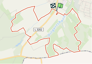
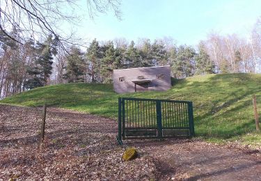
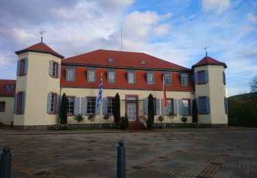
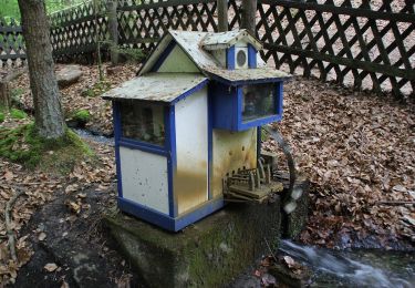
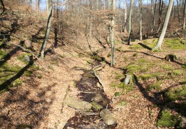
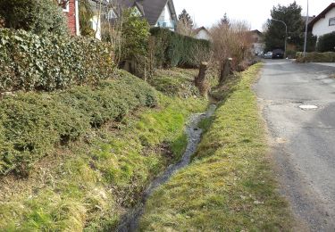
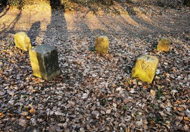
Randonnée A pied de 7,2 km à découvrir à Hesse, Main-Kinzig-Kreis, Freigericht. Cette randonnée est proposée par SityTrail - itinéraires balisés pédestres.
Description
Randonnée créée par Naturpark Hessischer Spessart.
Symbole: Blauer Strich und grüner Bogen über gelbem Rechteck auf hellblauem Hintergrund
Localisation
Pays :
Allemagne
Région :
Hesse
Département/Province :
Main-Kinzig-Kreis
Commune :
Freigericht
Localité :
Somborn
Départ:(Dec)
Départ:(UTM)
507742 ; 5553664 (32U) N.
Commentaires
Randonnées à proximité
![Randonnée A pied Freigericht - Spessartspuren - Neuseser Fernblick - Photo](https://media.geolcdn.com/t/375/260/ca56fb1d-ddad-4098-9ae7-66f7201cd6d2.jpeg&format=jpg&maxdim=2)
![A pied A pied](https://static1.geolcdn.com/sitytour/trail-icons/100.png)
Spessartspuren - Neuseser Fernblick
A pied
Facile
Freigericht,
Hesse,
Main-Kinzig-Kreis,
Allemagne
![](/images/other/stat-length.png)
6,3 km | 8,8 km-effort
1h 59min
![](https://static1.geolcdn.com/siteimages/upload/files/16400158638029165_repeat_loop_refresh_sync_direction_icon.png)
Oui
![Randonnée A pied Hasselroth - Spessartspuren - Neuenhaßlauer Ysenburg-Runde - Photo](https://media.geolcdn.com/t/375/260/2c041be9-e260-4358-b852-b0670ff23424.jpeg&format=jpg&maxdim=2)
![A pied A pied](https://static1.geolcdn.com/sitytour/trail-icons/100.png)
Spessartspuren - Neuenhaßlauer Ysenburg-Runde
A pied
Facile
Hasselroth,
Hesse,
Main-Kinzig-Kreis,
Allemagne
![](/images/other/stat-length.png)
5,3 km | 6,7 km-effort
1h 31min
![](https://static1.geolcdn.com/siteimages/upload/files/16400158638029165_repeat_loop_refresh_sync_direction_icon.png)
Oui
![Randonnée A pied Hasselroth - Spessartspuren - Niedermittlauer Berkopp Runde - Photo](https://media.geolcdn.com/t/375/260/3e623794-157c-40b8-a2d8-4cb5e8847430.jpeg&format=jpg&maxdim=2)
![A pied A pied](https://static1.geolcdn.com/sitytour/trail-icons/100.png)
Spessartspuren - Niedermittlauer Berkopp Runde
A pied
Facile
Hasselroth,
Hesse,
Main-Kinzig-Kreis,
Allemagne
![](/images/other/stat-length.png)
4,2 km | 5,7 km-effort
1h 17min
![](https://static1.geolcdn.com/siteimages/upload/files/16400158638029165_repeat_loop_refresh_sync_direction_icon.png)
Oui
![Randonnée A pied Alzenau - Willy Windisch Weg - Photo](https://media.geolcdn.com/t/375/260/1bf1e90d-58a9-497a-89ed-a0a607d0cc13.jpeg&format=jpg&maxdim=2)
![A pied A pied](https://static1.geolcdn.com/sitytour/trail-icons/100.png)
Willy Windisch Weg
A pied
Facile
Alzenau,
Bavière,
Landkreis Aschaffenburg,
Allemagne
![](/images/other/stat-length.png)
3,6 km | 6,5 km-effort
1h 29min
![](https://static1.geolcdn.com/siteimages/upload/files/16400158638029165_repeat_loop_refresh_sync_direction_icon.png)
Non
![Randonnée A pied Alzenau - Ortswanderweg Alzenau 6 - Photo](https://media.geolcdn.com/t/375/260/7d03b839-bebf-4325-8b7c-8cb104d05654.jpeg&format=jpg&maxdim=2)
![A pied A pied](https://static1.geolcdn.com/sitytour/trail-icons/100.png)
Ortswanderweg Alzenau 6
A pied
Facile
Alzenau,
Bavière,
Landkreis Aschaffenburg,
Allemagne
![](/images/other/stat-length.png)
4,8 km | 5,4 km-effort
1h 13min
![](https://static1.geolcdn.com/siteimages/upload/files/16400158638029165_repeat_loop_refresh_sync_direction_icon.png)
Non
![Randonnée A pied Rodenbach - Rodenbach - Rundwanderweg Fuchs - Photo](https://media.geolcdn.com/t/375/260/33d9f344-0467-4633-8ac3-2274a87c27a3.jpeg&format=jpg&maxdim=2)
![A pied A pied](https://static1.geolcdn.com/sitytour/trail-icons/100.png)
Rodenbach - Rundwanderweg Fuchs
A pied
Facile
Rodenbach,
Hesse,
Main-Kinzig-Kreis,
Allemagne
![](/images/other/stat-length.png)
4,7 km | 5,8 km-effort
1h 19min
![](https://static1.geolcdn.com/siteimages/upload/files/16400158638029165_repeat_loop_refresh_sync_direction_icon.png)
Oui
![Randonnée A pied Freigericht - Horbach (Feuerwehr) Rundwanderweg Schmetterling - Photo](https://media.geolcdn.com/t/375/260/6f48a2b6-b347-45b4-aae7-34b302cccd57.jpeg&format=jpg&maxdim=2)
![A pied A pied](https://static1.geolcdn.com/sitytour/trail-icons/100.png)
Horbach (Feuerwehr) Rundwanderweg Schmetterling
A pied
Facile
Freigericht,
Hesse,
Main-Kinzig-Kreis,
Allemagne
![](/images/other/stat-length.png)
7,9 km | 10,6 km-effort
2h 23min
![](https://static1.geolcdn.com/siteimages/upload/files/16400158638029165_repeat_loop_refresh_sync_direction_icon.png)
Oui
![Randonnée A pied Alzenau - Ortswanderweg Alzenau 1 - Photo](https://media.geolcdn.com/t/375/260/91425280-ab27-4454-8251-48a315abcbeb.jpeg&format=jpg&maxdim=2)
![A pied A pied](https://static1.geolcdn.com/sitytour/trail-icons/100.png)
Ortswanderweg Alzenau 1
A pied
Facile
Alzenau,
Bavière,
Landkreis Aschaffenburg,
Allemagne
![](/images/other/stat-length.png)
6,1 km | 7,5 km-effort
1h 42min
![](https://static1.geolcdn.com/siteimages/upload/files/16400158638029165_repeat_loop_refresh_sync_direction_icon.png)
Non
![Randonnée A pied Hasselroth - Kulturweg Hasselroth - Photo](https://media.geolcdn.com/t/375/260/3e623794-157c-40b8-a2d8-4cb5e8847430.jpeg&format=jpg&maxdim=2)
![A pied A pied](https://static1.geolcdn.com/sitytour/trail-icons/100.png)
Kulturweg Hasselroth
A pied
Facile
Hasselroth,
Hesse,
Main-Kinzig-Kreis,
Allemagne
![](/images/other/stat-length.png)
16 km | 18,6 km-effort
4h 13min
![](https://static1.geolcdn.com/siteimages/upload/files/16400158638029165_repeat_loop_refresh_sync_direction_icon.png)
Non