![](/images/other/stat-length.png)
![Randonnée A pied Bad Neuenahr-Ahrweiler - Rundweg 8 Gimmingen - Photo](https://media.geolcdn.com/t/1900/400/ext.pjpeg?maxdim=2&url=https%3A%2F%2Fmedia.geolcdn.com%2Ff%2Fafe28d54-8362-474d-8d66-b77f50c689dd.jpeg)
Rundweg 8 Gimmingen
SityTrail - itinéraires balisés pédestres
Tous les sentiers balisés d’Europe PRO
![Longueur](/images/other/stat-length.png)
Longueur
10,7 km
![Altitude max](https://static1.geolcdn.com/siteimages/upload/files/1508320355ic_sort_altitude_max_24dp.png)
Altitude max
247 m
![Dénivelé positif](https://static1.geolcdn.com/siteimages/upload/files/1508320355ic_sort_den_pos_24dp.png)
Dénivelé positif
333 m
![Km-Effort](/images/other/stat-length.png)
Km-Effort
15,2 km
![Altitude min](https://static1.geolcdn.com/siteimages/upload/files/1508320355ic_sort_altitude_min_24dp.png)
Altitude min
99 m
![Dénivelé négatif](https://static1.geolcdn.com/siteimages/upload/files/1508320355ic_sort_den_neg_24dp.png)
Dénivelé négatif
332 m
![Boucle](https://static1.geolcdn.com/siteimages/upload/files/16400158638029165_repeat_loop_refresh_sync_direction_icon.png)
Boucle
Oui
Balise
Date de création :
2022-02-11 20:19:23.217
Dernière modification :
2022-02-11 20:19:23.217
![A pied](https://static1.geolcdn.com/sitytour/trail-icons/100.png)
3h26
Difficulté : Facile
![Scannez ce code QR pour ouvrir la randonnée dans l'application SityTrail](https://capi.geolives.com/qq0zvz2zws4bq2lad0pu/sitytour/trails/3101670/qr.png?size=200)
Application GPS de randonnée GRATUITE
À propos
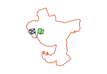
Randonnée A pied de 10,7 km à découvrir à Rhénanie-Palatinat, Landkreis Ahrweiler, Bad Neuenahr-Ahrweiler. Cette randonnée est proposée par SityTrail - itinéraires balisés pédestres.
Description
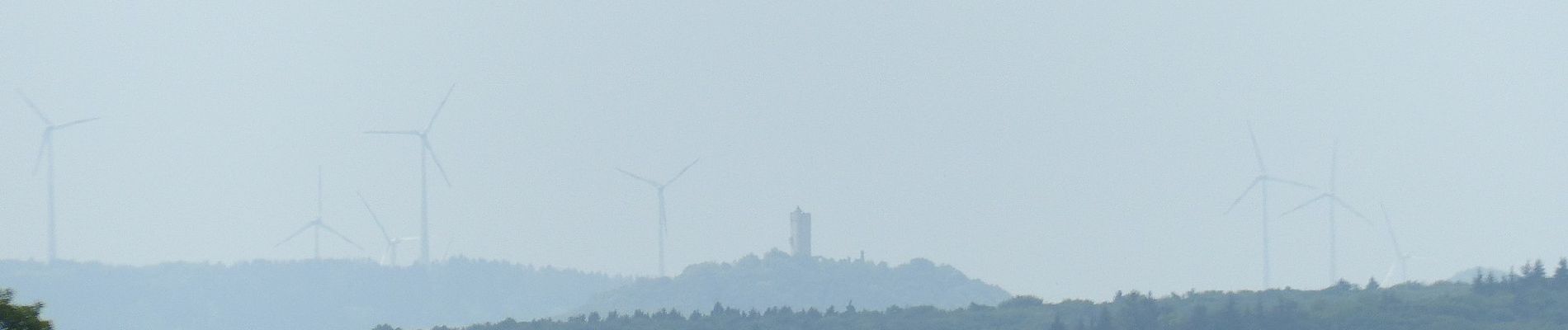
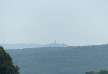
Webseite dazu? Sehr aufwendig ausgeschildert, aber keine Beschreibung im Netz zur Verifikation gefunden.
Localisation
Pays :
Allemagne
Région :
Rhénanie-Palatinat
Département/Province :
Landkreis Ahrweiler
Commune :
Bad Neuenahr-Ahrweiler
Localité :
Gimmigen
Départ:(Dec)
Départ:(UTM)
370075 ; 5602339 (32U) N.
Commentaires
Randonnées à proximité
![Randonnée A pied Remagen - Apollinaris-Schleife (Rheinburgenweg Rundtour) - Photo](https://media.geolcdn.com/t/375/260/ext.jpg?maxdim=2&url=https%3A%2F%2Fmedia.geolcdn.com%2Ff%2Fafe28d54-8362-474d-8d66-b77f50c689dd.jpeg)
![A pied A pied](https://static1.geolcdn.com/sitytour/trail-icons/100.png)
Apollinaris-Schleife (Rheinburgenweg Rundtour)
A pied
Facile
Remagen,
Rhénanie-Palatinat,
Landkreis Ahrweiler,
Allemagne
![](/images/other/stat-length.png)
12,7 km | 16,4 km-effort
3h 43min
![](https://static1.geolcdn.com/siteimages/upload/files/16400158638029165_repeat_loop_refresh_sync_direction_icon.png)
Oui
![Randonnée A pied Sinzig - Rundweg 7 Bad Bodendorf - Photo](https://media.geolcdn.com/t/375/260/ext.jpg?maxdim=2&url=https%3A%2F%2Fmedia.geolcdn.com%2Ff%2Fd3fff6ae-8a86-4233-9da6-73de21a37b8c.jpeg)
![A pied A pied](https://static1.geolcdn.com/sitytour/trail-icons/100.png)
Rundweg 7 Bad Bodendorf
A pied
Facile
Sinzig,
Rhénanie-Palatinat,
Landkreis Ahrweiler,
Allemagne
![](/images/other/stat-length.png)
8,8 km | 11,1 km-effort
2h 30min
![](https://static1.geolcdn.com/siteimages/upload/files/16400158638029165_repeat_loop_refresh_sync_direction_icon.png)
Oui
![Randonnée A pied Bad Neuenahr-Ahrweiler - Rundweg A2 Gimmingen - Photo](https://media.geolcdn.com/t/375/260/ext.jpg?maxdim=2&url=https%3A%2F%2Fmedia.geolcdn.com%2Ff%2Ffc23cae3-4d12-45b0-899f-2f205d4ce91d.jpeg)
![A pied A pied](https://static1.geolcdn.com/sitytour/trail-icons/100.png)
Rundweg A2 Gimmingen
A pied
Facile
Bad Neuenahr-Ahrweiler,
Rhénanie-Palatinat,
Landkreis Ahrweiler,
Allemagne
![](/images/other/stat-length.png)
7 km | 9,5 km-effort
2h 8min
![](https://static1.geolcdn.com/siteimages/upload/files/16400158638029165_repeat_loop_refresh_sync_direction_icon.png)
Oui
![Randonnée A pied Remagen - Wanderweg Remagen - Photo](https://media.geolcdn.com/t/375/260/ext.jpg?maxdim=2&url=https%3A%2F%2Fmedia.geolcdn.com%2Ff%2Fafe28d54-8362-474d-8d66-b77f50c689dd.jpeg)
![A pied A pied](https://static1.geolcdn.com/sitytour/trail-icons/100.png)
Wanderweg Remagen
A pied
Facile
Remagen,
Rhénanie-Palatinat,
Landkreis Ahrweiler,
Allemagne
![](/images/other/stat-length.png)
10 km | 13,8 km-effort
3h 7min
![](https://static1.geolcdn.com/siteimages/upload/files/16400158638029165_repeat_loop_refresh_sync_direction_icon.png)
Oui
![Randonnée A pied Remagen - DE-A3 - Photo](https://media.geolcdn.com/t/375/260/ext.jpg?maxdim=2&url=https%3A%2F%2Fmedia.geolcdn.com%2Ff%2F5e7c6f42-f88c-4062-9277-171320514dad.jpeg)
![A pied A pied](https://static1.geolcdn.com/sitytour/trail-icons/100.png)
DE-A3
A pied
Facile
Remagen,
Rhénanie-Palatinat,
Landkreis Ahrweiler,
Allemagne
![](/images/other/stat-length.png)
4,7 km | 6,3 km-effort
1h 26min
![](https://static1.geolcdn.com/siteimages/upload/files/16400158638029165_repeat_loop_refresh_sync_direction_icon.png)
Oui
![Randonnée A pied Bad Neuenahr-Ahrweiler - Eisenweg - Photo](https://media.geolcdn.com/t/375/260/ext.jpg?maxdim=2&url=https%3A%2F%2Fmedia.geolcdn.com%2Ff%2Ffb3543ed-099d-4e89-a581-5255ebeb06e2.jpeg)
![A pied A pied](https://static1.geolcdn.com/sitytour/trail-icons/100.png)
Eisenweg
A pied
Facile
Bad Neuenahr-Ahrweiler,
Rhénanie-Palatinat,
Landkreis Ahrweiler,
Allemagne
![](/images/other/stat-length.png)
10,3 km | 13,9 km-effort
3h 9min
![](https://static1.geolcdn.com/siteimages/upload/files/16400158638029165_repeat_loop_refresh_sync_direction_icon.png)
Oui
![Randonnée A pied Bad Neuenahr-Ahrweiler - Rundgang 25 Gimmingen - Photo](https://media.geolcdn.com/t/375/260/ext.jpg?maxdim=2&url=https%3A%2F%2Fmedia.geolcdn.com%2Ff%2Ffc23cae3-4d12-45b0-899f-2f205d4ce91d.jpeg)
![A pied A pied](https://static1.geolcdn.com/sitytour/trail-icons/100.png)
Rundgang 25 Gimmingen
A pied
Facile
Bad Neuenahr-Ahrweiler,
Rhénanie-Palatinat,
Landkreis Ahrweiler,
Allemagne
![](/images/other/stat-length.png)
4,3 km | 5,9 km-effort
1h 20min
![](https://static1.geolcdn.com/siteimages/upload/files/16400158638029165_repeat_loop_refresh_sync_direction_icon.png)
Oui
![Randonnée A pied Bad Neuenahr-Ahrweiler - DE-10 - Photo](https://media.geolcdn.com/t/375/260/ext.jpg?maxdim=2&url=https%3A%2F%2Fmedia.geolcdn.com%2Ff%2Fafe28d54-8362-474d-8d66-b77f50c689dd.jpeg)
![A pied A pied](https://static1.geolcdn.com/sitytour/trail-icons/100.png)
DE-10
A pied
Facile
Bad Neuenahr-Ahrweiler,
Rhénanie-Palatinat,
Landkreis Ahrweiler,
Allemagne
![](/images/other/stat-length.png)
8,8 km | 12 km-effort
2h 43min
![](https://static1.geolcdn.com/siteimages/upload/files/16400158638029165_repeat_loop_refresh_sync_direction_icon.png)
Oui
![Randonnée A pied Remagen - Panoramaweg Remagen (A5) - Photo](https://media.geolcdn.com/t/375/260/ext.jpg?maxdim=2&url=https%3A%2F%2Fstatic1.geolcdn.com%2Fsiteimages%2Fupload%2Ffiles%2F1545311037marcheuse_200dpi.jpg)
![A pied A pied](https://static1.geolcdn.com/sitytour/trail-icons/100.png)
Panoramaweg Remagen (A5)
A pied
Facile
Remagen,
Rhénanie-Palatinat,
Landkreis Ahrweiler,
Allemagne
![](/images/other/stat-length.png)
4,7 km | 6,5 km-effort
1h 28min
![](https://static1.geolcdn.com/siteimages/upload/files/16400158638029165_repeat_loop_refresh_sync_direction_icon.png)
Non