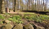
![](/images/other/stat-length.png)
![Randonnée A pied Ammersbek - Strecke S2 - Photo](https://media.geolcdn.com/t/1900/400/cde75c80-72e6-4bb1-b3c7-babfb314e4bb.jpeg&format=pjpeg&maxdim=2)
Strecke S2
SityTrail - itinéraires balisés pédestres
Tous les sentiers balisés d’Europe GUIDE+
![Longueur](/images/other/stat-length.png)
Longueur
16,9 km
![Altitude max](https://static1.geolcdn.com/siteimages/upload/files/1508320355ic_sort_altitude_max_24dp.png)
Altitude max
66 m
![Dénivelé positif](https://static1.geolcdn.com/siteimages/upload/files/1508320355ic_sort_den_pos_24dp.png)
Dénivelé positif
130 m
![Km-Effort](/images/other/stat-length.png)
Km-Effort
18,5 km
![Altitude min](https://static1.geolcdn.com/siteimages/upload/files/1508320355ic_sort_altitude_min_24dp.png)
Altitude min
22 m
![Dénivelé négatif](https://static1.geolcdn.com/siteimages/upload/files/1508320355ic_sort_den_neg_24dp.png)
Dénivelé négatif
109 m
![Boucle](https://static1.geolcdn.com/siteimages/upload/files/16400158638029165_repeat_loop_refresh_sync_direction_icon.png)
Boucle
Non
Balise
Date de création :
2022-02-11 20:09:36.132
Dernière modification :
2022-02-11 20:09:36.132
![A pied](https://static1.geolcdn.com/sitytour/trail-icons/100.png)
4h12
Difficulté : Facile
![Scannez ce code QR pour ouvrir la randonnée dans l'application SityTrail](https://capi.geolives.com/qq0zvz2zws4bq2lad0pu/sitytour/trails/3101484/qr.png?size=200)
Application GPS de randonnée GRATUITE
À propos
Randonnée A pied de 16,9 km à découvrir à Schleswig-Holstein, Stormarn, Ammersbek. Cette randonnée est proposée par SityTrail - itinéraires balisés pédestres.
Description
Randonnée créée par AktivRegion Alsterland.
Localisation
Pays :
Allemagne
Région :
Schleswig-Holstein
Département/Province :
Stormarn
Commune :
Ammersbek
Localité :
Unknown
Départ:(Dec)
Départ:(UTM)
576327 ; 5947916 (32U) N.
Commentaires
Randonnées à proximité
![Randonnée A pied Ahrensburg - Zwischen Schloss und Landschaftspark - Photo](https://media.geolcdn.com/t/375/260/ac5a272d-e0de-4e9d-9cdb-597be0c084b2.jpeg&format=jpg&maxdim=2)
![A pied A pied](https://static1.geolcdn.com/sitytour/trail-icons/100.png)
Zwischen Schloss und Landschaftspark
A pied
Facile
Ahrensburg,
Schleswig-Holstein,
Stormarn,
Allemagne
![](/images/other/stat-length.png)
17 km | 18,7 km-effort
4h 14min
![](https://static1.geolcdn.com/siteimages/upload/files/16400158638029165_repeat_loop_refresh_sync_direction_icon.png)
Oui
![Randonnée A pied Ammersbek - Rund um Wulfsdorf und Hoisbüttel - Photo](https://media.geolcdn.com/t/375/260/94ff159e-8c10-43b8-99a8-426588784f47.jpeg&format=jpg&maxdim=2)
![A pied A pied](https://static1.geolcdn.com/sitytour/trail-icons/100.png)
Rund um Wulfsdorf und Hoisbüttel
A pied
Facile
Ammersbek,
Schleswig-Holstein,
Stormarn,
Allemagne
![](/images/other/stat-length.png)
8,9 km | 9,8 km-effort
2h 13min
![](https://static1.geolcdn.com/siteimages/upload/files/16400158638029165_repeat_loop_refresh_sync_direction_icon.png)
Non
![Randonnée A pied Jersbek - Durch Brook, Wald und Auen - Photo](https://media.geolcdn.com/t/375/260/cf591de7-f704-41ca-8614-72fdeaba37ec.jpeg&format=jpg&maxdim=2)
![A pied A pied](https://static1.geolcdn.com/sitytour/trail-icons/100.png)
Durch Brook, Wald und Auen
A pied
Facile
Jersbek,
Schleswig-Holstein,
Stormarn,
Allemagne
![](/images/other/stat-length.png)
14,6 km | 15,9 km-effort
3h 36min
![](https://static1.geolcdn.com/siteimages/upload/files/16400158638029165_repeat_loop_refresh_sync_direction_icon.png)
Oui
![Randonnée A pied Tangstedt - Rund um Gut Wulksfelde entlang der Oberalster - Photo](https://media.geolcdn.com/t/375/260/26808b25-e50f-4654-a424-05ae5d430b1d.jpeg&format=jpg&maxdim=2)
![A pied A pied](https://static1.geolcdn.com/sitytour/trail-icons/100.png)
Rund um Gut Wulksfelde entlang der Oberalster
A pied
Facile
Tangstedt,
Schleswig-Holstein,
Stormarn,
Allemagne
![](/images/other/stat-length.png)
5,4 km | 6,2 km-effort
1h 24min
![](https://static1.geolcdn.com/siteimages/upload/files/16400158638029165_repeat_loop_refresh_sync_direction_icon.png)
Non
![Randonnée A pied Inconnu - Ohlstedt - Friedrichsgabe (OH-FR) - Photo](https://media.geolcdn.com/t/375/260/9be76716-abf2-41de-9118-04f3bc90f397.jpeg&format=jpg&maxdim=2)
![A pied A pied](https://static1.geolcdn.com/sitytour/trail-icons/100.png)
Ohlstedt - Friedrichsgabe (OH-FR)
A pied
Facile
Inconnu,
Hambourg,
Inconnu,
Allemagne
![](/images/other/stat-length.png)
8,6 km | 9,6 km-effort
2h 10min
![](https://static1.geolcdn.com/siteimages/upload/files/16400158638029165_repeat_loop_refresh_sync_direction_icon.png)
Non
![Randonnée A pied Inconnu - Poppenbüttel - Alsterquelle - Meeschensee (P-AQ-ME) - Photo](https://media.geolcdn.com/t/375/260/4fb9f1b8-a566-4885-99f5-2e54c9ddcf8d.jpeg&format=jpg&maxdim=2)
![A pied A pied](https://static1.geolcdn.com/sitytour/trail-icons/100.png)
Poppenbüttel - Alsterquelle - Meeschensee (P-AQ-ME)
A pied
Moyen
Inconnu,
Hambourg,
Inconnu,
Allemagne
![](/images/other/stat-length.png)
22 km | 24 km-effort
5h 32min
![](https://static1.geolcdn.com/siteimages/upload/files/16400158638029165_repeat_loop_refresh_sync_direction_icon.png)
Non
![Randonnée A pied Inconnu - Poppenbüttel - Alsterquelle (P-AQ) - Photo](https://media.geolcdn.com/t/375/260/4fb9f1b8-a566-4885-99f5-2e54c9ddcf8d.jpeg&format=jpg&maxdim=2)
![A pied A pied](https://static1.geolcdn.com/sitytour/trail-icons/100.png)
Poppenbüttel - Alsterquelle (P-AQ)
A pied
Moyen
Inconnu,
Hambourg,
Inconnu,
Allemagne
![](/images/other/stat-length.png)
19,8 km | 22 km-effort
4h 54min
![](https://static1.geolcdn.com/siteimages/upload/files/16400158638029165_repeat_loop_refresh_sync_direction_icon.png)
Non
![Randonnée A pied Inconnu - Ohlstedt - Ahrensburg (OH-AH) - Photo](https://media.geolcdn.com/t/375/260/e9c9c469-51f5-4a17-a96e-ed34eb0904c2.jpeg&format=jpg&maxdim=2)
![A pied A pied](https://static1.geolcdn.com/sitytour/trail-icons/100.png)
Ohlstedt - Ahrensburg (OH-AH)
A pied
Facile
Inconnu,
Hambourg,
Inconnu,
Allemagne
![](/images/other/stat-length.png)
8,8 km | 10,1 km-effort
2h 17min
![](https://static1.geolcdn.com/siteimages/upload/files/16400158638029165_repeat_loop_refresh_sync_direction_icon.png)
Non
![Randonnée A pied Inconnu - Poppenbüttel - Ohlsdorf - Hafen (P-O-H) - Photo](https://media.geolcdn.com/t/375/260/25cd4def-67ff-461f-bdb9-254962d30a95.jpeg&format=jpg&maxdim=2)
![A pied A pied](https://static1.geolcdn.com/sitytour/trail-icons/100.png)
Poppenbüttel - Ohlsdorf - Hafen (P-O-H)
A pied
Facile
Inconnu,
Hambourg,
Inconnu,
Allemagne
![](/images/other/stat-length.png)
6,4 km | 6,9 km-effort
1h 34min
![](https://static1.geolcdn.com/siteimages/upload/files/16400158638029165_repeat_loop_refresh_sync_direction_icon.png)
Non