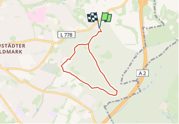
![](/images/other/stat-length.png)
![Randonnée A pied Herford - Bad Salzuflen Rundweg 10 - Photo](https://media.geolcdn.com/t/1900/400/5067fc69-7ee0-486a-a976-cbc0fbb26700.jpeg&format=pjpeg&maxdim=2)
Bad Salzuflen Rundweg 10
SityTrail - itinéraires balisés pédestres
Tous les sentiers balisés d’Europe GUIDE+
![Longueur](/images/other/stat-length.png)
![Altitude max](https://static1.geolcdn.com/siteimages/upload/files/1508320355ic_sort_altitude_max_24dp.png)
![Dénivelé positif](https://static1.geolcdn.com/siteimages/upload/files/1508320355ic_sort_den_pos_24dp.png)
![Km-Effort](/images/other/stat-length.png)
![Altitude min](https://static1.geolcdn.com/siteimages/upload/files/1508320355ic_sort_altitude_min_24dp.png)
![Dénivelé négatif](https://static1.geolcdn.com/siteimages/upload/files/1508320355ic_sort_den_neg_24dp.png)
![Boucle](https://static1.geolcdn.com/siteimages/upload/files/16400158638029165_repeat_loop_refresh_sync_direction_icon.png)
![A pied](https://static1.geolcdn.com/sitytour/trail-icons/100.png)
1h33
Difficulté : Facile
![Scannez ce code QR pour ouvrir la randonnée dans l'application SityTrail](https://capi.geolives.com/qq0zvz2zws4bq2lad0pu/sitytour/trails/3101481/qr.png?size=200)
Application GPS de randonnée GRATUITE
À propos
Randonnée A pied de 5,1 km à découvrir à Rhénanie-du-Nord-Westphalie, Kreis Herford, Herford. Cette randonnée est proposée par SityTrail - itinéraires balisés pédestres.
Description
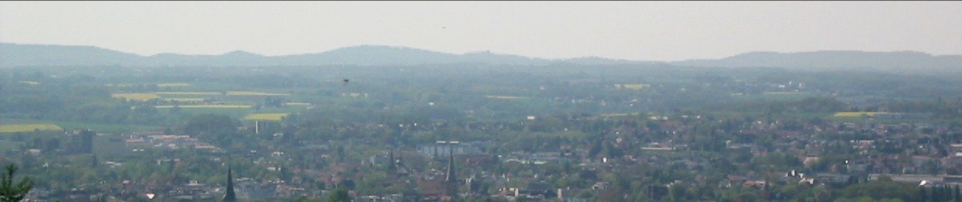
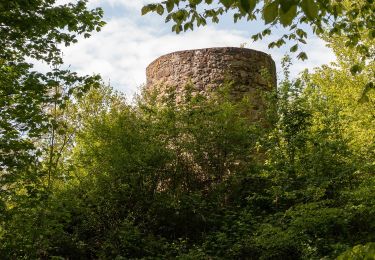
Hier finden Sie einen Überblick über 10 verschiedenen Rundwanderweg rund um Bad Salzuflen, im Salzetal oder durch die Waldgebiete Asenberg und Obernberg.
Site web: https://www.staatsbad-salzuflen.de/aktivurlaub/wandern/wandern-rund-um-bad-salzuflen
Localisation
Commentaires
Randonnées à proximité
![Randonnée A pied Bad Salzuflen - Bad Salzuflen Rundweg 4 - Photo](https://media.geolcdn.com/t/375/260/55a2b1c9-3a22-4e3d-9ddb-0635778c833e.jpeg&format=jpg&maxdim=2)
![A pied A pied](https://static1.geolcdn.com/sitytour/trail-icons/100.png)
A pied
![](/images/other/stat-length.png)
![](https://static1.geolcdn.com/siteimages/upload/files/16400158638029165_repeat_loop_refresh_sync_direction_icon.png)
![Randonnée A pied Bad Salzuflen - Bad Salzuflen Rundweg 7 - Photo](https://media.geolcdn.com/t/375/260/d38cd37f-5ca4-44e9-9c5e-2e0035159efc.jpeg&format=jpg&maxdim=2)
![A pied A pied](https://static1.geolcdn.com/sitytour/trail-icons/100.png)
A pied
![](/images/other/stat-length.png)
![](https://static1.geolcdn.com/siteimages/upload/files/16400158638029165_repeat_loop_refresh_sync_direction_icon.png)
![Randonnée A pied Bad Salzuflen - Bad Salzuflen Rundweg 1 - Photo](https://media.geolcdn.com/t/375/260/9f73af4e-fdaa-4fc6-9b9b-9ba11044498e.jpeg&format=jpg&maxdim=2)
![A pied A pied](https://static1.geolcdn.com/sitytour/trail-icons/100.png)
A pied
![](/images/other/stat-length.png)
![](https://static1.geolcdn.com/siteimages/upload/files/16400158638029165_repeat_loop_refresh_sync_direction_icon.png)
![Randonnée A pied Bad Salzuflen - Bad Salzuflen Rundweg 3 - Photo](https://media.geolcdn.com/t/375/260/14714b46-9977-4f9a-96cd-896adf6a708e.jpeg&format=jpg&maxdim=2)
![A pied A pied](https://static1.geolcdn.com/sitytour/trail-icons/100.png)
A pied
![](/images/other/stat-length.png)
![](https://static1.geolcdn.com/siteimages/upload/files/16400158638029165_repeat_loop_refresh_sync_direction_icon.png)
![Randonnée A pied Bad Salzuflen - Bad Salzuflen Rundweg 2 - Photo](https://media.geolcdn.com/t/375/260/9f73af4e-fdaa-4fc6-9b9b-9ba11044498e.jpeg&format=jpg&maxdim=2)
![A pied A pied](https://static1.geolcdn.com/sitytour/trail-icons/100.png)
A pied
![](/images/other/stat-length.png)
![](https://static1.geolcdn.com/siteimages/upload/files/16400158638029165_repeat_loop_refresh_sync_direction_icon.png)
![Randonnée A pied Herford - Bad Salzuflen Rundweg 9 - Photo](https://media.geolcdn.com/t/375/260/55a2b1c9-3a22-4e3d-9ddb-0635778c833e.jpeg&format=jpg&maxdim=2)
![A pied A pied](https://static1.geolcdn.com/sitytour/trail-icons/100.png)
A pied
![](/images/other/stat-length.png)
![](https://static1.geolcdn.com/siteimages/upload/files/16400158638029165_repeat_loop_refresh_sync_direction_icon.png)
![Randonnée A pied Bad Salzuflen - Bad Salzuflen Rundweg 5 - Photo](https://media.geolcdn.com/t/375/260/8f9b1dc0-e42c-41ec-b989-3abc90d7d316.jpeg&format=jpg&maxdim=2)
![A pied A pied](https://static1.geolcdn.com/sitytour/trail-icons/100.png)
A pied
![](/images/other/stat-length.png)
![](https://static1.geolcdn.com/siteimages/upload/files/16400158638029165_repeat_loop_refresh_sync_direction_icon.png)
![Randonnée A pied Hiddenhausen - Schweicheln Rundweg A2 - Photo](https://media.geolcdn.com/t/375/260/2037728a-2fb1-4580-8bf1-60d8f25ef715.jpeg&format=jpg&maxdim=2)
![A pied A pied](https://static1.geolcdn.com/sitytour/trail-icons/100.png)
A pied
![](/images/other/stat-length.png)
![](https://static1.geolcdn.com/siteimages/upload/files/16400158638029165_repeat_loop_refresh_sync_direction_icon.png)
![Randonnée A pied Hiddenhausen - Schweicheln Rundweg A1 - Photo](https://media.geolcdn.com/t/375/260/2037728a-2fb1-4580-8bf1-60d8f25ef715.jpeg&format=jpg&maxdim=2)
![A pied A pied](https://static1.geolcdn.com/sitytour/trail-icons/100.png)
A pied
![](/images/other/stat-length.png)
![](https://static1.geolcdn.com/siteimages/upload/files/16400158638029165_repeat_loop_refresh_sync_direction_icon.png)