![](/images/other/stat-length.png)
![Randonnée A pied Heimbach - Meuchelberg - Photo](https://media.geolcdn.com/t/1900/400/3837c9cb-359c-4bbd-9282-4a20b946f05d.jpeg&format=pjpeg&maxdim=2)
Meuchelberg
SityTrail - itinéraires balisés pédestres
Tous les sentiers balisés d’Europe GUIDE+
![Longueur](/images/other/stat-length.png)
![Altitude max](https://static1.geolcdn.com/siteimages/upload/files/1508320355ic_sort_altitude_max_24dp.png)
![Dénivelé positif](https://static1.geolcdn.com/siteimages/upload/files/1508320355ic_sort_den_pos_24dp.png)
![Km-Effort](/images/other/stat-length.png)
![Altitude min](https://static1.geolcdn.com/siteimages/upload/files/1508320355ic_sort_altitude_min_24dp.png)
![Dénivelé négatif](https://static1.geolcdn.com/siteimages/upload/files/1508320355ic_sort_den_neg_24dp.png)
![Boucle](https://static1.geolcdn.com/siteimages/upload/files/16400158638029165_repeat_loop_refresh_sync_direction_icon.png)
![A pied](https://static1.geolcdn.com/sitytour/trail-icons/100.png)
1h44
Difficulté : Facile
![Scannez ce code QR pour ouvrir la randonnée dans l'application SityTrail](https://capi.geolives.com/qq0zvz2zws4bq2lad0pu/sitytour/trails/3101467/qr.png?size=200)
Application GPS de randonnée GRATUITE
À propos
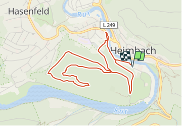
Randonnée A pied de 4,9 km à découvrir à Rhénanie-du-Nord-Westphalie, Kreis Düren, Heimbach. Cette randonnée est proposée par SityTrail - itinéraires balisés pédestres.
Description
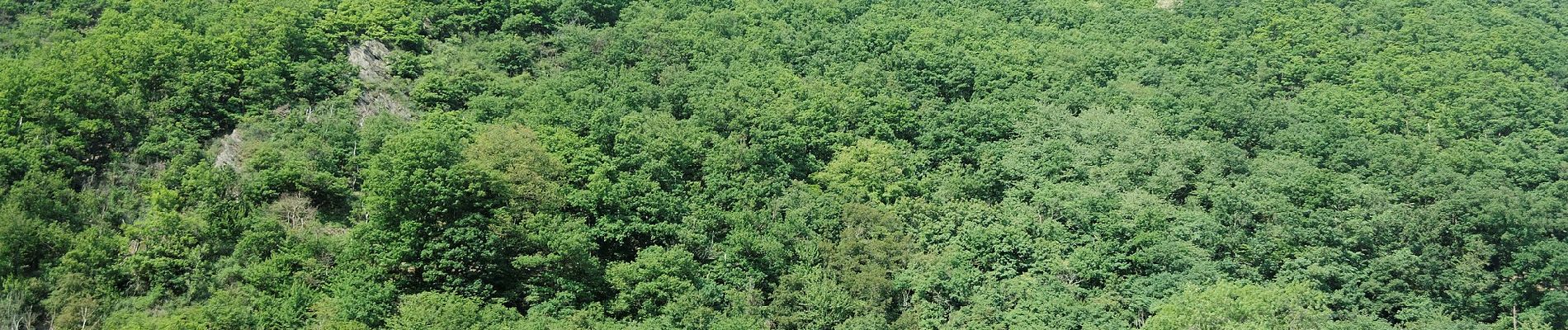
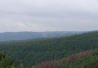
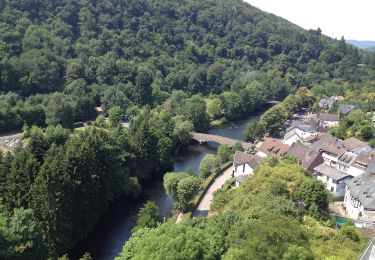
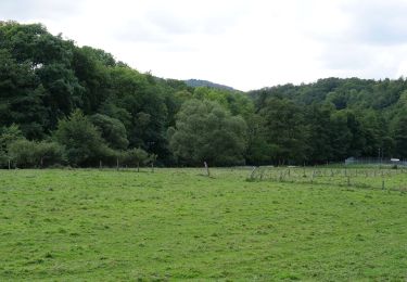
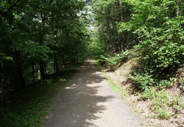
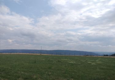
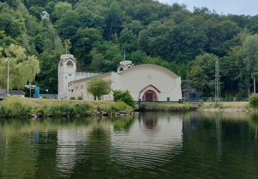
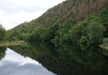
Der Name Meuchelberg entspringt einer Sage, nach der dort zwei Brüder im Streit zu Tode geprügelt haben. Auf dem 373 Meter hohen Umlaufberg, wurden wertvolle Lebensräume wie z.B. Felsen, Heiden Hangschuttwälder und trocken warme Eichenwälder entwickelt. Eine kurze Wanderung mit tollen Panoramablicken auf den Luftkurort Heimbach mit Burg Hengebach und das Wasserkraftwerk. Die Wanderung ist im Frühjahr und Herbst besonders zu empfehlen, da durch das dann fehlende Laub die Ausblicke vor allem auf den Stausee von Heimbach noch schöner sind. Wir folgen hier ausschließlich dem Wanderweg Nr. 29, ab Wanderparkplatz in Heimbach an der Rur.
Site web: https://www.rureifel-tourismus.de/wandern/wanderland-rureifel/a-meuchelberg
Localisation
Commentaires
Randonnées à proximité
![Randonnée A pied Nideggen - Schmidter Runde - Photo](https://media.geolcdn.com/t/375/260/68d8615b-3db1-4004-9cff-4afadf42000f.jpeg&format=jpg&maxdim=2)
![A pied A pied](https://static1.geolcdn.com/sitytour/trail-icons/100.png)
A pied
![](/images/other/stat-length.png)
![](https://static1.geolcdn.com/siteimages/upload/files/16400158638029165_repeat_loop_refresh_sync_direction_icon.png)
![Randonnée A pied Heimbach - Klosterrunde - Photo](https://media.geolcdn.com/t/375/260/bff8ca8c-867c-4335-bbdd-0941f75df916.jpeg&format=jpg&maxdim=2)
![A pied A pied](https://static1.geolcdn.com/sitytour/trail-icons/100.png)
A pied
![](/images/other/stat-length.png)
![](https://static1.geolcdn.com/siteimages/upload/files/16400158638029165_repeat_loop_refresh_sync_direction_icon.png)
![Randonnée A pied Heimbach - Heimbacher Burgen - Photo](https://media.geolcdn.com/t/375/260/f5795a34-a044-4946-b55a-ed4a5df87132.jpeg&format=jpg&maxdim=2)
![A pied A pied](https://static1.geolcdn.com/sitytour/trail-icons/100.png)
A pied
![](/images/other/stat-length.png)
![](https://static1.geolcdn.com/siteimages/upload/files/16400158638029165_repeat_loop_refresh_sync_direction_icon.png)
![Randonnée A pied Nideggen - Um den Wildpark Schmidt - Photo](https://media.geolcdn.com/t/375/260/68d8615b-3db1-4004-9cff-4afadf42000f.jpeg&format=jpg&maxdim=2)
![A pied A pied](https://static1.geolcdn.com/sitytour/trail-icons/100.png)
A pied
![](/images/other/stat-length.png)
![](https://static1.geolcdn.com/siteimages/upload/files/16400158638029165_repeat_loop_refresh_sync_direction_icon.png)
![Randonnée A pied Heimbach - Jägerpfad - Photo](https://media.geolcdn.com/t/375/260/8802dd30-e31d-4ab7-b566-4e4467c17e40.jpeg&format=jpg&maxdim=2)
![A pied A pied](https://static1.geolcdn.com/sitytour/trail-icons/100.png)
A pied
![](/images/other/stat-length.png)
![](https://static1.geolcdn.com/siteimages/upload/files/16400158638029165_repeat_loop_refresh_sync_direction_icon.png)
![Randonnée A pied Heimbach - Eifeler Steilküste - Photo](https://media.geolcdn.com/t/375/260/ee70ba86-d692-447b-9025-6a74594c265b.jpeg&format=jpg&maxdim=2)
![A pied A pied](https://static1.geolcdn.com/sitytour/trail-icons/100.png)
A pied
![](/images/other/stat-length.png)
![](https://static1.geolcdn.com/siteimages/upload/files/16400158638029165_repeat_loop_refresh_sync_direction_icon.png)
![Randonnée Marche Nideggen - Rursee lac et bois - Photo](https://media.geolcdn.com/t/375/260/84e14ffd-8d2f-46ac-be0c-36696b60d77a.jpg&format=jpg&maxdim=2)
![Marche Marche](https://static1.geolcdn.com/sitytour/trail-icons/101.png)
Marche
![](/images/other/stat-length.png)
![](https://static1.geolcdn.com/siteimages/upload/files/16400158638029165_repeat_loop_refresh_sync_direction_icon.png)
![Randonnée Marche Heimbach - Rur tour - Photo](https://media.geolcdn.com/t/375/260/3fd7ad3b-a81c-4273-8d60-98e45bb2ff5e.jpg&format=jpg&maxdim=2)
![Marche Marche](https://static1.geolcdn.com/sitytour/trail-icons/101.png)
Marche
![](/images/other/stat-length.png)
![](https://static1.geolcdn.com/siteimages/upload/files/16400158638029165_repeat_loop_refresh_sync_direction_icon.png)
![Randonnée A pied Heimbach - Heimbach Rundweg T5 - Photo](https://media.geolcdn.com/t/375/260/93e215ac-9d54-4f50-a1ec-c973409f8069.jpeg&format=jpg&maxdim=2)
![A pied A pied](https://static1.geolcdn.com/sitytour/trail-icons/100.png)
A pied
![](/images/other/stat-length.png)
![](https://static1.geolcdn.com/siteimages/upload/files/16400158638029165_repeat_loop_refresh_sync_direction_icon.png)