


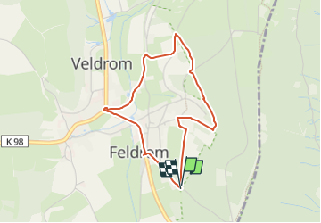

14,6 km | 19,1 km-effort

Tous les sentiers balisés d’Europe GUIDE+


Application GPS de randonnée GRATUITE
 SityTrail
IGN / Instituts géographiques
SityTrail World
Le monde est à vous
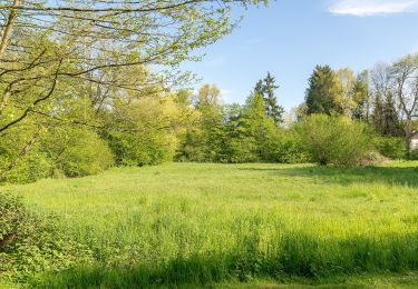
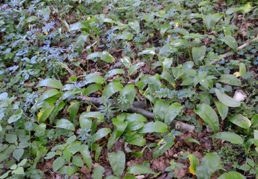
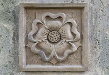
Randonnée A pied de 3,1 km à découvrir à Rhénanie-du-Nord-Westphalie, Kreis Lippe, Horn-Bad Meinberg. Cette randonnée est proposée par SityTrail - itinéraires balisés pédestres.
Randonnée créée par katholische Kirchengemeinde Heilig-Kreuz Horn-Bad Meinberg.
Symbole: unbekannt, Schwarzer "hiker" auf weißen Grund als vorläuftiges Symbol gewählt
 "
data-pinterest-text="Pin it"
data-tweet-text="share on twitter"
data-facebook-share-url="https://www.sitytrail.com/fr/trails/3101424-hornxbad-meinberg--pilgerweg-xbesinn-dichx-sehenx-horenx-fuhlen-x-besinnungsweg-kempenxfeldromxveldromx/?photo=1#lg=1&slide=1"
data-twitter-share-url="https://www.sitytrail.com/fr/trails/3101424-hornxbad-meinberg--pilgerweg-xbesinn-dichx-sehenx-horenx-fuhlen-x-besinnungsweg-kempenxfeldromxveldromx/?photo=1#lg=1&slide=1"
data-googleplus-share-url="https://www.sitytrail.com/fr/trails/3101424-hornxbad-meinberg--pilgerweg-xbesinn-dichx-sehenx-horenx-fuhlen-x-besinnungsweg-kempenxfeldromxveldromx/?photo=1#lg=1&slide=1"
data-pinterest-share-url="https://www.sitytrail.com/fr/trails/3101424-hornxbad-meinberg--pilgerweg-xbesinn-dichx-sehenx-horenx-fuhlen-x-besinnungsweg-kempenxfeldromxveldromx/?photo=1#lg=1&slide=1">
"
data-pinterest-text="Pin it"
data-tweet-text="share on twitter"
data-facebook-share-url="https://www.sitytrail.com/fr/trails/3101424-hornxbad-meinberg--pilgerweg-xbesinn-dichx-sehenx-horenx-fuhlen-x-besinnungsweg-kempenxfeldromxveldromx/?photo=1#lg=1&slide=1"
data-twitter-share-url="https://www.sitytrail.com/fr/trails/3101424-hornxbad-meinberg--pilgerweg-xbesinn-dichx-sehenx-horenx-fuhlen-x-besinnungsweg-kempenxfeldromxveldromx/?photo=1#lg=1&slide=1"
data-googleplus-share-url="https://www.sitytrail.com/fr/trails/3101424-hornxbad-meinberg--pilgerweg-xbesinn-dichx-sehenx-horenx-fuhlen-x-besinnungsweg-kempenxfeldromxveldromx/?photo=1#lg=1&slide=1"
data-pinterest-share-url="https://www.sitytrail.com/fr/trails/3101424-hornxbad-meinberg--pilgerweg-xbesinn-dichx-sehenx-horenx-fuhlen-x-besinnungsweg-kempenxfeldromxveldromx/?photo=1#lg=1&slide=1">
 "
data-pinterest-text="Pin it"
data-tweet-text="share on twitter"
data-facebook-share-url="https://www.sitytrail.com/fr/trails/3101424-hornxbad-meinberg--pilgerweg-xbesinn-dichx-sehenx-horenx-fuhlen-x-besinnungsweg-kempenxfeldromxveldromx/?photo=2#lg=1&slide=2"
data-twitter-share-url="https://www.sitytrail.com/fr/trails/3101424-hornxbad-meinberg--pilgerweg-xbesinn-dichx-sehenx-horenx-fuhlen-x-besinnungsweg-kempenxfeldromxveldromx/?photo=2#lg=1&slide=2"
data-googleplus-share-url="https://www.sitytrail.com/fr/trails/3101424-hornxbad-meinberg--pilgerweg-xbesinn-dichx-sehenx-horenx-fuhlen-x-besinnungsweg-kempenxfeldromxveldromx/?photo=2#lg=1&slide=2"
data-pinterest-share-url="https://www.sitytrail.com/fr/trails/3101424-hornxbad-meinberg--pilgerweg-xbesinn-dichx-sehenx-horenx-fuhlen-x-besinnungsweg-kempenxfeldromxveldromx/?photo=2#lg=1&slide=2">
"
data-pinterest-text="Pin it"
data-tweet-text="share on twitter"
data-facebook-share-url="https://www.sitytrail.com/fr/trails/3101424-hornxbad-meinberg--pilgerweg-xbesinn-dichx-sehenx-horenx-fuhlen-x-besinnungsweg-kempenxfeldromxveldromx/?photo=2#lg=1&slide=2"
data-twitter-share-url="https://www.sitytrail.com/fr/trails/3101424-hornxbad-meinberg--pilgerweg-xbesinn-dichx-sehenx-horenx-fuhlen-x-besinnungsweg-kempenxfeldromxveldromx/?photo=2#lg=1&slide=2"
data-googleplus-share-url="https://www.sitytrail.com/fr/trails/3101424-hornxbad-meinberg--pilgerweg-xbesinn-dichx-sehenx-horenx-fuhlen-x-besinnungsweg-kempenxfeldromxveldromx/?photo=2#lg=1&slide=2"
data-pinterest-share-url="https://www.sitytrail.com/fr/trails/3101424-hornxbad-meinberg--pilgerweg-xbesinn-dichx-sehenx-horenx-fuhlen-x-besinnungsweg-kempenxfeldromxveldromx/?photo=2#lg=1&slide=2">
 "
data-pinterest-text="Pin it"
data-tweet-text="share on twitter"
data-facebook-share-url="https://www.sitytrail.com/fr/trails/3101424-hornxbad-meinberg--pilgerweg-xbesinn-dichx-sehenx-horenx-fuhlen-x-besinnungsweg-kempenxfeldromxveldromx/?photo=3#lg=1&slide=3"
data-twitter-share-url="https://www.sitytrail.com/fr/trails/3101424-hornxbad-meinberg--pilgerweg-xbesinn-dichx-sehenx-horenx-fuhlen-x-besinnungsweg-kempenxfeldromxveldromx/?photo=3#lg=1&slide=3"
data-googleplus-share-url="https://www.sitytrail.com/fr/trails/3101424-hornxbad-meinberg--pilgerweg-xbesinn-dichx-sehenx-horenx-fuhlen-x-besinnungsweg-kempenxfeldromxveldromx/?photo=3#lg=1&slide=3"
data-pinterest-share-url="https://www.sitytrail.com/fr/trails/3101424-hornxbad-meinberg--pilgerweg-xbesinn-dichx-sehenx-horenx-fuhlen-x-besinnungsweg-kempenxfeldromxveldromx/?photo=3#lg=1&slide=3">
"
data-pinterest-text="Pin it"
data-tweet-text="share on twitter"
data-facebook-share-url="https://www.sitytrail.com/fr/trails/3101424-hornxbad-meinberg--pilgerweg-xbesinn-dichx-sehenx-horenx-fuhlen-x-besinnungsweg-kempenxfeldromxveldromx/?photo=3#lg=1&slide=3"
data-twitter-share-url="https://www.sitytrail.com/fr/trails/3101424-hornxbad-meinberg--pilgerweg-xbesinn-dichx-sehenx-horenx-fuhlen-x-besinnungsweg-kempenxfeldromxveldromx/?photo=3#lg=1&slide=3"
data-googleplus-share-url="https://www.sitytrail.com/fr/trails/3101424-hornxbad-meinberg--pilgerweg-xbesinn-dichx-sehenx-horenx-fuhlen-x-besinnungsweg-kempenxfeldromxveldromx/?photo=3#lg=1&slide=3"
data-pinterest-share-url="https://www.sitytrail.com/fr/trails/3101424-hornxbad-meinberg--pilgerweg-xbesinn-dichx-sehenx-horenx-fuhlen-x-besinnungsweg-kempenxfeldromxveldromx/?photo=3#lg=1&slide=3">
 "
data-pinterest-text="Pin it"
data-tweet-text="share on twitter"
data-facebook-share-url="https://www.sitytrail.com/fr/trails/3101424-hornxbad-meinberg--pilgerweg-xbesinn-dichx-sehenx-horenx-fuhlen-x-besinnungsweg-kempenxfeldromxveldromx/?photo=4#lg=1&slide=4"
data-twitter-share-url="https://www.sitytrail.com/fr/trails/3101424-hornxbad-meinberg--pilgerweg-xbesinn-dichx-sehenx-horenx-fuhlen-x-besinnungsweg-kempenxfeldromxveldromx/?photo=4#lg=1&slide=4"
data-googleplus-share-url="https://www.sitytrail.com/fr/trails/3101424-hornxbad-meinberg--pilgerweg-xbesinn-dichx-sehenx-horenx-fuhlen-x-besinnungsweg-kempenxfeldromxveldromx/?photo=4#lg=1&slide=4"
data-pinterest-share-url="https://www.sitytrail.com/fr/trails/3101424-hornxbad-meinberg--pilgerweg-xbesinn-dichx-sehenx-horenx-fuhlen-x-besinnungsweg-kempenxfeldromxveldromx/?photo=4#lg=1&slide=4">
"
data-pinterest-text="Pin it"
data-tweet-text="share on twitter"
data-facebook-share-url="https://www.sitytrail.com/fr/trails/3101424-hornxbad-meinberg--pilgerweg-xbesinn-dichx-sehenx-horenx-fuhlen-x-besinnungsweg-kempenxfeldromxveldromx/?photo=4#lg=1&slide=4"
data-twitter-share-url="https://www.sitytrail.com/fr/trails/3101424-hornxbad-meinberg--pilgerweg-xbesinn-dichx-sehenx-horenx-fuhlen-x-besinnungsweg-kempenxfeldromxveldromx/?photo=4#lg=1&slide=4"
data-googleplus-share-url="https://www.sitytrail.com/fr/trails/3101424-hornxbad-meinberg--pilgerweg-xbesinn-dichx-sehenx-horenx-fuhlen-x-besinnungsweg-kempenxfeldromxveldromx/?photo=4#lg=1&slide=4"
data-pinterest-share-url="https://www.sitytrail.com/fr/trails/3101424-hornxbad-meinberg--pilgerweg-xbesinn-dichx-sehenx-horenx-fuhlen-x-besinnungsweg-kempenxfeldromxveldromx/?photo=4#lg=1&slide=4">
 "
data-pinterest-text="Pin it"
data-tweet-text="share on twitter"
data-facebook-share-url="https://www.sitytrail.com/fr/trails/3101424-hornxbad-meinberg--pilgerweg-xbesinn-dichx-sehenx-horenx-fuhlen-x-besinnungsweg-kempenxfeldromxveldromx/?photo=5#lg=1&slide=5"
data-twitter-share-url="https://www.sitytrail.com/fr/trails/3101424-hornxbad-meinberg--pilgerweg-xbesinn-dichx-sehenx-horenx-fuhlen-x-besinnungsweg-kempenxfeldromxveldromx/?photo=5#lg=1&slide=5"
data-googleplus-share-url="https://www.sitytrail.com/fr/trails/3101424-hornxbad-meinberg--pilgerweg-xbesinn-dichx-sehenx-horenx-fuhlen-x-besinnungsweg-kempenxfeldromxveldromx/?photo=5#lg=1&slide=5"
data-pinterest-share-url="https://www.sitytrail.com/fr/trails/3101424-hornxbad-meinberg--pilgerweg-xbesinn-dichx-sehenx-horenx-fuhlen-x-besinnungsweg-kempenxfeldromxveldromx/?photo=5#lg=1&slide=5">
"
data-pinterest-text="Pin it"
data-tweet-text="share on twitter"
data-facebook-share-url="https://www.sitytrail.com/fr/trails/3101424-hornxbad-meinberg--pilgerweg-xbesinn-dichx-sehenx-horenx-fuhlen-x-besinnungsweg-kempenxfeldromxveldromx/?photo=5#lg=1&slide=5"
data-twitter-share-url="https://www.sitytrail.com/fr/trails/3101424-hornxbad-meinberg--pilgerweg-xbesinn-dichx-sehenx-horenx-fuhlen-x-besinnungsweg-kempenxfeldromxveldromx/?photo=5#lg=1&slide=5"
data-googleplus-share-url="https://www.sitytrail.com/fr/trails/3101424-hornxbad-meinberg--pilgerweg-xbesinn-dichx-sehenx-horenx-fuhlen-x-besinnungsweg-kempenxfeldromxveldromx/?photo=5#lg=1&slide=5"
data-pinterest-share-url="https://www.sitytrail.com/fr/trails/3101424-hornxbad-meinberg--pilgerweg-xbesinn-dichx-sehenx-horenx-fuhlen-x-besinnungsweg-kempenxfeldromxveldromx/?photo=5#lg=1&slide=5">
 "
data-pinterest-text="Pin it"
data-tweet-text="share on twitter"
data-facebook-share-url="https://www.sitytrail.com/fr/trails/3101424-hornxbad-meinberg--pilgerweg-xbesinn-dichx-sehenx-horenx-fuhlen-x-besinnungsweg-kempenxfeldromxveldromx/?photo=6#lg=1&slide=6"
data-twitter-share-url="https://www.sitytrail.com/fr/trails/3101424-hornxbad-meinberg--pilgerweg-xbesinn-dichx-sehenx-horenx-fuhlen-x-besinnungsweg-kempenxfeldromxveldromx/?photo=6#lg=1&slide=6"
data-googleplus-share-url="https://www.sitytrail.com/fr/trails/3101424-hornxbad-meinberg--pilgerweg-xbesinn-dichx-sehenx-horenx-fuhlen-x-besinnungsweg-kempenxfeldromxveldromx/?photo=6#lg=1&slide=6"
data-pinterest-share-url="https://www.sitytrail.com/fr/trails/3101424-hornxbad-meinberg--pilgerweg-xbesinn-dichx-sehenx-horenx-fuhlen-x-besinnungsweg-kempenxfeldromxveldromx/?photo=6#lg=1&slide=6">
"
data-pinterest-text="Pin it"
data-tweet-text="share on twitter"
data-facebook-share-url="https://www.sitytrail.com/fr/trails/3101424-hornxbad-meinberg--pilgerweg-xbesinn-dichx-sehenx-horenx-fuhlen-x-besinnungsweg-kempenxfeldromxveldromx/?photo=6#lg=1&slide=6"
data-twitter-share-url="https://www.sitytrail.com/fr/trails/3101424-hornxbad-meinberg--pilgerweg-xbesinn-dichx-sehenx-horenx-fuhlen-x-besinnungsweg-kempenxfeldromxveldromx/?photo=6#lg=1&slide=6"
data-googleplus-share-url="https://www.sitytrail.com/fr/trails/3101424-hornxbad-meinberg--pilgerweg-xbesinn-dichx-sehenx-horenx-fuhlen-x-besinnungsweg-kempenxfeldromxveldromx/?photo=6#lg=1&slide=6"
data-pinterest-share-url="https://www.sitytrail.com/fr/trails/3101424-hornxbad-meinberg--pilgerweg-xbesinn-dichx-sehenx-horenx-fuhlen-x-besinnungsweg-kempenxfeldromxveldromx/?photo=6#lg=1&slide=6">
 "
data-pinterest-text="Pin it"
data-tweet-text="share on twitter"
data-facebook-share-url="https://www.sitytrail.com/fr/trails/3101424-hornxbad-meinberg--pilgerweg-xbesinn-dichx-sehenx-horenx-fuhlen-x-besinnungsweg-kempenxfeldromxveldromx/?photo=7#lg=1&slide=7"
data-twitter-share-url="https://www.sitytrail.com/fr/trails/3101424-hornxbad-meinberg--pilgerweg-xbesinn-dichx-sehenx-horenx-fuhlen-x-besinnungsweg-kempenxfeldromxveldromx/?photo=7#lg=1&slide=7"
data-googleplus-share-url="https://www.sitytrail.com/fr/trails/3101424-hornxbad-meinberg--pilgerweg-xbesinn-dichx-sehenx-horenx-fuhlen-x-besinnungsweg-kempenxfeldromxveldromx/?photo=7#lg=1&slide=7"
data-pinterest-share-url="https://www.sitytrail.com/fr/trails/3101424-hornxbad-meinberg--pilgerweg-xbesinn-dichx-sehenx-horenx-fuhlen-x-besinnungsweg-kempenxfeldromxveldromx/?photo=7#lg=1&slide=7">
"
data-pinterest-text="Pin it"
data-tweet-text="share on twitter"
data-facebook-share-url="https://www.sitytrail.com/fr/trails/3101424-hornxbad-meinberg--pilgerweg-xbesinn-dichx-sehenx-horenx-fuhlen-x-besinnungsweg-kempenxfeldromxveldromx/?photo=7#lg=1&slide=7"
data-twitter-share-url="https://www.sitytrail.com/fr/trails/3101424-hornxbad-meinberg--pilgerweg-xbesinn-dichx-sehenx-horenx-fuhlen-x-besinnungsweg-kempenxfeldromxveldromx/?photo=7#lg=1&slide=7"
data-googleplus-share-url="https://www.sitytrail.com/fr/trails/3101424-hornxbad-meinberg--pilgerweg-xbesinn-dichx-sehenx-horenx-fuhlen-x-besinnungsweg-kempenxfeldromxveldromx/?photo=7#lg=1&slide=7"
data-pinterest-share-url="https://www.sitytrail.com/fr/trails/3101424-hornxbad-meinberg--pilgerweg-xbesinn-dichx-sehenx-horenx-fuhlen-x-besinnungsweg-kempenxfeldromxveldromx/?photo=7#lg=1&slide=7">
 "
data-pinterest-text="Pin it"
data-tweet-text="share on twitter"
data-facebook-share-url="https://www.sitytrail.com/fr/trails/3101424-hornxbad-meinberg--pilgerweg-xbesinn-dichx-sehenx-horenx-fuhlen-x-besinnungsweg-kempenxfeldromxveldromx/?photo=8#lg=1&slide=8"
data-twitter-share-url="https://www.sitytrail.com/fr/trails/3101424-hornxbad-meinberg--pilgerweg-xbesinn-dichx-sehenx-horenx-fuhlen-x-besinnungsweg-kempenxfeldromxveldromx/?photo=8#lg=1&slide=8"
data-googleplus-share-url="https://www.sitytrail.com/fr/trails/3101424-hornxbad-meinberg--pilgerweg-xbesinn-dichx-sehenx-horenx-fuhlen-x-besinnungsweg-kempenxfeldromxveldromx/?photo=8#lg=1&slide=8"
data-pinterest-share-url="https://www.sitytrail.com/fr/trails/3101424-hornxbad-meinberg--pilgerweg-xbesinn-dichx-sehenx-horenx-fuhlen-x-besinnungsweg-kempenxfeldromxveldromx/?photo=8#lg=1&slide=8">
"
data-pinterest-text="Pin it"
data-tweet-text="share on twitter"
data-facebook-share-url="https://www.sitytrail.com/fr/trails/3101424-hornxbad-meinberg--pilgerweg-xbesinn-dichx-sehenx-horenx-fuhlen-x-besinnungsweg-kempenxfeldromxveldromx/?photo=8#lg=1&slide=8"
data-twitter-share-url="https://www.sitytrail.com/fr/trails/3101424-hornxbad-meinberg--pilgerweg-xbesinn-dichx-sehenx-horenx-fuhlen-x-besinnungsweg-kempenxfeldromxveldromx/?photo=8#lg=1&slide=8"
data-googleplus-share-url="https://www.sitytrail.com/fr/trails/3101424-hornxbad-meinberg--pilgerweg-xbesinn-dichx-sehenx-horenx-fuhlen-x-besinnungsweg-kempenxfeldromxveldromx/?photo=8#lg=1&slide=8"
data-pinterest-share-url="https://www.sitytrail.com/fr/trails/3101424-hornxbad-meinberg--pilgerweg-xbesinn-dichx-sehenx-horenx-fuhlen-x-besinnungsweg-kempenxfeldromxveldromx/?photo=8#lg=1&slide=8">
 "
data-pinterest-text="Pin it"
data-tweet-text="share on twitter"
data-facebook-share-url="https://www.sitytrail.com/fr/trails/3101424-hornxbad-meinberg--pilgerweg-xbesinn-dichx-sehenx-horenx-fuhlen-x-besinnungsweg-kempenxfeldromxveldromx/?photo=9#lg=1&slide=9"
data-twitter-share-url="https://www.sitytrail.com/fr/trails/3101424-hornxbad-meinberg--pilgerweg-xbesinn-dichx-sehenx-horenx-fuhlen-x-besinnungsweg-kempenxfeldromxveldromx/?photo=9#lg=1&slide=9"
data-googleplus-share-url="https://www.sitytrail.com/fr/trails/3101424-hornxbad-meinberg--pilgerweg-xbesinn-dichx-sehenx-horenx-fuhlen-x-besinnungsweg-kempenxfeldromxveldromx/?photo=9#lg=1&slide=9"
data-pinterest-share-url="https://www.sitytrail.com/fr/trails/3101424-hornxbad-meinberg--pilgerweg-xbesinn-dichx-sehenx-horenx-fuhlen-x-besinnungsweg-kempenxfeldromxveldromx/?photo=9#lg=1&slide=9">
"
data-pinterest-text="Pin it"
data-tweet-text="share on twitter"
data-facebook-share-url="https://www.sitytrail.com/fr/trails/3101424-hornxbad-meinberg--pilgerweg-xbesinn-dichx-sehenx-horenx-fuhlen-x-besinnungsweg-kempenxfeldromxveldromx/?photo=9#lg=1&slide=9"
data-twitter-share-url="https://www.sitytrail.com/fr/trails/3101424-hornxbad-meinberg--pilgerweg-xbesinn-dichx-sehenx-horenx-fuhlen-x-besinnungsweg-kempenxfeldromxveldromx/?photo=9#lg=1&slide=9"
data-googleplus-share-url="https://www.sitytrail.com/fr/trails/3101424-hornxbad-meinberg--pilgerweg-xbesinn-dichx-sehenx-horenx-fuhlen-x-besinnungsweg-kempenxfeldromxveldromx/?photo=9#lg=1&slide=9"
data-pinterest-share-url="https://www.sitytrail.com/fr/trails/3101424-hornxbad-meinberg--pilgerweg-xbesinn-dichx-sehenx-horenx-fuhlen-x-besinnungsweg-kempenxfeldromxveldromx/?photo=9#lg=1&slide=9">

A pied
A pied
A pied
A pied
A pied
![Randonnée A pied Horn-Bad Meinberg - Rundwanderweg A4 [Feldrom] - Photo](https://media.geolcdn.com/t/375/260/c3e2fda2-4a4b-4515-b251-ad31aeb36002.jpeg&format=jpg&maxdim=2)
A pied
A pied
![Randonnée A pied Steinheim - Rundwanderweg A1 [Grevenhagen] - Photo](https://media.geolcdn.com/t/375/260/202ac17e-dbff-44d1-b3d9-93eb341f466c.jpeg&format=jpg&maxdim=2)
A pied
![Randonnée A pied Schlangen - Rundwanderweg 34 [Barnacken] - Photo](https://media.geolcdn.com/t/375/260/83e8c965-88dc-4fa7-9331-4da86113c518.jpeg&format=jpg&maxdim=2)
A pied