


6 km | 7,6 km-effort
![Randonnée A pied Windhagen - [W1] Stockhauser Weg - Photo](https://media.geolcdn.com/t/1900/400/ext.pjpeg?maxdim=2&url=https%3A%2F%2Fmedia.geolcdn.com%2Ff%2Fadef9696-6d08-4cbb-94cd-bba75114ff6a.jpeg)

Tous les sentiers balisés d’Europe PRO


Application GPS de randonnée GRATUITE
 SityTrail
IGN / Instituts géographiques
SityTrail World
Le monde est à vous
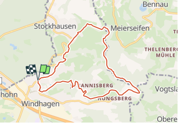
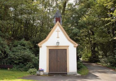
Randonnée A pied de 8,6 km à découvrir à Rhénanie-Palatinat, Landkreis Neuwied, Windhagen. Cette randonnée est proposée par SityTrail - itinéraires balisés pédestres.
Randonnée créée par Verbandsgemeinde Asbach.
Symbole: Weißer Text W1 auf rotem Grund
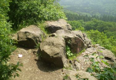
![Randonnée A pied Windhagen - [W1] Stockhauser Weg - Photo 1](https://media.geolcdn.com/t/2048/auto/bb1fe1dc-3609-4a3f-b254-37d13a7aedcd.jpeg&format=jpg&maxdim=0 "Randonnée A pied Windhagen - [W1] Stockhauser Weg - Photo 1")
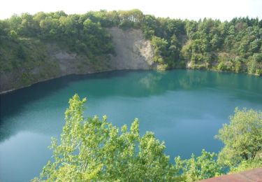
![Randonnée A pied Windhagen - [W1] Stockhauser Weg - Photo 2](https://media.geolcdn.com/t/2048/auto/adef9696-6d08-4cbb-94cd-bba75114ff6a.jpeg&format=jpg&maxdim=0 "Randonnée A pied Windhagen - [W1] Stockhauser Weg - Photo 2")
A pied
![Randonnée A pied Windhagen - [W2] Windhagener Weg - Photo](https://media.geolcdn.com/t/375/260/ext.jpg?maxdim=2&url=https%3A%2F%2Fmedia.geolcdn.com%2Ff%2Fadef9696-6d08-4cbb-94cd-bba75114ff6a.jpeg)
A pied
![Randonnée A pied Asbach - [A1] Basaltweg - Photo](https://media.geolcdn.com/t/375/260/ext.jpg?maxdim=2&url=https%3A%2F%2Fmedia.geolcdn.com%2Ff%2F17f9fb3a-b4a7-45d7-a2b4-ea773ee9f1e5.jpeg)
A pied
![Randonnée A pied Buchholz - [B3] Silberbergweg - Photo](https://media.geolcdn.com/t/375/260/ext.jpg?maxdim=2&url=https%3A%2F%2Fmedia.geolcdn.com%2Ff%2F26598f31-7aa1-441d-a048-772ec0888cec.jpeg)
A pied
A pied
A pied
A pied
A pied

A pied