5,9 km | 6,6 km-effort
Rüttebuck-Route
SityTrail - itinéraires balisés pédestres
Tous les sentiers balisés d’Europe GUIDE+
Longueur
5,5 km
Altitude max
482 m
Dénivelé positif
169 m
Km-Effort
7,8 km
Altitude min
345 m
Dénivelé négatif
183 m
Boucle
Oui
Balise
Date de création :
2022-02-11 19:43:27.02
Dernière modification :
2022-02-11 19:43:27.02
1h46
Difficulté : Facile
Application GPS de randonnée GRATUITE
À propos
Randonnée A pied de 5,5 km à découvrir à Bade-Wurtemberg, Landkreis Waldshut, Dogern. Cette randonnée est proposée par SityTrail - itinéraires balisés pédestres.
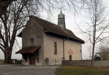
Localisation
Pays :
Allemagne
Région :
Bade-Wurtemberg
Département/Province :
Landkreis Waldshut
Commune :
Dogern
Localité :
Unknown
Départ:(Dec)
Départ:(UTM)
437323 ; 5273534 (32T) N.
Commentaires
Randonnées à proximité
Full Fähre - Leibstadt Postauto
A pied
Facile
Full-Reuenthal,
Argovie,
Bezirk Zurzach,
Suisse
1h 30min
Non
Full Fähre - Schwaderloch Postauto
A pied
Facile
Full-Reuenthal,
Argovie,
Bezirk Zurzach,
Suisse
8 km | 8,7 km-effort
1h 58min
Non
Full Fähre - Schwaderloch Zollhaus
A pied
Facile
Full-Reuenthal,
Argovie,
Bezirk Zurzach,
Suisse
7,4 km | 8,1 km-effort
1h 50min
Non
Schwaderloch - Etzgen Dorf
A pied
Facile
Schwaderloch,
Argovie,
Bezirk Laufenburg,
Suisse
4,1 km | 6 km-effort
1h 21min
Non
Regenhalden - Döttingen Brücke
A pied
Facile
Leuggern,
Argovie,
Bezirk Zurzach,
Suisse
3,4 km | 3,7 km-effort
50min
Non
Etzgen Dorf - Rheinsulz
A pied
Facile
Mettauertal,
Argovie,
Bezirk Laufenburg,
Suisse
5,1 km | 6,4 km-effort
1h 27min
Non
Kraftwerk Klingnau-Döttingen Brücke
A pied
Facile
Klingnau,
Argovie,
Bezirk Zurzach,
Suisse
3,1 km | 3,4 km-effort
46min
Non
Bossenhus - Leibstadt Postauto
A pied
Facile
Mettauertal,
Argovie,
Bezirk Laufenburg,
Suisse
3,4 km | 4,4 km-effort
1h 0min
Non
bdr14_Koblenz_BS
Autre activité
Très facile
Waldshut-Tiengen,
Bade-Wurtemberg,
Landkreis Waldshut,
Allemagne
82 km | 92 km-effort
Inconnu
Non