![](/images/other/stat-length.png)
![Randonnée A pied Gärtringen - Gärtringer Rundweg 1 - Photo](https://media.geolcdn.com/t/1900/400/52414d3f-8650-45af-b4d3-19b2f137a2a5.jpeg&format=pjpeg&maxdim=2)
Gärtringer Rundweg 1
SityTrail - itinéraires balisés pédestres
Tous les sentiers balisés d’Europe GUIDE+
![Longueur](/images/other/stat-length.png)
Longueur
12 km
![Altitude max](https://static1.geolcdn.com/siteimages/upload/files/1508320355ic_sort_altitude_max_24dp.png)
Altitude max
527 m
![Dénivelé positif](https://static1.geolcdn.com/siteimages/upload/files/1508320355ic_sort_den_pos_24dp.png)
Dénivelé positif
231 m
![Km-Effort](/images/other/stat-length.png)
Km-Effort
15,2 km
![Altitude min](https://static1.geolcdn.com/siteimages/upload/files/1508320355ic_sort_altitude_min_24dp.png)
Altitude min
436 m
![Dénivelé négatif](https://static1.geolcdn.com/siteimages/upload/files/1508320355ic_sort_den_neg_24dp.png)
Dénivelé négatif
271 m
![Boucle](https://static1.geolcdn.com/siteimages/upload/files/16400158638029165_repeat_loop_refresh_sync_direction_icon.png)
Boucle
Non
Balise
Date de création :
2022-02-11 19:26:58.852
Dernière modification :
2022-02-11 19:26:58.852
![A pied](https://static1.geolcdn.com/sitytour/trail-icons/100.png)
3h27
Difficulté : Facile
![Scannez ce code QR pour ouvrir la randonnée dans l'application SityTrail](https://capi.geolives.com/qq0zvz2zws4bq2lad0pu/sitytour/trails/3100691/qr.png?size=200)
Application GPS de randonnée GRATUITE
À propos
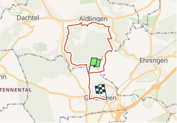
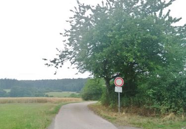
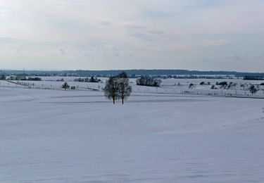
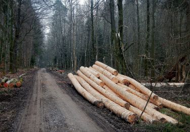
Randonnée A pied de 12 km à découvrir à Bade-Wurtemberg, Landkreis Böblingen, Gärtringen. Cette randonnée est proposée par SityTrail - itinéraires balisés pédestres.
Description
Randonnée créée par Schwarzwaldverein Gärtringen e.V..
Mit gelber und blauer Raute beschildert: yellow:white:yellow_diamond;blue:white:blue_diamond
Localisation
Pays :
Allemagne
Région :
Bade-Wurtemberg
Département/Province :
Landkreis Böblingen
Commune :
Gärtringen
Localité :
Rohrau
Départ:(Dec)
Départ:(UTM)
492274 ; 5388895 (32U) N.
Commentaires
Randonnées à proximité
![Randonnée A pied Gärtringen - alte Wegführung HW 5 - Schwarzwald-Schwäbische Alb-Allgäu-Weg - Photo](https://media.geolcdn.com/t/375/260/0cd9abad-3d57-44e1-80ea-06f3ddb1a05f.jpeg&format=jpg&maxdim=2)
![A pied A pied](https://static1.geolcdn.com/sitytour/trail-icons/100.png)
alte Wegführung HW 5 - Schwarzwald-Schwäbische Alb-Allgäu-Weg
A pied
Facile
Gärtringen,
Bade-Wurtemberg,
Landkreis Böblingen,
Allemagne
![](/images/other/stat-length.png)
7,6 km | 9,1 km-effort
2h 4min
![](https://static1.geolcdn.com/siteimages/upload/files/16400158638029165_repeat_loop_refresh_sync_direction_icon.png)
Non
![Randonnée A pied Aidlingen - Land.Tour Venusberg - Photo](https://media.geolcdn.com/t/375/260/ba60b6f8-e49a-4e76-82e7-43cfb6dfee57.jpeg&format=jpg&maxdim=2)
![A pied A pied](https://static1.geolcdn.com/sitytour/trail-icons/100.png)
Land.Tour Venusberg
A pied
Facile
Aidlingen,
Bade-Wurtemberg,
Landkreis Böblingen,
Allemagne
![](/images/other/stat-length.png)
12,2 km | 15,2 km-effort
3h 27min
![](https://static1.geolcdn.com/siteimages/upload/files/16400158638029165_repeat_loop_refresh_sync_direction_icon.png)
Oui
![Randonnée A pied Aidlingen - SchafSpuren - Photo](https://media.geolcdn.com/t/375/260/69322f55-f638-4b5e-beef-b335a87afd64.jpeg&format=jpg&maxdim=2)
![A pied A pied](https://static1.geolcdn.com/sitytour/trail-icons/100.png)
SchafSpuren
A pied
Facile
Aidlingen,
Bade-Wurtemberg,
Landkreis Böblingen,
Allemagne
![](/images/other/stat-length.png)
8,8 km | 12,1 km-effort
2h 45min
![](https://static1.geolcdn.com/siteimages/upload/files/16400158638029165_repeat_loop_refresh_sync_direction_icon.png)
Oui
![Randonnée A pied Aidlingen - Gärtringer Rundweg 2 - Photo](https://media.geolcdn.com/t/375/260/29cbc548-32dc-423b-bdf4-261fb0206665.jpeg&format=jpg&maxdim=2)
![A pied A pied](https://static1.geolcdn.com/sitytour/trail-icons/100.png)
Gärtringer Rundweg 2
A pied
Facile
Aidlingen,
Bade-Wurtemberg,
Landkreis Böblingen,
Allemagne
![](/images/other/stat-length.png)
7,1 km | 9,2 km-effort
2h 5min
![](https://static1.geolcdn.com/siteimages/upload/files/16400158638029165_repeat_loop_refresh_sync_direction_icon.png)
Non
![Randonnée A pied Gärtringen - Gärtringer Rundweg 3 - Photo](https://media.geolcdn.com/t/375/260/d78cc5cc-aa5b-475e-b259-27a62da55859.jpeg&format=jpg&maxdim=2)
![A pied A pied](https://static1.geolcdn.com/sitytour/trail-icons/100.png)
Gärtringer Rundweg 3
A pied
Facile
Gärtringen,
Bade-Wurtemberg,
Landkreis Böblingen,
Allemagne
![](/images/other/stat-length.png)
8,5 km | 10,1 km-effort
2h 17min
![](https://static1.geolcdn.com/siteimages/upload/files/16400158638029165_repeat_loop_refresh_sync_direction_icon.png)
Non
![Randonnée A pied Aidlingen - DE-Dachtel Bürgerhaus - Bierkeller - Dachteler Linde - Photo](https://media.geolcdn.com/t/375/260/29cbc548-32dc-423b-bdf4-261fb0206665.jpeg&format=jpg&maxdim=2)
![A pied A pied](https://static1.geolcdn.com/sitytour/trail-icons/100.png)
DE-Dachtel Bürgerhaus - Bierkeller - Dachteler Linde
A pied
Facile
Aidlingen,
Bade-Wurtemberg,
Landkreis Böblingen,
Allemagne
![](/images/other/stat-length.png)
3,8 km | 4,7 km-effort
1h 4min
![](https://static1.geolcdn.com/siteimages/upload/files/16400158638029165_repeat_loop_refresh_sync_direction_icon.png)
Non
![Randonnée A pied Aidlingen - Lerchenberg - Dachteler Linde - Photo](https://media.geolcdn.com/t/375/260/29cbc548-32dc-423b-bdf4-261fb0206665.jpeg&format=jpg&maxdim=2)
![A pied A pied](https://static1.geolcdn.com/sitytour/trail-icons/100.png)
Lerchenberg - Dachteler Linde
A pied
Facile
Aidlingen,
Bade-Wurtemberg,
Landkreis Böblingen,
Allemagne
![](/images/other/stat-length.png)
3,4 km | 4,4 km-effort
1h 0min
![](https://static1.geolcdn.com/siteimages/upload/files/16400158638029165_repeat_loop_refresh_sync_direction_icon.png)
Non