Randonnée A pied Bruckmühl - Ritter von Holnstain-Runde - Photo

Tous les sentiers balisés d’Europe PRO

© OpenStreetMap contributors
Longueur
Longueur
8,2 km
Altitude max
Altitude max
611 m
Dénivelé positif
Dénivelé positif
149 m
Km-Effort
Km-Effort  
10,1 km
Altitude min
Altitude min
507 m
Dénivelé négatif
Dénivelé négatif
149 m
Boucle
Boucle
Oui
Balise
Balise
Date de création :
2022-02-11 19:18:32.551
Dernière modification :
2022-02-11 19:18:32.551

(0 Avis)

A pied
A pied
2h18
Difficulté : Facile

Scannez ce code QR pour ouvrir la randonnée dans l'application SityTrail

Application GPS de randonnée GRATUITE

Logo SityTrail SityTrail

IGN / Instituts géographiques

Télécharger SityTrail sur l'App Store Télécharger SityTrail sur Google Play

Logo SityTrail SityTrail World

Le monde est à vous

Télécharger SityTrail sur l'App Store Télécharger SityTrail sur Google Play Télécharger SityTrail sur Huawei AppGallery

À propos

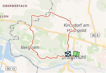
Randonnée A pied de 8,2 km à découvrir à Bavière, Landkreis Rosenheim, Bruckmühl. Cette randonnée est proposée par SityTrail - itinéraires balisés pédestres.

Description

Randonnée créée par Tourismus und Freizeit Bruckmühl Mangfalltal.

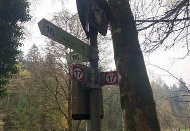
Symbole: Grüne Wegweisschilder mit der Zahl 1 und dem Namen "Ritter v. Holnstain-Runde"

Photos

Localisation

Pays :
Allemagne
Région :
Bavière
Département/Province :
Landkreis Rosenheim
Commune :
Bruckmühl
Localité :
Unknown
Départ:(UTM)
717848 ; 5307230 (32T) N.

Randonnées à proximité

Randonnée A pied Weyarn - Seerundweg - Photo
A pied
PRO

A pied

Facile
Weyarn, Bavière, Landkreis Miesbach, Allemagne
6,3 km | 7,2 km-effort
1h 37min
Oui
Randonnée A pied Feldkirchen-Westerham - Kreuzweg Kleinhöhenrain - Photo
A pied
PRO

A pied

Facile
Feldkirchen-Westerham, Bavière, Landkreis Rosenheim, Allemagne
6,2 km | 7,5 km-effort
1h 42min
Non
Randonnée A pied Feldkirchen-Westerham - Seehamer Weg - Photo
A pied
PRO

A pied

Facile
Feldkirchen-Westerham, Bavière, Landkreis Rosenheim, Allemagne
3,5 km | 5,8 km-effort
1h 19min
Non
Randonnée A pied Feldkirchen-Westerham - Rundweg Aschhofen - Photo
A pied
PRO

A pied

Facile
Feldkirchen-Westerham, Bavière, Landkreis Rosenheim, Allemagne
4,1 km | 4,8 km-effort
1h 6min
Non


Fermer
Mes abonnements