![](/images/other/stat-length.png)
![Randonnée A pied Karben - Schöneck Rundweg (Kulturroute) - Photo](https://media.geolcdn.com/t/1900/400/62b0332a-a4c4-495c-b7a1-cba4d268cc54.jpeg&format=pjpeg&maxdim=2)
Schöneck Rundweg (Kulturroute)
SityTrail - itinéraires balisés pédestres
Tous les sentiers balisés d’Europe GUIDE+
![Longueur](/images/other/stat-length.png)
![Altitude max](https://static1.geolcdn.com/siteimages/upload/files/1508320355ic_sort_altitude_max_24dp.png)
![Dénivelé positif](https://static1.geolcdn.com/siteimages/upload/files/1508320355ic_sort_den_pos_24dp.png)
![Km-Effort](/images/other/stat-length.png)
![Altitude min](https://static1.geolcdn.com/siteimages/upload/files/1508320355ic_sort_altitude_min_24dp.png)
![Dénivelé négatif](https://static1.geolcdn.com/siteimages/upload/files/1508320355ic_sort_den_neg_24dp.png)
![Boucle](https://static1.geolcdn.com/siteimages/upload/files/16400158638029165_repeat_loop_refresh_sync_direction_icon.png)
![A pied](https://static1.geolcdn.com/sitytour/trail-icons/100.png)
3h00
Difficulté : Facile
![Scannez ce code QR pour ouvrir la randonnée dans l'application SityTrail](https://capi.geolives.com/qq0zvz2zws4bq2lad0pu/sitytour/trails/3100005/qr.png?size=200)
Application GPS de randonnée GRATUITE
À propos
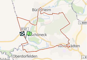
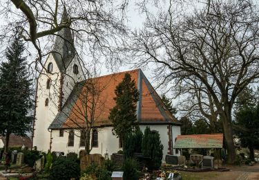
Randonnée A pied de 11,3 km à découvrir à Hesse, Wetteraukreis, Karben. Cette randonnée est proposée par SityTrail - itinéraires balisés pédestres.
Description
Randonnée créée par Gemeinde Schöneck.
Symbole: Gelber Kreis auf blauem Hintergrund mit eingeschriebener weißer 1. Häufig auch gelbe Pfeile auf dem Asphalt oder Gehweg.
Site web: http://www.rundwege.schoeneck.de/
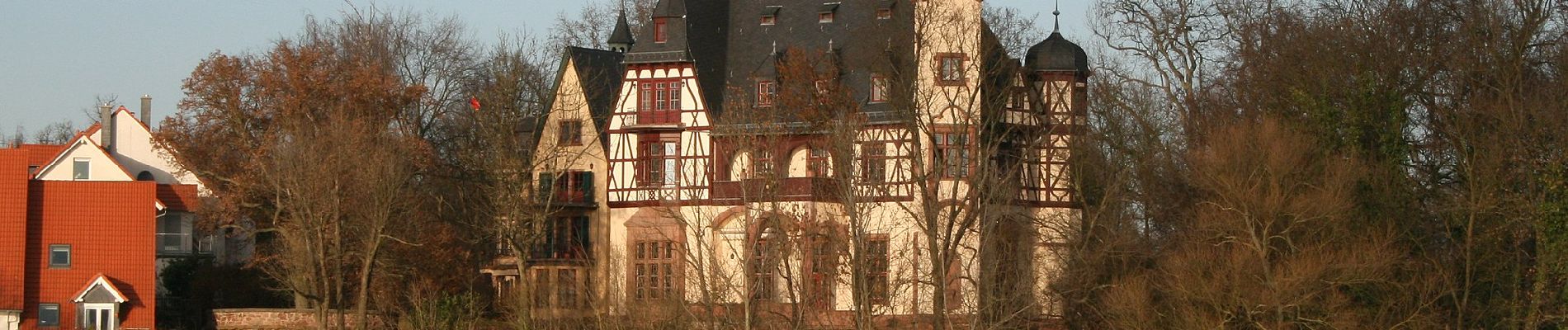
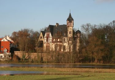
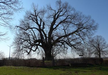
Localisation
Commentaires
Randonnées à proximité
![Randonnée A pied Schöneck - Schöneck Landschaftsweg (Halbmarathonroute) - Photo](https://media.geolcdn.com/t/375/260/62b0332a-a4c4-495c-b7a1-cba4d268cc54.jpeg&format=jpg&maxdim=2)
![A pied A pied](https://static1.geolcdn.com/sitytour/trail-icons/100.png)
A pied
![](/images/other/stat-length.png)
![](https://static1.geolcdn.com/siteimages/upload/files/16400158638029165_repeat_loop_refresh_sync_direction_icon.png)
![Randonnée A pied Nidderau - Bruchköbel Wanderweg 7 - Photo](https://media.geolcdn.com/t/375/260/79e409c7-3a39-4959-b084-c1e0bfafb87d.jpeg&format=jpg&maxdim=2)
![A pied A pied](https://static1.geolcdn.com/sitytour/trail-icons/100.png)
A pied
![](/images/other/stat-length.png)
![](https://static1.geolcdn.com/siteimages/upload/files/16400158638029165_repeat_loop_refresh_sync_direction_icon.png)
![Randonnée A pied Bad Vilbel - Wanderweg 2 - Photo](https://media.geolcdn.com/t/375/260/0ceec778-200a-44bc-bc30-d4d90e73ca76.jpeg&format=jpg&maxdim=2)
![A pied A pied](https://static1.geolcdn.com/sitytour/trail-icons/100.png)
A pied
![](/images/other/stat-length.png)
![](https://static1.geolcdn.com/siteimages/upload/files/16400158638029165_repeat_loop_refresh_sync_direction_icon.png)