


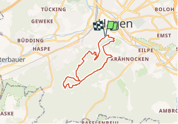

8,4 km | 12,2 km-effort


Tous les sentiers balisés d’Europe GUIDE+


Application GPS de randonnée GRATUITE
 SityTrail
IGN / Instituts géographiques
SityTrail World
Le monde est à vous
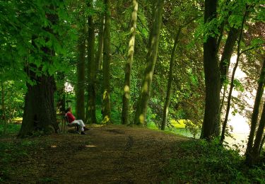
Randonnée A pied de 11 km à découvrir à Rhénanie-du-Nord-Westphalie, Hagen, Inconnu. Cette randonnée est proposée par SityTrail - itinéraires balisés pédestres.
Randonnée créée par Sauerländischer Gebirgsverein.


![Randonnée A pied Herdecke - [H2] Ruhrtal zum Hickenstein - Photo](https://media.geolcdn.com/t/375/260/47dfa9a4-572d-4f34-b111-ae10e112c377.jpeg&format=jpg&maxdim=2)
A pied
![Randonnée A pied Herdecke - [H1] Viadukt und Nacken - Photo](https://media.geolcdn.com/t/375/260/0816fcff-a194-4a3a-b211-f59c276124fc.jpeg&format=jpg&maxdim=2)
A pied
A pied
A pied
![Randonnée A pied Inconnu - [-] Höhenweg Wehringhausen - Herdecke - Photo](https://media.geolcdn.com/t/375/260/4387e361-0797-400d-87e7-45695bb9bdc7.jpeg&format=jpg&maxdim=2)
A pied
A pied
![Randonnée A pied Inconnu - [A9] Mäckinger Bach - Photo](https://media.geolcdn.com/t/375/260/d61b9506-745a-4b16-a3ef-d9924317a03e.jpeg&format=jpg&maxdim=2)
A pied
A pied
A pied