![](/images/other/stat-length.png)
![Randonnée A pied Nebra (Unstrut) - Triastor Geopfad Route Ost - Photo](https://media.geolcdn.com/t/1900/400/a1f061a6-f362-4fb0-b1e6-123453fbb631.jpeg&format=pjpeg&maxdim=2)
Triastor Geopfad Route Ost
SityTrail - itinéraires balisés pédestres
Tous les sentiers balisés d’Europe GUIDE+
![Longueur](/images/other/stat-length.png)
Longueur
10,8 km
![Altitude max](https://static1.geolcdn.com/siteimages/upload/files/1508320355ic_sort_altitude_max_24dp.png)
Altitude max
236 m
![Dénivelé positif](https://static1.geolcdn.com/siteimages/upload/files/1508320355ic_sort_den_pos_24dp.png)
Dénivelé positif
270 m
![Km-Effort](/images/other/stat-length.png)
Km-Effort
14,4 km
![Altitude min](https://static1.geolcdn.com/siteimages/upload/files/1508320355ic_sort_altitude_min_24dp.png)
Altitude min
110 m
![Dénivelé négatif](https://static1.geolcdn.com/siteimages/upload/files/1508320355ic_sort_den_neg_24dp.png)
Dénivelé négatif
273 m
![Boucle](https://static1.geolcdn.com/siteimages/upload/files/16400158638029165_repeat_loop_refresh_sync_direction_icon.png)
Boucle
Oui
Balise
Date de création :
2022-02-11 18:15:15.912
Dernière modification :
2022-02-11 18:15:15.912
![A pied](https://static1.geolcdn.com/sitytour/trail-icons/100.png)
3h16
Difficulté : Facile
![Scannez ce code QR pour ouvrir la randonnée dans l'application SityTrail](https://capi.geolives.com/qq0zvz2zws4bq2lad0pu/sitytour/trails/3099206/qr.png?size=200)
Application GPS de randonnée GRATUITE
À propos
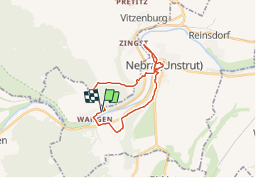
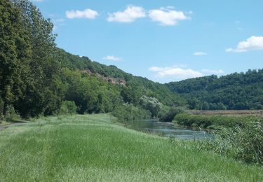
Randonnée A pied de 10,8 km à découvrir à Saxe-Anhalt, Burgenlandkreis, Nebra (Unstrut). Cette randonnée est proposée par SityTrail - itinéraires balisés pédestres.
Description
Randonnée créée par Geo Naturpark SUT.
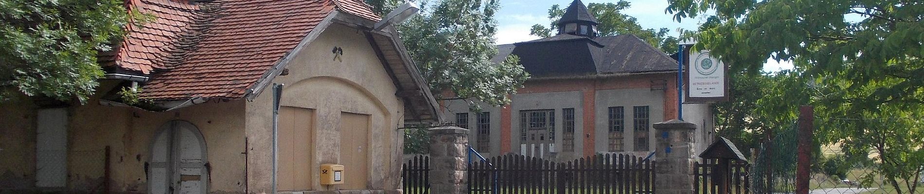
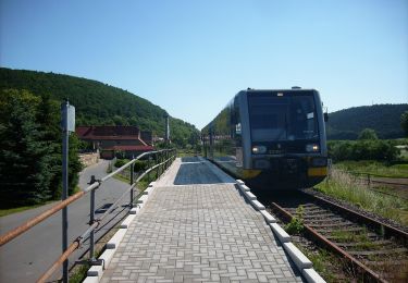
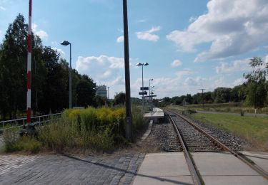
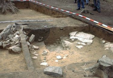
Localisation
Pays :
Allemagne
Région :
Saxe-Anhalt
Département/Province :
Burgenlandkreis
Commune :
Nebra (Unstrut)
Localité :
Unknown
Départ:(Dec)
Départ:(UTM)
677791 ; 5683286 (32U) N.
Commentaires
Randonnées à proximité
![Randonnée A pied Nebra (Unstrut) - Triastor Geopfad Route West - Photo](https://media.geolcdn.com/t/375/260/e406c940-40ef-4ea0-8f55-aae290492fc5.jpeg&format=jpg&maxdim=2)
![A pied A pied](https://static1.geolcdn.com/sitytour/trail-icons/100.png)
Triastor Geopfad Route West
A pied
Moyen
Nebra (Unstrut),
Saxe-Anhalt,
Burgenlandkreis,
Allemagne
![](/images/other/stat-length.png)
21 km | 27 km-effort
6h 3min
![](https://static1.geolcdn.com/siteimages/upload/files/16400158638029165_repeat_loop_refresh_sync_direction_icon.png)
Oui
![Randonnée A pied Nebra (Unstrut) - Weinweg Reinsdorf-Steigra-Karsdorf - Photo](https://media.geolcdn.com/t/375/260/030336d4-5fcd-4592-9124-62525e35df0d.jpeg&format=jpg&maxdim=2)
![A pied A pied](https://static1.geolcdn.com/sitytour/trail-icons/100.png)
Weinweg Reinsdorf-Steigra-Karsdorf
A pied
Facile
Nebra (Unstrut),
Saxe-Anhalt,
Burgenlandkreis,
Allemagne
![](/images/other/stat-length.png)
5,2 km | 6,3 km-effort
1h 25min
![](https://static1.geolcdn.com/siteimages/upload/files/16400158638029165_repeat_loop_refresh_sync_direction_icon.png)
Non
![Randonnée A pied Kaiserpfalz - Bahnwanderweg - Photo](https://media.geolcdn.com/t/375/260/57a8e049-07cb-4b8d-9151-53c3bc960250.jpeg&format=jpg&maxdim=2)
![A pied A pied](https://static1.geolcdn.com/sitytour/trail-icons/100.png)
Bahnwanderweg
A pied
Facile
Kaiserpfalz,
Saxe-Anhalt,
Burgenlandkreis,
Allemagne
![](/images/other/stat-length.png)
5,5 km | 6,7 km-effort
1h 31min
![](https://static1.geolcdn.com/siteimages/upload/files/16400158638029165_repeat_loop_refresh_sync_direction_icon.png)
Non
![Randonnée A pied Nebra (Unstrut) - Arche-Rundweg - Photo](https://media.geolcdn.com/t/375/260/10de6a28-a8c0-47fe-a79d-7e3097057602.jpeg&format=jpg&maxdim=2)
![A pied A pied](https://static1.geolcdn.com/sitytour/trail-icons/100.png)
Arche-Rundweg
A pied
Facile
Nebra (Unstrut),
Saxe-Anhalt,
Burgenlandkreis,
Allemagne
![](/images/other/stat-length.png)
5,5 km | 7,6 km-effort
1h 43min
![](https://static1.geolcdn.com/siteimages/upload/files/16400158638029165_repeat_loop_refresh_sync_direction_icon.png)
Oui